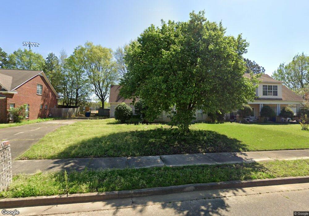
6278 Mcclendon Cir Olive Branch, MS 38654
Estimated Value: $255,271 - $267,000
3
Beds
2
Baths
1,712
Sq Ft
$152/Sq Ft
Est. Value
About This Home
This home is located at 6278 Mcclendon Cir, Olive Branch, MS 38654 and is currently estimated at $260,068, approximately $151 per square foot. 6278 Mcclendon Cir is a home located in DeSoto County with nearby schools including Olive Branch Elementary School, Chickasaw Elementary School, and Olive Branch Middle School.
Ownership History
Date
Name
Owned For
Owner Type
Purchase Details
Closed on
Mar 27, 2023
Sold by
Thurman Rachel Lashae
Bought by
Mcolive Properties Llc
Current Estimated Value
Purchase Details
Closed on
Dec 28, 2009
Sold by
Federal National Mortgage Association
Bought by
Thurman Rachel Lashae
Home Financials for this Owner
Home Financials are based on the most recent Mortgage that was taken out on this home.
Original Mortgage
$77,028
Interest Rate
4.82%
Mortgage Type
FHA
Purchase Details
Closed on
Jul 16, 2009
Sold by
Hubbell Jerry L and Hubbell Debra H
Bought by
Federal National Mortgage Association
Create a Home Valuation Report for This Property
The Home Valuation Report is an in-depth analysis detailing your home's value as well as a comparison with similar homes in the area
Home Values in the Area
Average Home Value in this Area
Purchase History
We collect this data history from publicly available records. To have your information removed, we recommend requesting removal directly through your county’s website.
| Date | Buyer | Sale Price | Title Company |
|---|---|---|---|
| Mcolive Properties Llc | -- | Mumford Title Llc | |
| Thurman Rachel Lashae | -- | 1St American Title | |
| Federal National Mortgage Association | $112,280 | None Available |
Source: Public Records
Mortgage History
We collect this data history from publicly available records. To have your information removed, we recommend requesting removal directly through your county’s website.
| Date | Status | Borrower | Loan Amount |
|---|---|---|---|
| Previous Owner | Thurman Rachel Lashae | $77,028 |
Source: Public Records
Tax History
| Year | Tax Paid | Tax Assessment Tax Assessment Total Assessment is a certain percentage of the fair market value that is determined by local assessors to be the total taxable value of land and additions on the property. | Land | Improvement |
|---|---|---|---|---|
| 2025 | $2,804 | $24,218 | $3,750 | $20,468 |
| 2024 | $2,441 | $17,882 | $3,750 | $14,132 |
| 2023 | $2,441 | $11,921 | $0 | $0 |
| 2022 | $1,627 | $11,921 | $2,500 | $9,421 |
| 2021 | $1,327 | $11,921 | $2,500 | $9,421 |
| 2020 | $1,219 | $11,130 | $2,500 | $8,630 |
| 2019 | $1,219 | $11,130 | $2,500 | $8,630 |
| 2017 | $1,205 | $19,436 | $10,968 | $8,468 |
| 2016 | $1,205 | $10,968 | $2,500 | $8,468 |
| 2015 | $1,505 | $19,436 | $10,968 | $8,468 |
| 2014 | $1,269 | $11,438 | $0 | $0 |
| 2013 | $1,200 | $11,438 | $0 | $0 |
Source: Public Records
Map
Nearby Homes
- 5295 Blocker St
- 9271 Brooks Dr
- 9077 Rue Orleans Ln
- 9084 Belle Maison Blvd
- 6180 Rd
- 6748 Cockrum Rd
- 9361 Pigeon Roost Rd
- 9868 Sequoia Ln
- 9730 Pigeon Roost Park Cir
- 9313 Pigeon Roost Rd
- 9450 Stone Point Dr
- 6406 Cherokee Dr
- 9852 Pigeon Roost Park Cir
- 0 Caroma Unit 4006992
- 0 Caroma Unit 10199426
- 6710 Cockrum
- 5881 Morganton Dr
- 6192 Houston Ln
- 8911 Oak Branch Ln
- 8847 Parkview Oaks Cir Unit 28
- 6244 Mcclendon Cir
- 6266 Mcclendon Cir
- 6290 Mcclendon Cir
- 6291 Mcclendon Cir
- 42.1 Mcclendon
- 9294 Mcclendon Cir N
- 6254 Mcclendon Cir
- 6302 Mcclendon Cir
- 6309 Mcclendon Cir
- 6314 Mcclendon Cir
- 6236 Blocker St
- 6280 Blocker St
- 3 Mcclendon Cir
- 1 Mcclendon Cir
- 6326 Mcclendon Cir
- 6208 Blocker St
- 6312 Blocker St
- 6308 Mcclendon Cir
- 9296 Mcclendon Cir N
- 6190 Blocker St
Your Personal Tour Guide
Ask me questions while you tour the home.