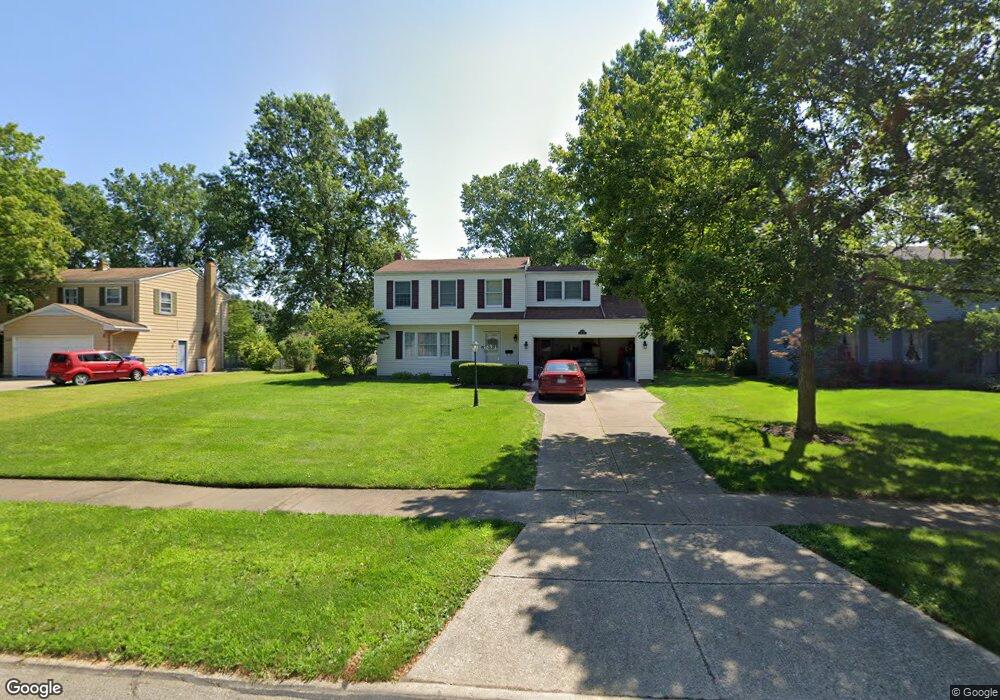
6279 Stafford Dr North Olmsted, OH 44070
Estimated Value: $290,000 - $313,000
4
Beds
2
Baths
1,656
Sq Ft
$183/Sq Ft
Est. Value
About This Home
This home is located at 6279 Stafford Dr, North Olmsted, OH 44070 and is currently estimated at $303,042, approximately $182 per square foot. 6279 Stafford Dr is a home located in Cuyahoga County with nearby schools including Chestnut Intermediate Elementary School, Pine Intermediate School, and North Olmsted Middle School.
Ownership History
Date
Name
Owned For
Owner Type
Purchase Details
Closed on
Feb 18, 1997
Sold by
Stroh Thomas M
Bought by
Rittwage Raymond M and Rittwage Lisa A
Current Estimated Value
Home Financials for this Owner
Home Financials are based on the most recent Mortgage that was taken out on this home.
Original Mortgage
$142,400
Outstanding Balance
$16,360
Interest Rate
7.74%
Mortgage Type
New Conventional
Estimated Equity
$286,682
Purchase Details
Closed on
May 25, 1983
Sold by
Stroh Thomas M and Stroh Karen K
Bought by
Stroh Thomas M
Purchase Details
Closed on
Jan 1, 1975
Bought by
Stroh Thomas M and Stroh Karen K
Create a Home Valuation Report for This Property
The Home Valuation Report is an in-depth analysis detailing your home's value as well as a comparison with similar homes in the area
Home Values in the Area
Average Home Value in this Area
Purchase History
| Date | Buyer | Sale Price | Title Company |
|---|---|---|---|
| Rittwage Raymond M | $149,900 | -- | |
| Stroh Thomas M | -- | -- | |
| Stroh Thomas M | -- | -- |
Source: Public Records
Mortgage History
| Date | Status | Borrower | Loan Amount |
|---|---|---|---|
| Open | Rittwage Raymond M | $142,400 |
Source: Public Records
Tax History Compared to Growth
Tax History
| Year | Tax Paid | Tax Assessment Tax Assessment Total Assessment is a certain percentage of the fair market value that is determined by local assessors to be the total taxable value of land and additions on the property. | Land | Improvement |
|---|---|---|---|---|
| 2024 | $6,301 | $91,945 | $19,075 | $72,870 |
| 2023 | $5,923 | $72,520 | $14,980 | $57,540 |
| 2022 | $5,892 | $72,520 | $14,980 | $57,540 |
| 2021 | $5,332 | $72,520 | $14,980 | $57,540 |
| 2020 | $5,146 | $61,990 | $12,810 | $49,180 |
| 2019 | $5,007 | $177,100 | $36,600 | $140,500 |
| 2018 | $5,078 | $61,990 | $12,810 | $49,180 |
| 2017 | $5,077 | $57,050 | $11,130 | $45,920 |
| 2016 | $5,033 | $57,050 | $11,130 | $45,920 |
| 2015 | $4,916 | $57,050 | $11,130 | $45,920 |
| 2014 | $4,916 | $55,410 | $10,820 | $44,590 |
Source: Public Records
Map
Nearby Homes
- 6281 Christman Dr
- 6305 Christman Dr
- 0 Stearns Rd
- 6321 Brighton Dr
- 29408 Stewart Dr
- 30247 Lorain Rd
- 6723 Warrington Dr
- 29667 Bretton Ridge Dr
- 6617 Sutton Dr
- 28628 Aspen Dr
- 6151 Sherwood Dr
- 5833 Stearns Rd
- 28521 Aspen Dr
- 6580 Barton Rd
- 30630 Lorain Rd
- 29861 Wellington Dr
- 6427 Mackenzie Rd
- 6127 Mackenzie Rd
- 29600 Westminster Dr
- 5461 Wellesley Ave
- 6293 Stafford Dr
- 6265 Stafford Dr
- 6309 Stafford Dr
- 6251 Stafford Dr
- 6272 Somerset Dr
- 6286 Somerset Dr
- 6258 Somerset Dr
- 6300 Somerset Dr
- 6321 Stafford Dr
- 6280 Stafford Dr
- 6237 Stafford Dr
- 6294 Stafford Dr
- 6266 Stafford Dr
- 6316 Somerset Dr
- 6244 Somerset Dr
- 6304 Stafford Dr
- 6252 Stafford Dr
- 6333 Stafford Dr
- 6223 Stafford Dr
- 6316 Stafford Dr