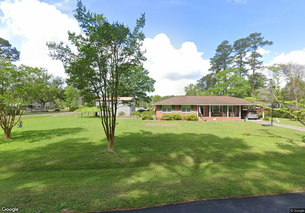
628 Branch Dr Georgetown, SC 29440
Estimated Value: $223,482 - $278,000
3
Beds
1
Bath
1,370
Sq Ft
$185/Sq Ft
Est. Value
About This Home
This home is located at 628 Branch Dr, Georgetown, SC 29440 and is currently estimated at $253,871, approximately $185 per square foot. 628 Branch Dr is a home located in Georgetown County with nearby schools including Kensington Elementary School, Georgetown Middle School, and Georgetown High School.
Ownership History
Date
Name
Owned For
Owner Type
Purchase Details
Closed on
Mar 24, 2018
Sold by
Nesmith Robert Wayne
Bought by
Foxworth Jo Anne W
Current Estimated Value
Home Financials for this Owner
Home Financials are based on the most recent Mortgage that was taken out on this home.
Original Mortgage
$146,464
Outstanding Balance
$125,508
Interest Rate
4.38%
Mortgage Type
New Conventional
Estimated Equity
$128,363
Create a Home Valuation Report for This Property
The Home Valuation Report is an in-depth analysis detailing your home's value as well as a comparison with similar homes in the area
Purchase History
| Date | Buyer | Sale Price | Title Company |
|---|---|---|---|
| Foxworth Jo Anne W | $145,000 | None Available |
Source: Public Records
Mortgage History
| Date | Status | Borrower | Loan Amount |
|---|---|---|---|
| Open | Foxworth Jo Anne W | $146,464 |
Source: Public Records
Tax History Compared to Growth
Tax History
| Year | Tax Paid | Tax Assessment Tax Assessment Total Assessment is a certain percentage of the fair market value that is determined by local assessors to be the total taxable value of land and additions on the property. | Land | Improvement |
|---|---|---|---|---|
| 2024 | $649 | $5,340 | $1,260 | $4,080 |
| 2023 | $579 | $5,340 | $1,260 | $4,080 |
| 2022 | $540 | $5,340 | $1,260 | $4,080 |
| 2021 | $528 | $5,348 | $1,264 | $4,084 |
| 2020 | $488 | $5,048 | $1,264 | $3,784 |
| 2019 | $2,003 | $5,220 | $1,264 | $3,956 |
| 2018 | $697 | $45,840 | $0 | $0 |
| 2017 | $313 | $45,840 | $0 | $0 |
| 2016 | $309 | $4,828 | $0 | $0 |
| 2015 | $383 | $0 | $0 | $0 |
| 2014 | $383 | $117,100 | $31,600 | $85,500 |
| 2012 | -- | $117,100 | $31,600 | $85,500 |
Source: Public Records
Map
Nearby Homes
- 1824 Sumter St
- 814 2nd Ave Unit Colonial Estates
- 1984 Middleton St Unit Lot 14 - Rylee 2
- 2516 N Fraser St Unit 12.26 acres
- 465 Summit Ave Unit Lot 13 - Abaco
- 1841 Jasper St
- 2004 Seitter St
- TBD Weehaw Plantation Dr Unit 65 Acres
- 459 Garden Ave
- 607 Garden Ave
- 621 Garden Ave
- 0 Rainey Dr
- 2478 N Fraser St Unit 12+ acres
- 902 Palm St
- 910 Willowbank Rd
- 126 Jericho Ct Unit Wedgefield Country C
- 291 Francis Parker Rd
- 908 Francis Parker Rd Unit Lot 448 Wedgefield
- 908 Francis Parker Rd
- 1137 Palmetto St
- 463 Walnut Ave
- 512 Lakewood Ave
- 625 Branch Dr
- 494 Lakewood Ave
- 473 Forest Ave
- 473 Forest Ave Unit 473 Forrest Avenue
- 676 Branch Dr
- 435 Walnut Ave
- 1994 Marion St
- 455 Forest Ave
- 454 Lakewood Ave
- 511 Lakewood Ave
- 425 Forest Ave
- 407 Walnut Ave
- 520 Forest Ave
- 473 Lakewood Ave Unit North of Kensington
- 473 Lakewood Ave
- 493 Lakewood Ave
- 569 Branch Dr
- 1971 Marion St
