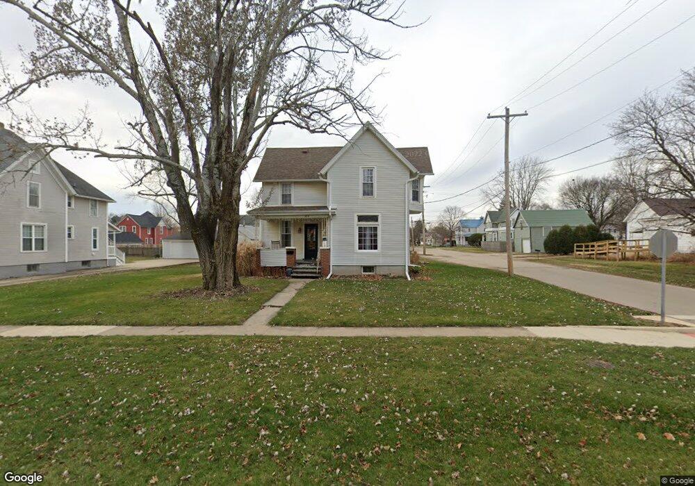
628 N Euclid Ave Princeton, IL 61356
Estimated Value: $160,007 - $208,000
--
Bed
--
Bath
--
Sq Ft
10,280
Sq Ft Lot
About This Home
This home is located at 628 N Euclid Ave, Princeton, IL 61356 and is currently estimated at $182,752. 628 N Euclid Ave is a home located in Bureau County with nearby schools including Jefferson Elementary School, Lincoln Elementary School, and Logan Junior High School.
Ownership History
Date
Name
Owned For
Owner Type
Purchase Details
Closed on
Aug 30, 2021
Sold by
Eberhardt Patricia and Timothy C Hayes Est
Bought by
Taylor Alexander J and Taylor Stacey K
Current Estimated Value
Home Financials for this Owner
Home Financials are based on the most recent Mortgage that was taken out on this home.
Original Mortgage
$102,500
Outstanding Balance
$93,717
Interest Rate
3.13%
Mortgage Type
New Conventional
Estimated Equity
$89,035
Purchase Details
Closed on
Aug 17, 2007
Sold by
Henegar Jeanne
Bought by
Hayes Timothy C
Home Financials for this Owner
Home Financials are based on the most recent Mortgage that was taken out on this home.
Original Mortgage
$61,500
Interest Rate
6.77%
Mortgage Type
New Conventional
Create a Home Valuation Report for This Property
The Home Valuation Report is an in-depth analysis detailing your home's value as well as a comparison with similar homes in the area
Home Values in the Area
Average Home Value in this Area
Purchase History
| Date | Buyer | Sale Price | Title Company |
|---|---|---|---|
| Taylor Alexander J | $125,000 | None Available | |
| Hayes Timothy C | -- | None Available |
Source: Public Records
Mortgage History
| Date | Status | Borrower | Loan Amount |
|---|---|---|---|
| Open | Taylor Alexander J | $102,500 | |
| Previous Owner | Hayes Timothy C | $61,500 |
Source: Public Records
Tax History Compared to Growth
Tax History
| Year | Tax Paid | Tax Assessment Tax Assessment Total Assessment is a certain percentage of the fair market value that is determined by local assessors to be the total taxable value of land and additions on the property. | Land | Improvement |
|---|---|---|---|---|
| 2024 | $3,619 | $52,491 | $6,137 | $46,354 |
| 2023 | $3,619 | $48,343 | $5,652 | $42,691 |
| 2022 | $3,388 | $45,324 | $5,299 | $40,025 |
| 2021 | $3,819 | $42,904 | $5,016 | $37,888 |
| 2020 | $1,746 | $25,502 | $4,832 | $20,670 |
| 2019 | $1,746 | $25,197 | $4,774 | $20,423 |
| 2018 | $1,704 | $24,766 | $4,692 | $20,074 |
| 2017 | $1,736 | $24,856 | $4,709 | $20,147 |
| 2016 | $1,679 | $24,207 | $4,586 | $19,621 |
| 2015 | -- | $23,784 | $4,506 | $19,278 |
| 2014 | -- | $23,784 | $4,506 | $19,278 |
| 2013 | -- | $23,913 | $4,530 | $19,383 |
Source: Public Records
Map
Nearby Homes
- 405 N Church St
- 319 N Chestnut St
- 919 N Euclid Ave
- 210 N Church St
- 20 S Church St
- 725 Independence Dr
- 311 W Franklin St
- 305 S Chestnut St
- 0 W Longhaven St Unit MRD12383107
- 9 S Randolph St
- 443 E Peru St
- 32 S Dallas St
- 702 W Hudson St
- 525 E Marion St
- 221 W Peru St
- 103 S Plum St
- 411 W Peru St
- 810 W Railroad Ave
- 8&9 W Century Dr
- 8 & 9 Century Dr
- 22206 Il Highway 26
- 22206 Il Highway 26
- 22206 Il Highway 26
- 620 N Euclid Ave
- 706 N Euclid Ave
- 612 N Euclid Ave
- 621 N Chestnut St
- 617 N Chestnut St
- 619 N Euclid Ave
- 705 N Euclid Ave
- 716 N Euclid Ave
- 703 N Chestnut St
- 617 N Euclid Ave
- 609 N Chestnut St
- 604 N Euclid Ave
- 715 N Euclid Ave
- 627 N Euclid Ave
- 613 N Euclid Ave
- 713 N Chestnut St
- 717 N Euclid Ave