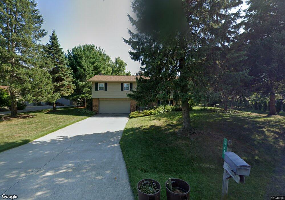
628 Royal Crest Dr Saint Joseph, MI 49085
Vineland NeighborhoodEstimated Value: $277,000 - $313,000
3
Beds
2
Baths
1,824
Sq Ft
$163/Sq Ft
Est. Value
About This Home
This home is located at 628 Royal Crest Dr, Saint Joseph, MI 49085 and is currently estimated at $297,043, approximately $162 per square foot. 628 Royal Crest Dr is a home located in Berrien County with nearby schools including Upton Middle School, St. Joseph High School, and Michigan Lutheran High School.
Ownership History
Date
Name
Owned For
Owner Type
Purchase Details
Closed on
Feb 21, 2020
Sold by
Tarantino James E and Mcshane Lisa A
Bought by
Guerrero Cara and Guerrero Carlos
Current Estimated Value
Home Financials for this Owner
Home Financials are based on the most recent Mortgage that was taken out on this home.
Original Mortgage
$185,000
Outstanding Balance
$163,805
Interest Rate
3.6%
Mortgage Type
New Conventional
Estimated Equity
$133,238
Purchase Details
Closed on
Nov 21, 2001
Purchase Details
Closed on
Jul 22, 1986
Purchase Details
Closed on
Mar 1, 1982
Purchase Details
Closed on
Oct 31, 1980
Create a Home Valuation Report for This Property
The Home Valuation Report is an in-depth analysis detailing your home's value as well as a comparison with similar homes in the area
Home Values in the Area
Average Home Value in this Area
Purchase History
| Date | Buyer | Sale Price | Title Company |
|---|---|---|---|
| Guerrero Cara | $200,000 | First American Title | |
| -- | $100 | -- | |
| -- | $67,900 | -- | |
| -- | $52,000 | -- | |
| -- | $6,000 | -- |
Source: Public Records
Mortgage History
| Date | Status | Borrower | Loan Amount |
|---|---|---|---|
| Open | Guerrero Cara | $185,000 |
Source: Public Records
Tax History Compared to Growth
Tax History
| Year | Tax Paid | Tax Assessment Tax Assessment Total Assessment is a certain percentage of the fair market value that is determined by local assessors to be the total taxable value of land and additions on the property. | Land | Improvement |
|---|---|---|---|---|
| 2025 | $3,165 | $116,300 | $0 | $0 |
| 2024 | $1,917 | $113,600 | $0 | $0 |
| 2023 | $1,826 | $90,200 | $0 | $0 |
| 2022 | $1,739 | $85,700 | $0 | $0 |
| 2021 | $2,960 | $87,100 | $24,700 | $62,400 |
| 2020 | $2,213 | $83,000 | $0 | $0 |
| 2019 | $2,117 | $75,700 | $19,800 | $55,900 |
| 2018 | $2,022 | $75,700 | $0 | $0 |
| 2017 | $1,993 | $74,200 | $0 | $0 |
| 2016 | $1,946 | $72,300 | $0 | $0 |
| 2015 | $1,914 | $68,600 | $0 | $0 |
| 2014 | $1,304 | $66,300 | $0 | $0 |
Source: Public Records
Map
Nearby Homes
- 530 Manitou Rd
- 792 Lonesome Pine Trail
- 670 Marvin Ave
- 631 Marvin Ave
- 3215 Meade Ct
- 317 Maiden Ln
- 753 Lattimer Dr
- 940 Vineland Rd
- 2960 Niles Rd
- 398121 Anchors Way
- 649 Grant Ave
- 3423 Niles Rd
- 484 W Glenlord Rd
- 4010 Deja Dr
- 00 Niles Rd
- 1153 W Glenlord Rd Unit 22
- 2841 Niles Rd
- 3620 Katherine Ln Unit 1
- 3545 Wyndwicke Dr
- 3553 Martin Path
- 627 Royal Crest Dr
- 608 Royal Crest Dr
- 607 Lonesome Pine Trail
- 609 Royal Crest Dr
- 643 Royal Crest Dr
- 591 Lonesome Pine Trail
- 625 Lonesome Pine Trail
- 658 Royal Crest Dr
- 592 Royal Crest Dr
- 593 Royal Crest Dr
- 657 Royal Crest Dr
- 641 Lonesome Pine Trail
- 575 Lonesome Pine Trail
- 672 Royal Crest Dr
- 572 Royal Crest Dr
- 655 Lonesome Pine Trail
- 577 Royal Crest Dr
- 606 Lonesome Pine Trail
- 626 Lonesome Pine Trail
- 3594 Arlington St