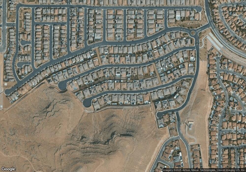
6280 Carol Butte Ct Las Vegas, NV 89141
Southern Highlands NeighborhoodEstimated Value: $1,356,000 - $1,521,000
4
Beds
4
Baths
3,955
Sq Ft
$359/Sq Ft
Est. Value
About This Home
This home is located at 6280 Carol Butte Ct, Las Vegas, NV 89141 and is currently estimated at $1,421,489, approximately $359 per square foot. 6280 Carol Butte Ct is a home with nearby schools including Charles & Phyllis Frias Elementary School, Lois & Jerry Tarkanian Middle School, and Desert Oasis High School.
Ownership History
Date
Name
Owned For
Owner Type
Purchase Details
Closed on
Jun 13, 2022
Sold by
Moffett Jr Roy E and Moffett Paula A
Bought by
Roy And Paula Moffett Family Trust
Current Estimated Value
Purchase Details
Closed on
May 17, 2018
Sold by
Richmond American Homes Of Nevada Inc
Bought by
Moffett Roy E and Moffett Paula A
Home Financials for this Owner
Home Financials are based on the most recent Mortgage that was taken out on this home.
Original Mortgage
$458,763
Interest Rate
4.4%
Mortgage Type
VA
Create a Home Valuation Report for This Property
The Home Valuation Report is an in-depth analysis detailing your home's value as well as a comparison with similar homes in the area
Home Values in the Area
Average Home Value in this Area
Purchase History
| Date | Buyer | Sale Price | Title Company |
|---|---|---|---|
| Roy And Paula Moffett Family Trust | -- | Young Law Group Pllc | |
| Moffett Roy E | -- | Young Law Group Pllc | |
| Moffett Roy E | $827,466 | Ticor Title Las Vegas |
Source: Public Records
Mortgage History
| Date | Status | Borrower | Loan Amount |
|---|---|---|---|
| Previous Owner | Moffett Roy E | $458,763 |
Source: Public Records
Tax History Compared to Growth
Tax History
| Year | Tax Paid | Tax Assessment Tax Assessment Total Assessment is a certain percentage of the fair market value that is determined by local assessors to be the total taxable value of land and additions on the property. | Land | Improvement |
|---|---|---|---|---|
| 2025 | $8,285 | $373,665 | $115,500 | $258,165 |
| 2024 | $8,045 | $373,665 | $115,500 | $258,165 |
| 2023 | $8,045 | $345,311 | $103,950 | $241,361 |
| 2022 | $7,100 | $311,043 | $92,400 | $218,643 |
| 2021 | $6,950 | $288,646 | $80,850 | $207,796 |
| 2020 | $6,567 | $279,515 | $80,850 | $198,665 |
| 2019 | $6,406 | $241,730 | $47,600 | $194,130 |
| 2018 | $770 | $33,600 | $33,600 | $0 |
| 2017 | $0 | $25,480 | $25,480 | $0 |
Source: Public Records
Map
Nearby Homes
- 6248 Carol Butte Ct
- 6315 Carol Butte Ct
- 6160 Lautman Ridge Ct
- 11032 Brandan Alps St
- 6442 Kobe Knoll Ct
- 11218 Dolcetto Dr
- 5954 Varese Dr
- 5914 Tinazzi Way
- 5966 Candia Ct
- 6496 Cape Canyon Ct
- 6476 Little Harbor Ct
- 5909 Candia Ct
- 5914 Attavilla Dr
- 5907 Ancona Dr
- 6516 Blessed Thistle Ave
- 6534 Blessed Thistle Ave
- 6279 Dollar Bill Ct
- 6255 Dollar Bill Ct
- 5832 Ivy Vine Ct
- 6134 W Levi Ave
- 6288 Carol Butte Ct
- 6272 Carol Butte Ct
- 6273 Lautman Ridge Ct
- 6265 Lautman Ridge Ct
- 6296 Carol Butte Ct
- 6281 Lautman Ridge Ct
- 6264 Carol Butte Ct
- 6291 Carol Butte Ct
- 6283 Carol Butte Ct
- 6257 Lautman Ridge Ct
- 6289 Lautman Ridge Ct
- 6299 Carol Butte Ct
- 6275 Carol Butte Ct
- 6256 Carol Butte Ct
- 6304 Carol Butte Ct
- 6297 Lautman Ridge Ct
- 6249 Lautman Ridge Ct
- 6307 Carol Butte Ct
- 6267 Carol Butte Ct
- 6305 Lautman Ridge Ct
