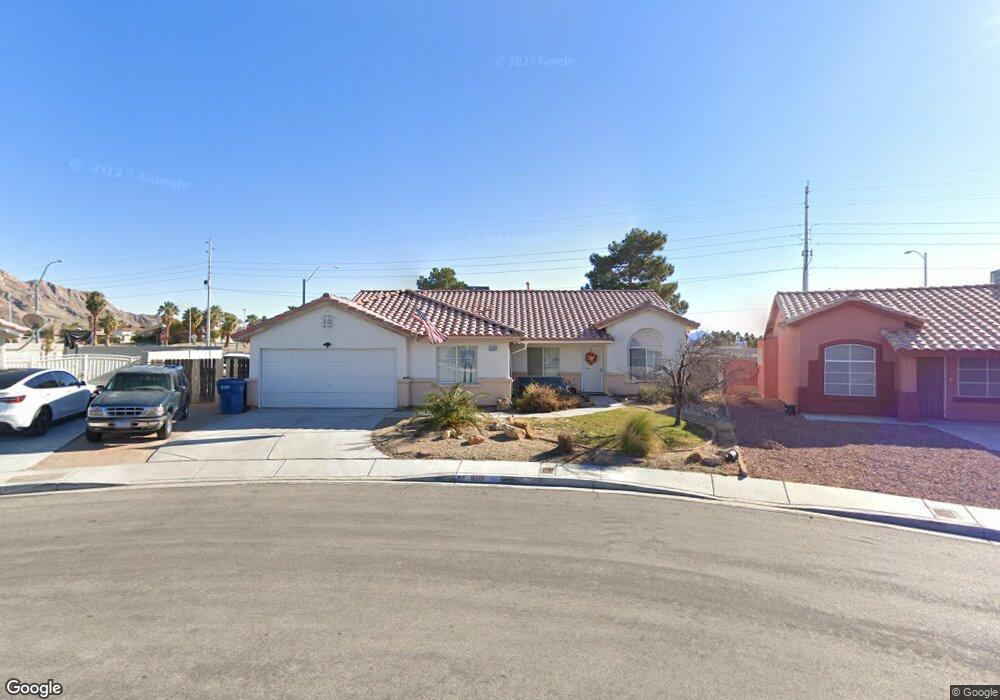
6281 Dundee Port Ave Las Vegas, NV 89110
Estimated Value: $450,000 - $523,000
4
Beds
2
Baths
2,120
Sq Ft
$229/Sq Ft
Est. Value
About This Home
This home is located at 6281 Dundee Port Ave, Las Vegas, NV 89110 and is currently estimated at $485,933, approximately $229 per square foot. 6281 Dundee Port Ave is a home located in Clark County with nearby schools including Eileen Brookman Elementary School, Dr. William H. Bailey Middle School, and Eldorado High School.
Ownership History
Date
Name
Owned For
Owner Type
Purchase Details
Closed on
Dec 7, 2023
Sold by
Yates Lannie M and Yates Lucille
Bought by
Yates Family Trust and Yates
Current Estimated Value
Create a Home Valuation Report for This Property
The Home Valuation Report is an in-depth analysis detailing your home's value as well as a comparison with similar homes in the area
Home Values in the Area
Average Home Value in this Area
Purchase History
| Date | Buyer | Sale Price | Title Company |
|---|---|---|---|
| Yates Family Trust | -- | None Listed On Document |
Source: Public Records
Tax History Compared to Growth
Tax History
| Year | Tax Paid | Tax Assessment Tax Assessment Total Assessment is a certain percentage of the fair market value that is determined by local assessors to be the total taxable value of land and additions on the property. | Land | Improvement |
|---|---|---|---|---|
| 2025 | $1,564 | $104,516 | $32,708 | $71,808 |
| 2024 | $1,519 | $104,516 | $32,708 | $71,808 |
| 2023 | $1,519 | $102,094 | $33,810 | $68,284 |
| 2022 | $1,475 | $90,565 | $27,930 | $62,635 |
| 2021 | $1,432 | $83,992 | $24,255 | $59,737 |
| 2020 | $1,387 | $82,850 | $23,520 | $59,330 |
| 2019 | $1,347 | $78,730 | $20,213 | $58,517 |
| 2018 | $1,307 | $72,150 | $15,750 | $56,400 |
| 2017 | $2,089 | $71,222 | $14,000 | $57,222 |
| 2016 | $1,239 | $58,535 | $10,500 | $48,035 |
| 2015 | $1,236 | $48,790 | $8,750 | $40,040 |
| 2014 | $1,200 | $39,684 | $7,000 | $32,684 |
Source: Public Records
Map
Nearby Homes
- 796 Ringwood Ln
- 6235 Sapporo Cir
- 6218 Sapporo Cir
- 740 Santree Cir
- 6449 Elizabethtown Ave
- 1083 Devon Lake St
- 6209 Exquisite Ave
- 6538 Astorville Ct
- 6561 Alma White St
- 563 Moon Chase St
- 0 Linden Ave
- 6440 Spanish Garden Ct
- 807 Sun Shimmer Place
- 6030 Halehaven Dr
- 6400 Stewart Ave
- 910 N Sloan Ln Unit 201
- 1083 Sterling Peak St
- 5923 Halehaven Dr
- 650 N Hollywood Blvd
- 6502 Bristle Canyon Ave
- 826 Samoy St
- 6269 Dundee Port Ave
- 838 Samoy St
- 6259 Dundee Port Ave
- 6268 Dundee Port Ave
- 848 Samoy St
- 6249 Dundee Port Ave
- 6258 Dundee Port Ave
- 819 Carey Hall St
- 853 Samoy St
- 6248 Dundee Port Ave
- 858 Samoy St
- 831 Carey Hall St
- 6239 Dundee Port Ave
- 790 Theatre Ct
- 6313 Mahogany Peak Ave
- 765 Fogg St
- 843 Carey Hall St
- 863 Samoy St
- 6238 Dundee Port Ave