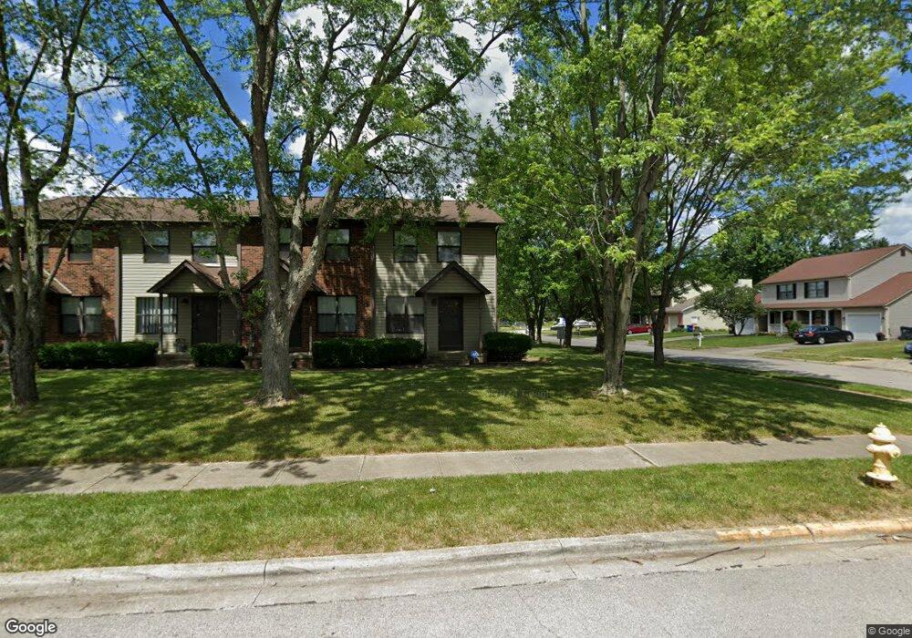
6281 Rippey Cir Reynoldsburg, OH 43068
Estimated Value: $210,000 - $246,000
2
Beds
2
Baths
1,096
Sq Ft
$209/Sq Ft
Est. Value
About This Home
This home is located at 6281 Rippey Cir, Reynoldsburg, OH 43068 and is currently estimated at $228,834, approximately $208 per square foot. 6281 Rippey Cir is a home located in Franklin County with nearby schools including Slate Ridge Elementary School, Baldwin Road Junior High School, and Hannah J Ashton Middle School.
Ownership History
Date
Name
Owned For
Owner Type
Purchase Details
Closed on
Feb 4, 2005
Sold by
Thomas Robert C and Thomas Victoria
Bought by
Camillus Enterprizes Ltd
Current Estimated Value
Home Financials for this Owner
Home Financials are based on the most recent Mortgage that was taken out on this home.
Original Mortgage
$312,000
Interest Rate
6.75%
Mortgage Type
Purchase Money Mortgage
Purchase Details
Closed on
Nov 1, 2002
Sold by
Abdalla Ahmed and Abdalla Salwa
Bought by
Central Ohio Property Llc
Purchase Details
Closed on
Mar 8, 1988
Bought by
Abdalla Ahmed M and Abdalla Salwa A
Create a Home Valuation Report for This Property
The Home Valuation Report is an in-depth analysis detailing your home's value as well as a comparison with similar homes in the area
Home Values in the Area
Average Home Value in this Area
Purchase History
| Date | Buyer | Sale Price | Title Company |
|---|---|---|---|
| Camillus Enterprizes Ltd | -- | -- | |
| Thomas Robert C | $305,000 | -- | |
| Central Ohio Property Llc | $275,000 | Real Living Title | |
| Abdalla Ahmed M | $48,800 | -- |
Source: Public Records
Mortgage History
| Date | Status | Borrower | Loan Amount |
|---|---|---|---|
| Closed | Thomas Robert C | $312,000 |
Source: Public Records
Tax History Compared to Growth
Tax History
| Year | Tax Paid | Tax Assessment Tax Assessment Total Assessment is a certain percentage of the fair market value that is determined by local assessors to be the total taxable value of land and additions on the property. | Land | Improvement |
|---|---|---|---|---|
| 2024 | $3,566 | $68,010 | $21,000 | $47,010 |
| 2023 | $3,407 | $68,010 | $21,000 | $47,010 |
| 2022 | $2,762 | $38,220 | $4,200 | $34,020 |
| 2021 | $2,902 | $38,220 | $4,200 | $34,020 |
| 2020 | $2,593 | $38,220 | $4,200 | $34,020 |
| 2019 | $2,377 | $31,710 | $3,500 | $28,210 |
| 2018 | $2,201 | $31,710 | $3,500 | $28,210 |
| 2017 | $2,233 | $31,710 | $3,500 | $28,210 |
| 2016 | $2,088 | $24,890 | $3,330 | $21,560 |
| 2015 | $2,025 | $24,890 | $3,330 | $21,560 |
| 2014 | $2,034 | $24,890 | $3,330 | $21,560 |
| 2013 | $1,165 | $29,295 | $3,920 | $25,375 |
Source: Public Records
Map
Nearby Homes
- 6348 E Livingston Ave
- 6549 Santa Cruz Place
- 6584 Benjamin Dr
- 0 Brice Rd
- 6682 Woodsedge Dr
- 0 Radekin Rd Unit 225029852
- 1550 Idlewild Dr
- 6486 Ethan Dr
- 6775 Centennial Dr
- 1888 Birkdale Dr
- 2997 Hubbardton Place
- 6535 Canby Place
- 6728 Greenbush Dr
- 6772 Gilette Dr
- 1826-1828 Bairsford Dr
- 1942 Bairsford Dr Unit 944
- 6658 Furth Dr
- 3119 Yorkdale Ln
- 1603 Hallworth Ct Unit 16038
- 3085 Bocastle Ct
- 6283 Rippey Cir
- 6285 Rippey Cir
- 6287 Rippey Cir
- 2289-2291 Ayers Dr Unit 291
- 2289 Ayers Dr Unit 291
- 2289 Ayers Dr Unit 2291
- 2285-2287 Ayers Dr
- 2285 Ayers Dr Unit 287
- 6289 Rippey Cir
- 2293 Ayers Dr
- 2293 Ayers Dr Unit 3000
- 2283 Ayers Dr
- 2295 Ayers Dr
- 2281 Ayers Dr
- 2245 Pinion Place Unit 247
- 2279 Ayers Dr
- 2249 Pinion Place Unit 251
- 2241 Pinion Place Unit 243
- 2241 Pinion Place Unit 2243
- 2277 Ayers Dr