Estimated Value: $804,345 - $860,000
3
Beds
2
Baths
4,504
Sq Ft
$186/Sq Ft
Est. Value
About This Home
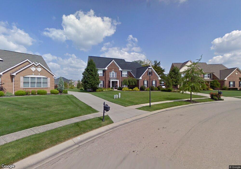
This home is located at 6282 Blackheath Cir, Mason, OH 45040 and is currently estimated at $839,836, approximately $186 per square foot. 6282 Blackheath Cir is a home located in Warren County with nearby schools including Mason Intermediate Elementary School, Mason Middle School, and William Mason High School.
Ownership History
Date
Name
Owned For
Owner Type
Purchase Details
Closed on
Aug 9, 2002
Sold by
Ray Murphy Homes Inc
Bought by
Oliver Keith A and Oliver Nancy A
Current Estimated Value
Home Financials for this Owner
Home Financials are based on the most recent Mortgage that was taken out on this home.
Original Mortgage
$272,000
Outstanding Balance
$115,673
Interest Rate
6.62%
Mortgage Type
New Conventional
Estimated Equity
$724,163
Purchase Details
Closed on
Jan 11, 1999
Sold by
Mason Joint Venture Pll
Bought by
Ray Murphy Homes Inc
Create a Home Valuation Report for This Property
The Home Valuation Report is an in-depth analysis detailing your home's value as well as a comparison with similar homes in the area
Home Values in the Area
Average Home Value in this Area
Purchase History
| Date | Buyer | Sale Price | Title Company |
|---|---|---|---|
| Oliver Keith A | $458,630 | -- | |
| Ray Murphy Homes Inc | $153,960 | -- |
Source: Public Records
Mortgage History
| Date | Status | Borrower | Loan Amount |
|---|---|---|---|
| Open | Oliver Keith A | $272,000 |
Source: Public Records
Tax History Compared to Growth
Tax History
| Year | Tax Paid | Tax Assessment Tax Assessment Total Assessment is a certain percentage of the fair market value that is determined by local assessors to be the total taxable value of land and additions on the property. | Land | Improvement |
|---|---|---|---|---|
| 2024 | $9,983 | $245,980 | $30,190 | $215,790 |
| 2023 | $9,584 | $199,503 | $28,875 | $170,628 |
| 2022 | $9,461 | $199,504 | $28,875 | $170,629 |
| 2021 | $8,962 | $199,504 | $28,875 | $170,629 |
| 2020 | $9,502 | $181,367 | $26,250 | $155,117 |
| 2019 | $8,736 | $181,367 | $26,250 | $155,117 |
| 2018 | $8,765 | $181,367 | $26,250 | $155,117 |
| 2017 | $8,329 | $160,895 | $24,437 | $136,458 |
| 2016 | $8,579 | $160,895 | $24,437 | $136,458 |
| 2015 | $8,597 | $160,895 | $24,437 | $136,458 |
| 2014 | $8,617 | $150,370 | $22,840 | $127,530 |
| 2013 | $8,635 | $172,840 | $26,250 | $146,590 |
Source: Public Records
Map
Nearby Homes
- 4109 Old Manchester Ct
- 4154 Fieldsedge Dr
- 3900 St Andrews Ct
- 5799 Fairway Dr
- 4087 Fieldsedge Dr Unit 285E
- 6550 Villagefield Dr
- 6668 Pondfield Ln
- 6545 Farmbrooke Ct
- 6292 Greenwood Ct
- 6334 Greenwood Ct
- 6298 Greenwood Ct
- 6328 Greenwood Ct
- 6279 Greenwood Ct
- 6346 Coverage Ct
- 6350 Coverage Ct
- 6342 Coverage Ct
- 6338 Coverage Ct
- 6267 Greenwood Ct
- 6674 Villager Place Unit 153D
- 4762 Flagstone Dr
- 6272 Blackheath Cir
- 6292 Blackheath Cir
- 6274 Blackheath Cir
- 6122 Fairway Dr
- 6108 Fairway Dr
- 6144 Fairway Dr
- 6304 Blackheath Cir
- 6160 Fairway Dr
- 6178 Fairway Dr
- 6322 Blackheath Cir
- 6257 Blackheath Cir
- 4063 Saint Andrews Ct
- 6198 Fairway Dr
- 4075 Saint Andrews Ct
- 4075 St Andrews Ct
- 6119 Fairway Dr
- 6135 Fairway Dr
- 6105 Fairway Dr
- 6153 Fairway Dr
- 6355 Blackheath Cir