Estimated Value: $462,000 - $783,885
4
Beds
2
Baths
2,772
Sq Ft
$218/Sq Ft
Est. Value
About This Home
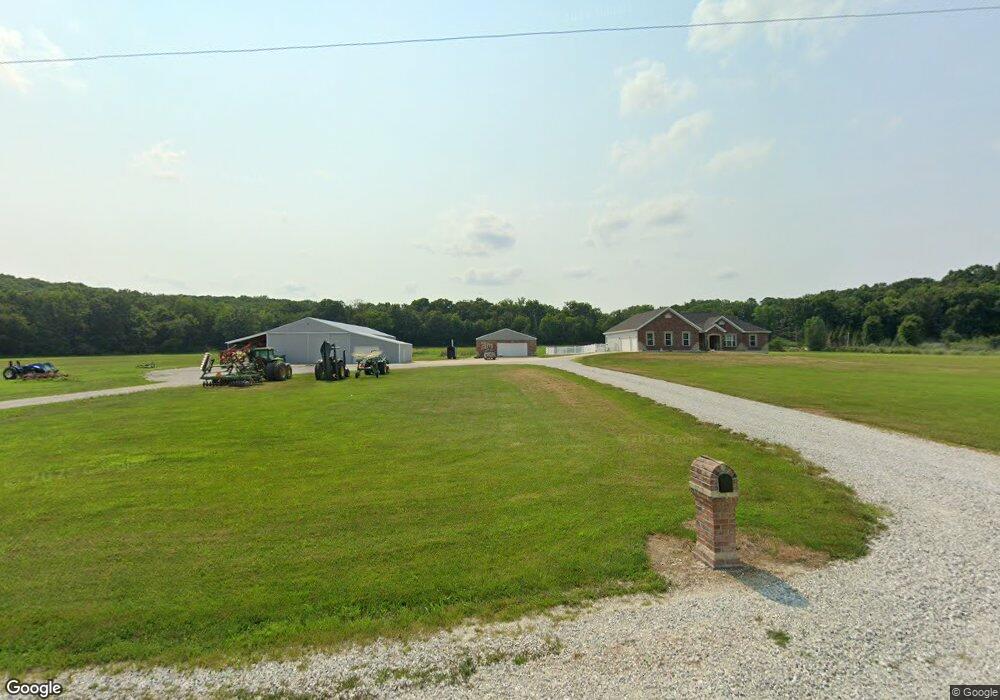
This home is located at 6282 E Rock Springs Rd, Troy, MO 63379 and is currently estimated at $604,471, approximately $218 per square foot. 6282 E Rock Springs Rd is a home located in Lincoln County with nearby schools including Wright City West Elementary School, Wright City East Elementary School, and Wright City Middle School.
Ownership History
Date
Name
Owned For
Owner Type
Purchase Details
Closed on
Jun 22, 2005
Sold by
Turpin Gregory M and Turpin Sandra
Bought by
Vacha Rick and Vacha Jennifer M
Current Estimated Value
Home Financials for this Owner
Home Financials are based on the most recent Mortgage that was taken out on this home.
Original Mortgage
$495,000
Outstanding Balance
$241,436
Interest Rate
4.75%
Mortgage Type
Adjustable Rate Mortgage/ARM
Estimated Equity
$363,035
Create a Home Valuation Report for This Property
The Home Valuation Report is an in-depth analysis detailing your home's value as well as a comparison with similar homes in the area
Home Values in the Area
Average Home Value in this Area
Purchase History
| Date | Buyer | Sale Price | Title Company |
|---|---|---|---|
| Vacha Rick | -- | None Available |
Source: Public Records
Mortgage History
| Date | Status | Borrower | Loan Amount |
|---|---|---|---|
| Open | Vacha Rick | $495,000 |
Source: Public Records
Tax History Compared to Growth
Tax History
| Year | Tax Paid | Tax Assessment Tax Assessment Total Assessment is a certain percentage of the fair market value that is determined by local assessors to be the total taxable value of land and additions on the property. | Land | Improvement |
|---|---|---|---|---|
| 2025 | $3,895 | $73,031 | $6,124 | $66,907 |
| 2024 | $3,895 | $64,745 | $4,868 | $59,877 |
| 2023 | $3,886 | $68,083 | $5,934 | $62,149 |
| 2022 | $3,677 | $61,583 | $4,868 | $56,715 |
| 2021 | $3,698 | $299,618 | $0 | $0 |
| 2020 | $3,280 | $262,354 | $0 | $0 |
| 2019 | $3,271 | $262,354 | $0 | $0 |
| 2018 | $3,238 | $54,947 | $0 | $0 |
| 2017 | $3,230 | $54,947 | $0 | $0 |
| 2016 | $2,908 | $48,633 | $0 | $0 |
| 2015 | $2,904 | $48,633 | $0 | $0 |
| 2014 | $2,901 | $49,551 | $0 | $0 |
| 2013 | -- | $48,455 | $0 | $0 |
Source: Public Records
Map
Nearby Homes
- 0 Staghorn Unit MIS25064759
- 498 Staghorn Ln
- 530 Hickory Knoll Dr
- 245 Auburn Ridge Dr
- 500 Hickory Knoll Dr
- 291 Auburn Ridge Dr
- 442 Shady Trail Dr
- 268 Auburn Ridge Dr
- 431 Shady Trail Dr
- 430 Shady Trail Dr
- 564 Highway Ww
- 31655 Dogwood Ln
- 311 Lopin Ct
- 31634 Dogwood Ln
- 31640 Dogwood Ln
- 212 Creek Valley Dr
- 201 Creek Valley Dr
- 125 Jabin Farm Rd
- 31899 Red Cedar Ct
- 11264 Village Dr W
- 6125 E Rock Springs Rd
- 6423 E Rock Springs Rd
- 0off of E Rock Springs Rd
- 6287 E Rock Springs Rd
- 6349 E Rock Springs Rd
- 6200 E Rock Springs Rd
- 6187 E Rock Springs Rd
- 6396 E Rock Springs Rd
- 6135 E Rock Springs Rd
- 6419 E Rock Springs Rd
- 230 Fox Run Ct
- 151 Serenity Ln
- 77 Fox Run Dr
- 265 Fox Run Ct
- 91 Big Creek Farm Dr
- 99 Big Creek Farm Dr
- 105 Big Creek Farm Dr
- 6494 E Rock Springs Rd
- 141 Serenity Ln
- 109 Big Creek Farm Dr