Estimated Value: $246,381 - $282,000
3
Beds
2
Baths
1,064
Sq Ft
$248/Sq Ft
Est. Value
About This Home
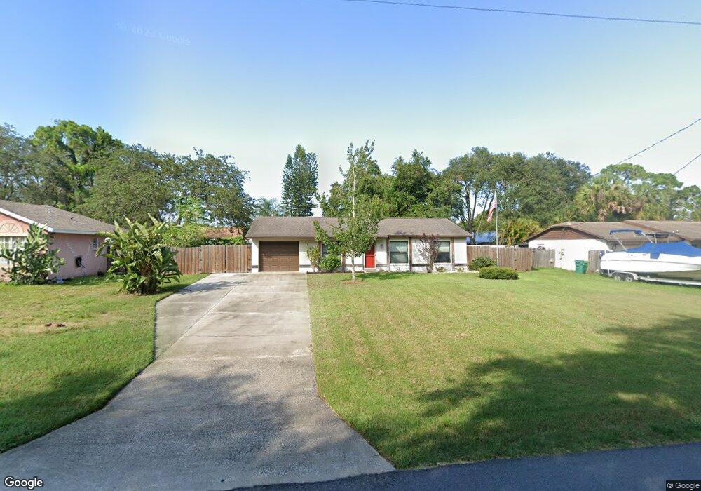
This home is located at 6285 Deer Ln, Cocoa, FL 32927 and is currently estimated at $264,095, approximately $248 per square foot. 6285 Deer Ln is a home located in Brevard County with nearby schools including Enterprise Elementary School, Space Coast Junior/Senior High School, and East Atlantic Prep of Brevard County.
Ownership History
Date
Name
Owned For
Owner Type
Purchase Details
Closed on
Dec 31, 2001
Sold by
Cooper Brett A and Cooper Marion E
Bought by
Bratt Daniel Douglas and Cooper Bridgett L
Current Estimated Value
Home Financials for this Owner
Home Financials are based on the most recent Mortgage that was taken out on this home.
Original Mortgage
$76,398
Outstanding Balance
$31,109
Interest Rate
6.99%
Estimated Equity
$232,986
Create a Home Valuation Report for This Property
The Home Valuation Report is an in-depth analysis detailing your home's value as well as a comparison with similar homes in the area
Home Values in the Area
Average Home Value in this Area
Purchase History
| Date | Buyer | Sale Price | Title Company |
|---|---|---|---|
| Bratt Daniel Douglas | $74,900 | -- |
Source: Public Records
Mortgage History
| Date | Status | Borrower | Loan Amount |
|---|---|---|---|
| Open | Bratt Daniel Douglas | $76,398 |
Source: Public Records
Tax History
| Year | Tax Paid | Tax Assessment Tax Assessment Total Assessment is a certain percentage of the fair market value that is determined by local assessors to be the total taxable value of land and additions on the property. | Land | Improvement |
|---|---|---|---|---|
| 2025 | $2,703 | $191,500 | -- | -- |
| 2024 | $2,651 | $195,150 | -- | -- |
| 2023 | $2,651 | $195,200 | $0 | $0 |
| 2022 | $2,400 | $187,260 | $0 | $0 |
| 2021 | $2,165 | $140,020 | $42,000 | $98,020 |
| 2020 | $2,005 | $126,220 | $40,000 | $86,220 |
| 2019 | $1,893 | $121,550 | $35,000 | $86,550 |
| 2018 | $1,791 | $109,940 | $27,000 | $82,940 |
| 2017 | $1,698 | $97,770 | $24,000 | $73,770 |
| 2016 | $1,589 | $83,420 | $18,000 | $65,420 |
| 2015 | $1,511 | $65,830 | $15,000 | $50,830 |
| 2014 | $1,383 | $59,850 | $11,000 | $48,850 |
Source: Public Records
Map
Nearby Homes
- 5680 Banos Ave
- 6438 Hudson Rd
- 5720 Flint Rd
- 6481 La Brea Ave
- 5715 Fairbridge St
- 6581 Bancroft Ave
- 6365 Homestead Ave
- 6450 Ember Ave
- 6470 Bamboo Ave
- 5946 Deer Ln
- 23-35-21-JX-B-2 Aruin St
- 6615 Dock Ave
- 5220 Holden Rd
- 5945 Coker Ave
- 5215 Holden Rd
- 5221 Carrick Rd
- 6010 Fay Blvd
- 6020 Cannon Ave
- 6545 Addie Ave
- 00 Unknown
Your Personal Tour Guide
Ask me questions while you tour the home.