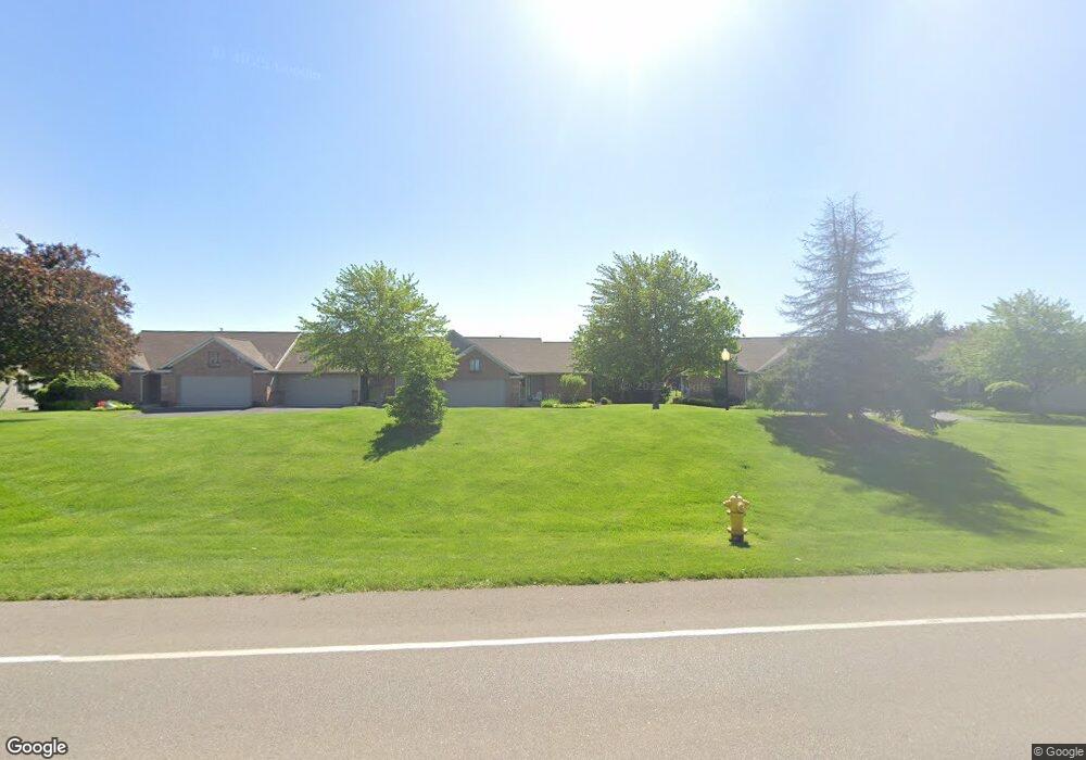
6286 Gentry Ct S Unit 22 Hudsonville, MI 49426
Estimated Value: $349,000 - $367,000
3
Beds
3
Baths
2,300
Sq Ft
$155/Sq Ft
Est. Value
About This Home
This home is located at 6286 Gentry Ct S Unit 22, Hudsonville, MI 49426 and is currently estimated at $356,305, approximately $154 per square foot. 6286 Gentry Ct S Unit 22 is a home located in Ottawa County with nearby schools including Bursley School, Jenison Junior High School, and Jenison High School.
Ownership History
Date
Name
Owned For
Owner Type
Purchase Details
Closed on
Jun 29, 2018
Sold by
Buskirk Alvin D
Bought by
Polkowski Amanda S and Chirco Joseph
Current Estimated Value
Home Financials for this Owner
Home Financials are based on the most recent Mortgage that was taken out on this home.
Original Mortgage
$135,000
Outstanding Balance
$117,256
Interest Rate
4.6%
Mortgage Type
New Conventional
Estimated Equity
$239,049
Purchase Details
Closed on
Dec 7, 2016
Sold by
Buskirk Alvin D
Bought by
Buskirk Alvin D and The Alvin D Buskirk Trust
Purchase Details
Closed on
May 27, 2005
Sold by
Hay Donald G and Hay Jacqueline E
Bought by
Buskirk Alvin D
Create a Home Valuation Report for This Property
The Home Valuation Report is an in-depth analysis detailing your home's value as well as a comparison with similar homes in the area
Home Values in the Area
Average Home Value in this Area
Purchase History
| Date | Buyer | Sale Price | Title Company |
|---|---|---|---|
| Polkowski Amanda S | $180,000 | Chicago Title Of Mi Inc | |
| Buskirk Alvin D | -- | Attorney | |
| Buskirk Alvin D | $215,000 | Chicago Title |
Source: Public Records
Mortgage History
| Date | Status | Borrower | Loan Amount |
|---|---|---|---|
| Open | Polkowski Amanda S | $135,000 |
Source: Public Records
Tax History Compared to Growth
Tax History
| Year | Tax Paid | Tax Assessment Tax Assessment Total Assessment is a certain percentage of the fair market value that is determined by local assessors to be the total taxable value of land and additions on the property. | Land | Improvement |
|---|---|---|---|---|
| 2025 | $3,867 | $163,100 | $0 | $0 |
| 2024 | $3,355 | $163,500 | $0 | $0 |
| 2023 | $3,203 | $134,800 | $0 | $0 |
| 2022 | $3,516 | $131,100 | $0 | $0 |
| 2021 | $3,414 | $120,700 | $0 | $0 |
| 2020 | $3,377 | $119,500 | $0 | $0 |
| 2019 | $3,380 | $116,400 | $0 | $0 |
| 2018 | $2,333 | $115,500 | $0 | $0 |
| 2017 | $2,177 | $108,500 | $0 | $0 |
| 2016 | $2,163 | $98,900 | $0 | $0 |
| 2015 | $2,065 | $101,500 | $0 | $0 |
| 2014 | $2,065 | $76,100 | $0 | $0 |
Source: Public Records
Map
Nearby Homes
- 6293 Eastridge Dr
- 6363 Eastridge Ct
- 6129 W Bay Ct
- 1520 Winifred St
- 1519 Eagle Shore Ct Unit Lot 33
- 1496 Eagle Shore Ct Unit 13
- 1481 Eagle Shore Ct Unit 39
- 1451 Eagle Shore Ct
- 1433 Winifred St
- 1355 Bent Tree Dr Unit 12
- 1361 Carol Dr
- 5833 Nelson Dr
- 6025 Gleneagle Dr
- 5954 Gleneagle Dr
- 6451 12th Ave
- 1187 Fairfield Dr
- Parcel 8 16th Ave
- 6905 Maple Ave
- 1037 Fairfield Dr
- 1040 Castlebay Way Unit 19
- 6288 Gentry Ct S Unit 23
- 6256 Gentry Ct S
- 6290 Gentry Ct S
- 6254 Gentry Ct S
- 6252 Gentry Ct S
- 6306 Gentry Ct S
- 6308 Gentry Ct S
- 6310 Gentry Ct S Unit 27
- 6287 Melbourne Ct
- 6273 Melbourne Ct
- 1783 Laramy Ln Unit 18
- 1781 Laramy Ln
- 6271 Melbourne Ct
- 6289 Melbourne Ct Unit 43
- 6255 Eastridge Dr
- 6287 Eastridge Dr
- 1776 Stonegate Dr
- 6251 Eastridge Dr
- 6249 Eastridge Dr Unit 26
- 6253 Eastridge Dr