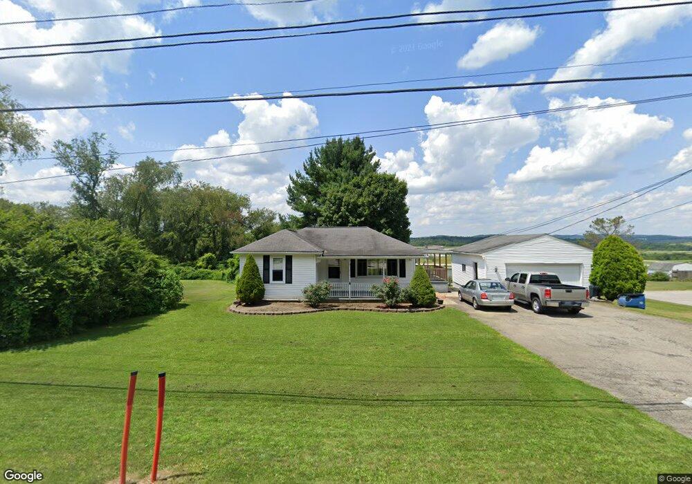
629 Charles Houck Rd Latrobe, PA 15650
Estimated Value: $82,459 - $206,000
--
Bed
--
Bath
--
Sq Ft
0.48
Acres
About This Home
This home is located at 629 Charles Houck Rd, Latrobe, PA 15650 and is currently estimated at $149,365. 629 Charles Houck Rd is a home located in Westmoreland County with nearby schools including Greater Latrobe Junior High School, Greater Latrobe Senior High School, and Christ the Divine Teacher School.
Ownership History
Date
Name
Owned For
Owner Type
Purchase Details
Closed on
Jul 30, 2025
Sold by
Spahn Susan Lynn
Bought by
Mccurdy Faith A and Mccurdy Carrie E
Current Estimated Value
Home Financials for this Owner
Home Financials are based on the most recent Mortgage that was taken out on this home.
Original Mortgage
$75,000
Outstanding Balance
$74,806
Interest Rate
6.77%
Mortgage Type
New Conventional
Estimated Equity
$74,559
Create a Home Valuation Report for This Property
The Home Valuation Report is an in-depth analysis detailing your home's value as well as a comparison with similar homes in the area
Home Values in the Area
Average Home Value in this Area
Purchase History
| Date | Buyer | Sale Price | Title Company |
|---|---|---|---|
| Mccurdy Faith A | $100,000 | Elite Settlement Services |
Source: Public Records
Mortgage History
| Date | Status | Borrower | Loan Amount |
|---|---|---|---|
| Open | Mccurdy Faith A | $75,000 |
Source: Public Records
Tax History Compared to Growth
Tax History
| Year | Tax Paid | Tax Assessment Tax Assessment Total Assessment is a certain percentage of the fair market value that is determined by local assessors to be the total taxable value of land and additions on the property. | Land | Improvement |
|---|---|---|---|---|
| 2025 | $1,620 | $13,420 | $1,890 | $11,530 |
| 2024 | $1,620 | $13,420 | $1,890 | $11,530 |
| 2023 | $1,485 | $13,420 | $1,890 | $11,530 |
| 2022 | $1,485 | $13,420 | $1,890 | $11,530 |
| 2021 | $1,472 | $13,420 | $1,890 | $11,530 |
| 2020 | $1,449 | $13,420 | $1,890 | $11,530 |
| 2019 | $1,428 | $13,420 | $1,890 | $11,530 |
| 2018 | $1,422 | $13,420 | $1,890 | $11,530 |
| 2017 | $1,385 | $13,420 | $1,890 | $11,530 |
| 2016 | $325 | $13,420 | $1,890 | $11,530 |
| 2015 | $325 | $13,420 | $1,890 | $11,530 |
| 2014 | -- | $13,420 | $1,890 | $11,530 |
Source: Public Records
Map
Nearby Homes
- 1160 Murray Ave
- 5634 State Route 981
- 1185 Murray Ave
- 2002 Deacon Dr Unit 3
- 1108 B St
- 1113 B St
- 112 Alpen Strasse Dr
- 01 Christ's Ln
- 1590 Lois Rd Unit Lot 13 B
- 1302 Roger Drive Lot 55 B
- Lot 22 Spruce St
- 1616 Lois Road Lot 18 A
- 1630 Lois Rd Unit Lot 22 B
- 1632 Lois Rd Unit Lot 22 A
- 1618 Lois Road Lot 19 B
- RT 130-Bell Memorial
- 1305 Roger Drive Lot 51 A
- 00 Ritenour Ln & MacEy Rd
- 1062 Schultz Rd
- 155 Smolleck St
- 635 Charles Houck Rd
- 5542 Pleasant Unity Rd
- 639 Charles Houck Rd
- 5552 Pleasant Unity Rd
- 636 Charles Houck Rd
- 620 Charles Houck Rd
- 9 State Route 2027
- 5538 Pleasant Unity Rd
- 617 Charles Houck Rd
- 645 Charles Houck Rd
- 2007 Sr
- 614 Charles Houck Rd
- 616 Charles Houck Rd
- 649 Charles Houck Rd
- 2007 Sr
- 648 Charles Houck Rd
- 1110 Murray Ave
- 2027 Sr Rd
- 609 Charles Houck Rd
- 610 Charles Houck Rd