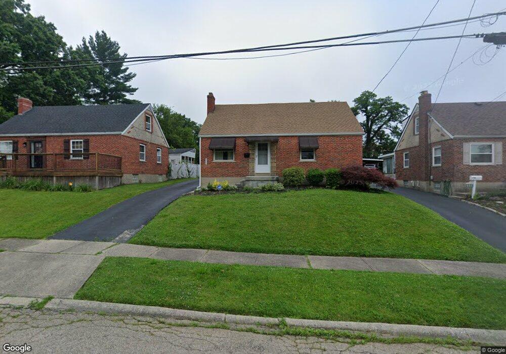
629 Dottie Ct Cincinnati, OH 45215
Estimated Value: $199,738 - $259,000
4
Beds
1
Bath
968
Sq Ft
$251/Sq Ft
Est. Value
About This Home
This home is located at 629 Dottie Ct, Cincinnati, OH 45215 and is currently estimated at $242,935, approximately $250 per square foot. 629 Dottie Ct is a home located in Hamilton County with nearby schools including Reading Community High School, Saints Peter and Paul Academy, and Mount Notre Dame High School.
Create a Home Valuation Report for This Property
The Home Valuation Report is an in-depth analysis detailing your home's value as well as a comparison with similar homes in the area
Home Values in the Area
Average Home Value in this Area
Tax History Compared to Growth
Tax History
| Year | Tax Paid | Tax Assessment Tax Assessment Total Assessment is a certain percentage of the fair market value that is determined by local assessors to be the total taxable value of land and additions on the property. | Land | Improvement |
|---|---|---|---|---|
| 2024 | $2,618 | $60,326 | $12,103 | $48,223 |
| 2023 | $2,693 | $60,326 | $12,103 | $48,223 |
| 2022 | $2,327 | $43,012 | $10,490 | $32,522 |
| 2021 | $1,938 | $43,012 | $10,490 | $32,522 |
| 2020 | $1,965 | $43,012 | $10,490 | $32,522 |
| 2019 | $1,841 | $38,063 | $9,282 | $28,781 |
| 2018 | $1,843 | $38,063 | $9,282 | $28,781 |
| 2017 | $1,734 | $38,063 | $9,282 | $28,781 |
| 2016 | $1,748 | $38,434 | $9,097 | $29,337 |
| 2015 | $1,767 | $38,434 | $9,097 | $29,337 |
| 2014 | $1,547 | $38,434 | $9,097 | $29,337 |
| 2013 | $1,577 | $39,218 | $9,282 | $29,936 |
Source: Public Records
Map
Nearby Homes
- 636 Maple Dr
- 796 Kenray Ct
- 2558 Apple Ridge Ln
- 0 Hill St Unit 1616370
- L Apple Ridge Ln
- 2071 Longmeadow Ln
- 2127 Longmeadow Ln
- 310 E Vine St
- 797 4th St
- 1246 Thurnridge Dr
- 2920 E Galbraith Rd
- 69 Orchard Knoll Dr
- 234 Mcguire Ln
- 17 Maple St
- 1194 Fuhrman Rd
- 8745 Reading Rd
- 1521 Hunt Rd
- 1013 Market St
- 116 Pike St
- 2281 E Galbraith Rd