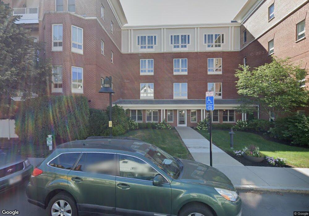
Hammonswood at Chestnut Hill 629 Hammond St Unit WPH2 Chestnut Hill, MA 02467
Chestnut Hill NeighborhoodEstimated Value: $930,733 - $1,125,000
2
Beds
2
Baths
1,098
Sq Ft
$930/Sq Ft
Est. Value
About This Home
This home is located at 629 Hammond St Unit WPH2, Chestnut Hill, MA 02467 and is currently estimated at $1,021,183, approximately $930 per square foot. 629 Hammond St Unit WPH2 is a home located in Norfolk County with nearby schools including Baker School, Brimmer & May School, and The Chestnut Hill School.
Ownership History
Date
Name
Owned For
Owner Type
Purchase Details
Closed on
Sep 30, 2008
Sold by
New Boston Fund 4 Inc
Bought by
Chan Sherwin Y
Current Estimated Value
Home Financials for this Owner
Home Financials are based on the most recent Mortgage that was taken out on this home.
Original Mortgage
$410,000
Outstanding Balance
$274,466
Interest Rate
6.57%
Mortgage Type
Purchase Money Mortgage
Estimated Equity
$746,717
Create a Home Valuation Report for This Property
The Home Valuation Report is an in-depth analysis detailing your home's value as well as a comparison with similar homes in the area
Home Values in the Area
Average Home Value in this Area
Purchase History
| Date | Buyer | Sale Price | Title Company |
|---|---|---|---|
| Chan Sherwin Y | $619,750 | -- |
Source: Public Records
Mortgage History
| Date | Status | Borrower | Loan Amount |
|---|---|---|---|
| Open | Chan Sherwin Y | $410,000 |
Source: Public Records
Tax History Compared to Growth
Tax History
| Year | Tax Paid | Tax Assessment Tax Assessment Total Assessment is a certain percentage of the fair market value that is determined by local assessors to be the total taxable value of land and additions on the property. | Land | Improvement |
|---|---|---|---|---|
| 2025 | $8,283 | $839,200 | $0 | $839,200 |
| 2024 | $8,039 | $822,800 | $0 | $822,800 |
| 2023 | $7,903 | $792,700 | $0 | $792,700 |
| 2022 | $7,919 | $777,100 | $0 | $777,100 |
| 2021 | $7,541 | $769,500 | $0 | $769,500 |
| 2020 | $7,200 | $761,900 | $0 | $761,900 |
| 2019 | $6,799 | $725,600 | $0 | $725,600 |
| 2018 | $6,975 | $737,300 | $0 | $737,300 |
| 2017 | $6,745 | $682,700 | $0 | $682,700 |
| 2016 | $6,467 | $620,600 | $0 | $620,600 |
| 2015 | $6,026 | $564,200 | $0 | $564,200 |
| 2014 | $6,093 | $534,900 | $0 | $534,900 |
Source: Public Records
About Hammonswood at Chestnut Hill
Map
Nearby Homes
- 3 Glenoe Rd
- 0 Glenoe Rd
- 15 Glenland Rd
- 76 Norfolk Rd
- 11 Hammond Pond Pkwy Unit 3
- 33 Hammond Pond Pkwy Unit 2
- 321 Hammond Pond Pkwy Unit 103
- 321 Hammond Pond Pkwy Unit 301
- 138 Woodland Rd
- 771 Heath St Unit 771
- 1014 Boylston St
- 335 Heath St
- 809-811 Heath St Unit 811
- 799 Heath St Unit 2
- 811 Heath St
- 174 Middlesex Rd
- 5 Heathwood Ln
- 85 Gate House Rd
- 130 Cabot St
- 142 Crafts Rd
- 629 Hammond St Unit EPH15
- 629 Hammond St Unit WPH14
- 629 Hammond St Unit WPH12
- 629 Hammond St Unit WPH10
- 629 Hammond St Unit WPH8
- 629 Hammond St Unit PH6
- 629 Hammond St Unit PH4
- 629 Hammond St Unit W212
- 629 Hammond St Unit W210
- 629 Hammond St Unit W208
- 629 Hammond St Unit W206
- 629 Hammond St Unit W204
- 629 Hammond St Unit W202
- 629 Hammond St Unit W200
- 629 Hammond St Unit W112
- 629 Hammond St Unit W110
- 629 Hammond St Unit W108
- 629 Hammond St Unit W106
- 629 Hammond St Unit W104
- 629 Hammond St Unit W102