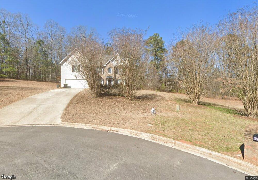
629 Saint Marys Ct Ellenwood, GA 30294
Estimated Value: $318,000 - $414,000
4
Beds
3
Baths
2,658
Sq Ft
$132/Sq Ft
Est. Value
About This Home
This home is located at 629 Saint Marys Ct, Ellenwood, GA 30294 and is currently estimated at $351,834, approximately $132 per square foot. 629 Saint Marys Ct is a home located in Henry County with nearby schools including Fairview Elementary School, Austin Road Middle School, and Stockbridge High School.
Ownership History
Date
Name
Owned For
Owner Type
Purchase Details
Closed on
Jan 30, 2019
Sold by
Malcolm Patricia
Bought by
Malcolm Patricia A
Current Estimated Value
Purchase Details
Closed on
Jun 9, 2005
Sold by
Double Eagle Land Dev Co Inc
Bought by
Malcolm Patricia A and Malcolm Ferron
Home Financials for this Owner
Home Financials are based on the most recent Mortgage that was taken out on this home.
Original Mortgage
$38,400
Interest Rate
5.26%
Mortgage Type
New Conventional
Create a Home Valuation Report for This Property
The Home Valuation Report is an in-depth analysis detailing your home's value as well as a comparison with similar homes in the area
Home Values in the Area
Average Home Value in this Area
Purchase History
| Date | Buyer | Sale Price | Title Company |
|---|---|---|---|
| Malcolm Patricia A | -- | -- | |
| Malcolm Patricia A | -- | -- | |
| Malcolm Patricia A | $192,000 | -- |
Source: Public Records
Mortgage History
| Date | Status | Borrower | Loan Amount |
|---|---|---|---|
| Previous Owner | Malcolm Patricia A | $38,400 | |
| Previous Owner | Malcolm Patricia A | $153,600 |
Source: Public Records
Tax History Compared to Growth
Tax History
| Year | Tax Paid | Tax Assessment Tax Assessment Total Assessment is a certain percentage of the fair market value that is determined by local assessors to be the total taxable value of land and additions on the property. | Land | Improvement |
|---|---|---|---|---|
| 2024 | $3,889 | $130,960 | $12,000 | $118,960 |
| 2023 | $3,300 | $128,040 | $12,000 | $116,040 |
| 2022 | $3,298 | $106,600 | $10,000 | $96,600 |
| 2021 | $2,752 | $83,480 | $10,000 | $73,480 |
| 2020 | $2,510 | $73,240 | $6,000 | $67,240 |
| 2019 | $2,332 | $65,720 | $6,000 | $59,720 |
| 2018 | $2,161 | $61,240 | $6,000 | $55,240 |
| 2016 | $1,716 | $49,640 | $6,000 | $43,640 |
| 2015 | $1,469 | $42,360 | $6,000 | $36,360 |
| 2014 | $1,233 | $36,120 | $4,000 | $32,120 |
Source: Public Records
Map
Nearby Homes
- 226 Saul Dr
- 0 River Rd Unit 10575921
- 101 Solomon Dr
- 115 Bond Dr
- 50 Oakridge Dr Unit 4
- LOT 15 Fairview Springs Dr
- 823 Haydens Ridge
- 3719 Upton Ct
- 3702 Upton Ct
- 0 Clark Dr Unit 7635843
- 0 Clark Dr Unit 10581907
- 4438 Northwind Dr
- 19 Poole Cir
- 308 Fair Dr Unit 1
- 856 Haydens Ridge
- 4489 Northwind Dr
- 4484 Northridge Trail
- 1548 Fairview Rd
- 201 Leigh Dr
- 4283 Northwind Dr
- 625 Saint Marys Ct
- 628 Saint Marys Ct
- 145 Bond Lake Dr
- 621 Saint Marys Ct
- 621 St Marys
- 139 Bond Lake Dr
- 624 Saint Marys Ct
- 434 Trinity Trail
- 438 Trinity Trail
- 430 Trinity Trail
- 140 Bond Lake
- 140 Bond Lake Dr
- 620 Saint Marys Ct
- 135 Bond Lake Dr
- 617 Saint Marys Ct
- 442 Trinity Trail
- 426 Trinity Trail
- 136 Bond Lake Dr
- 131 Bond Lake Dr
- 612 Saint Marys Ct