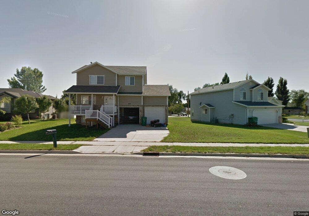
629 W Cook Dr N Layton, UT 84041
Estimated Value: $400,000 - $476,000
3
Beds
2
Baths
1,572
Sq Ft
$281/Sq Ft
Est. Value
About This Home
This home is located at 629 W Cook Dr N, Layton, UT 84041 and is currently estimated at $441,716, approximately $280 per square foot. 629 W Cook Dr N is a home located in Davis County with nearby schools including Layton Elementary School, Fairfield Junior High School, and Layton High School.
Ownership History
Date
Name
Owned For
Owner Type
Purchase Details
Closed on
Oct 16, 2006
Sold by
Secured Property Assets Llc
Bought by
Logan Mark Edward and Logan Janice Marie
Current Estimated Value
Home Financials for this Owner
Home Financials are based on the most recent Mortgage that was taken out on this home.
Original Mortgage
$26,235
Outstanding Balance
$15,594
Interest Rate
6.39%
Mortgage Type
Stand Alone Second
Estimated Equity
$426,122
Purchase Details
Closed on
Aug 25, 2006
Sold by
Dalton Jon Richard and Dalton Melissa Anne
Bought by
Secured Property Assets Llc
Home Financials for this Owner
Home Financials are based on the most recent Mortgage that was taken out on this home.
Original Mortgage
$131,175
Outstanding Balance
$77,567
Interest Rate
6.39%
Mortgage Type
Purchase Money Mortgage
Estimated Equity
$364,149
Purchase Details
Closed on
Feb 18, 2005
Sold by
Federal National Mortgage Association
Bought by
Dalton Jon Richard and Dalton Melissa Anne
Purchase Details
Closed on
Feb 13, 2004
Sold by
Federal National Mortgage Association
Bought by
Dalton Jon Richard and Dalton Melissa Anne
Home Financials for this Owner
Home Financials are based on the most recent Mortgage that was taken out on this home.
Original Mortgage
$97,600
Interest Rate
5.85%
Mortgage Type
Purchase Money Mortgage
Purchase Details
Closed on
Oct 15, 2003
Sold by
Lyman Michael C and Lyman Jaelyn
Bought by
Federal National Mortgage Association
Purchase Details
Closed on
Oct 8, 2002
Sold by
Scenic Development Inc
Bought by
Lyman Michael C and Lyman Jaelyn
Home Financials for this Owner
Home Financials are based on the most recent Mortgage that was taken out on this home.
Original Mortgage
$120,500
Interest Rate
6.17%
Purchase Details
Closed on
Aug 31, 2001
Sold by
Bank Of Utah
Bought by
Scenic Development Inc
Home Financials for this Owner
Home Financials are based on the most recent Mortgage that was taken out on this home.
Original Mortgage
$1,184,193
Interest Rate
7.05%
Mortgage Type
Seller Take Back
Create a Home Valuation Report for This Property
The Home Valuation Report is an in-depth analysis detailing your home's value as well as a comparison with similar homes in the area
Home Values in the Area
Average Home Value in this Area
Purchase History
| Date | Buyer | Sale Price | Title Company |
|---|---|---|---|
| Logan Mark Edward | -- | Utah Mountain Title & Escrow | |
| Secured Property Assets Llc | -- | Security Title Of Davis Coun | |
| Dalton Jon Richard | $122,000 | Us Title Company Of Utah | |
| Dalton Jon Richard | $122,000 | Us Title | |
| Federal National Mortgage Association | $105,288 | United Title Services | |
| Lyman Michael C | -- | Mt Olympus Title Ins Agency | |
| Scenic Development Inc | -- | -- |
Source: Public Records
Mortgage History
| Date | Status | Borrower | Loan Amount |
|---|---|---|---|
| Open | Logan Mark Edward | $26,235 | |
| Open | Logan Mark Edward | $131,175 | |
| Previous Owner | Dalton Jon Richard | $97,600 | |
| Previous Owner | Lyman Michael C | $120,500 | |
| Previous Owner | Scenic Development Inc | $1,184,193 | |
| Closed | Dalton Jon Richard | $24,400 |
Source: Public Records
Tax History Compared to Growth
Tax History
| Year | Tax Paid | Tax Assessment Tax Assessment Total Assessment is a certain percentage of the fair market value that is determined by local assessors to be the total taxable value of land and additions on the property. | Land | Improvement |
|---|---|---|---|---|
| 2025 | $2,148 | $225,500 | $116,692 | $108,808 |
| 2024 | $2,065 | $218,349 | $127,857 | $90,492 |
| 2023 | $1,991 | $204,050 | $70,939 | $133,111 |
| 2022 | $2,092 | $385,000 | $143,637 | $241,363 |
| 2021 | $2,007 | $303,000 | $118,514 | $184,486 |
| 2020 | $1,816 | $263,000 | $100,136 | $162,864 |
| 2019 | $1,791 | $254,000 | $101,792 | $152,208 |
| 2018 | $1,615 | $230,000 | $89,384 | $140,616 |
| 2016 | $1,455 | $106,865 | $35,600 | $71,265 |
| 2015 | $1,451 | $101,200 | $35,600 | $65,600 |
| 2014 | $1,364 | $97,286 | $35,600 | $61,686 |
| 2013 | -- | $92,667 | $28,952 | $63,715 |
Source: Public Records
Map
Nearby Homes
- 485 W 100 N
- 750 W Gentile St
- 526 King St Unit 2
- 356 W 25 N
- 6 Grover St
- 355 W Gentile St
- 933 W Gentile St
- 495 Spurlock St
- 267 S Melody St
- 480 Spurlock St
- 174 W Dawson St
- 362 S 950 W
- 441 Church St
- 1113 W Angel Hill Ct
- 1015 W 350 S
- 142 Green Dr
- 1677 N 1600 W Unit 134
- 278 W Francis Ave
- 562 S 850 W
- 298 Amber Ln