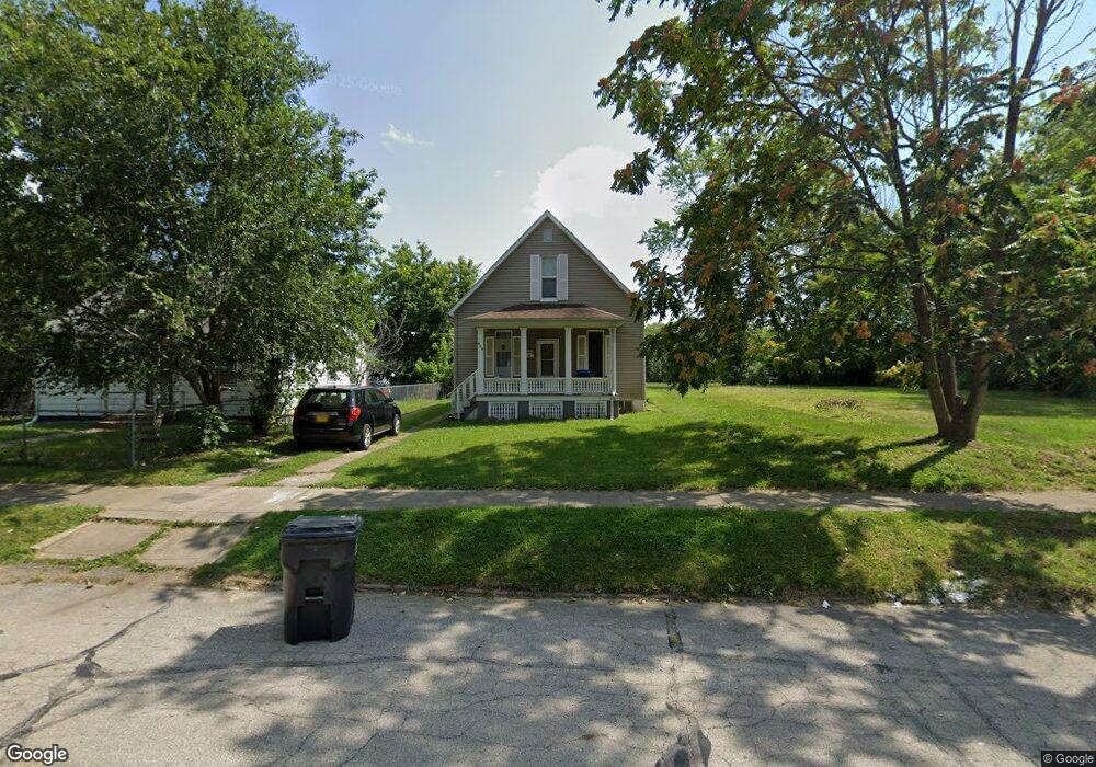
629 W Marietta St Decatur, IL 62522
Garfield Park NeighborhoodEstimated Value: $23,000 - $57,000
3
Beds
2
Baths
1,249
Sq Ft
$34/Sq Ft
Est. Value
About This Home
This home is located at 629 W Marietta St, Decatur, IL 62522 and is currently estimated at $42,333, approximately $33 per square foot. 629 W Marietta St is a home located in Macon County with nearby schools including Stephen Decatur Middle School, St. Patrick School, and Teen Challenge-Home For Girls.
Ownership History
Date
Name
Owned For
Owner Type
Purchase Details
Closed on
Aug 29, 2024
Sold by
Bates Jessie R
Bought by
Persh Properties Il Llc
Current Estimated Value
Purchase Details
Closed on
Nov 2, 2010
Sold by
West Patricia
Bought by
Bates Jessie R
Purchase Details
Closed on
May 1, 1995
Create a Home Valuation Report for This Property
The Home Valuation Report is an in-depth analysis detailing your home's value as well as a comparison with similar homes in the area
Home Values in the Area
Average Home Value in this Area
Purchase History
| Date | Buyer | Sale Price | Title Company |
|---|---|---|---|
| Persh Properties Il Llc | $400,000 | None Listed On Document | |
| Bates Jessie R | $15,000 | None Available | |
| -- | $8,000 | -- |
Source: Public Records
Tax History Compared to Growth
Tax History
| Year | Tax Paid | Tax Assessment Tax Assessment Total Assessment is a certain percentage of the fair market value that is determined by local assessors to be the total taxable value of land and additions on the property. | Land | Improvement |
|---|---|---|---|---|
| 2024 | $500 | $5,166 | $437 | $4,729 |
| 2023 | $496 | $4,984 | $422 | $4,562 |
| 2022 | $480 | $4,698 | $390 | $4,308 |
| 2021 | $452 | $4,388 | $365 | $4,023 |
| 2020 | $445 | $4,186 | $349 | $3,837 |
| 2019 | $445 | $4,186 | $349 | $3,837 |
| 2018 | $483 | $4,593 | $315 | $4,278 |
| 2017 | $494 | $4,715 | $323 | $4,392 |
| 2016 | $503 | $4,763 | $326 | $4,437 |
| 2015 | $478 | $4,679 | $320 | $4,359 |
| 2014 | $387 | $4,037 | $222 | $3,815 |
| 2013 | $400 | $4,188 | $230 | $3,958 |
Source: Public Records
Map
Nearby Homes
- 875 N Monroe St
- 415 W Green St
- 844 N Edward St
- 837 W Grand Ave
- 1245 N Union St
- 1065 W Green St
- 1545 N Monroe St
- 1504 N Monroe St
- 141 E Packard St
- 1458 N Union St
- 422 W William St
- 609 W William St
- 254 N Pine St
- 330 W William St
- 958 W William St
- 452 W Prairie Ave
- 644 W Division St
- 442 W Prairie Ave
- 233 N Edward St
- 366 W Prairie Ave
- 629 W Marietta St
- 623 W Marietta St
- 977 N Monroe St
- 655 W Marietta St
- 618 W Marietta St
- 624 W Marietta St
- 709 W Marietta St
- 630 W Marietta St
- 602 W King St
- 648 W Marietta St
- 1005 N Monroe St
- 634 W King St
- 1015 N Monroe St
- 1027 N Monroe St
- 946 N Monroe St
- 619 W Elm St
- 1004 N Monroe St
- 656 W Marietta St
- 645 W Elm St
- 727 W Marietta St