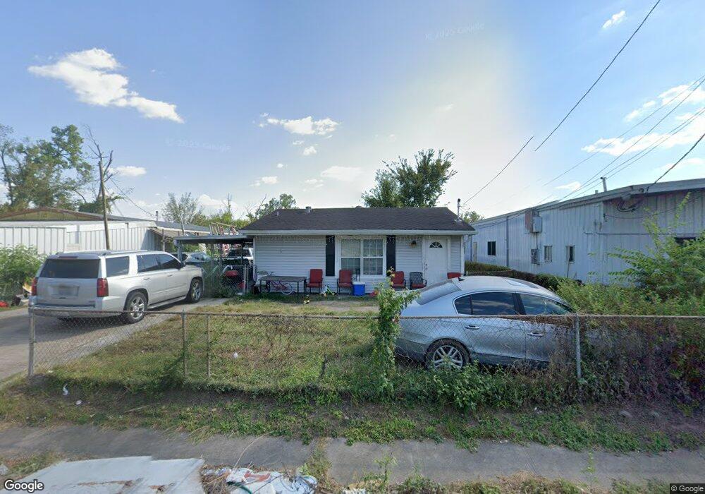
629 W Parker Rd Houston, TX 77091
Northside-Northline NeighborhoodEstimated Value: $178,000 - $210,000
3
Beds
2
Baths
1,344
Sq Ft
$143/Sq Ft
Est. Value
About This Home
This home is located at 629 W Parker Rd, Houston, TX 77091 and is currently estimated at $192,814, approximately $143 per square foot. 629 W Parker Rd is a home located in Harris County with nearby schools including Wesley Elementary School, Williams Middle, and Booker T Washington Sr High.
Ownership History
Date
Name
Owned For
Owner Type
Purchase Details
Closed on
Oct 23, 1995
Sold by
Lowry Joy Marie and Lowry Walter B
Bought by
Ketta Mohamed
Current Estimated Value
Home Financials for this Owner
Home Financials are based on the most recent Mortgage that was taken out on this home.
Original Mortgage
$35,150
Outstanding Balance
$245
Interest Rate
7.53%
Estimated Equity
$192,569
Create a Home Valuation Report for This Property
The Home Valuation Report is an in-depth analysis detailing your home's value as well as a comparison with similar homes in the area
Home Values in the Area
Average Home Value in this Area
Purchase History
| Date | Buyer | Sale Price | Title Company |
|---|---|---|---|
| Ketta Mohamed | -- | Fidelity National Title |
Source: Public Records
Mortgage History
| Date | Status | Borrower | Loan Amount |
|---|---|---|---|
| Open | Ketta Mohamed | $35,150 |
Source: Public Records
Tax History Compared to Growth
Tax History
| Year | Tax Paid | Tax Assessment Tax Assessment Total Assessment is a certain percentage of the fair market value that is determined by local assessors to be the total taxable value of land and additions on the property. | Land | Improvement |
|---|---|---|---|---|
| 2025 | $3,255 | $160,947 | $89,640 | $71,307 |
| 2024 | $3,255 | $155,575 | $74,700 | $80,875 |
| 2023 | $3,255 | $155,575 | $74,700 | $80,875 |
| 2022 | $2,453 | $111,383 | $52,290 | $59,093 |
| 2021 | $1,705 | $73,172 | $22,410 | $50,762 |
| 2020 | $1,547 | $63,863 | $14,940 | $48,923 |
| 2019 | $1,534 | $60,636 | $14,940 | $45,696 |
| 2018 | $1,534 | $60,636 | $14,940 | $45,696 |
| 2017 | $1,533 | $60,636 | $14,940 | $45,696 |
| 2016 | $1,533 | $60,636 | $14,940 | $45,696 |
| 2015 | $1,488 | $60,636 | $14,940 | $45,696 |
| 2014 | $1,488 | $57,900 | $14,940 | $42,960 |
Source: Public Records
Map
Nearby Homes
- 609 W Parker Rd
- 6315 N Shepherd Dr
- 0 Pickering St
- 5736 Stuebner Airline Rd
- 778 Pickering St
- 6100 Stuebner Airline Rd
- 715 W Rittenhouse Rd
- 824 W Rittenhouse St
- 6610 Morrow St
- 522 Surratt Dr
- 833 Rosie St
- 422 Surratt Dr
- 6105 Morrow St
- 0 Brinkman Unit 54849680
- 0 Lovers Ln Unit 36585920
- 0 De Priest St Unit 66567963
- 859 W Rittenhouse St
- 434 Yale Oaks Ln
- 747 W Rittenhouse Rd
- 422 Yale Oaks Ln
- 615 W Parker Rd
- 626 W Parker Rd
- 634 W Parker Rd
- 622 W Parker Rd
- 618 W Parker Rd
- 610 W Parker Rd
- 6502 N Shepherd Dr
- 639 Luke St
- 641 Luke St
- 610 Pickering St
- 633 Luke St
- 6433 Stuebner Airline Rd
- 6415 Stuebner Airline Rd
- 629 Luke St
- 634 Pickering St
- 627 Luke St
- 625 Luke St
- 6411 Stuebner Airline Rd
- 6525 Stuebner Airline Rd
- 6407 Stuebner Airline Rd