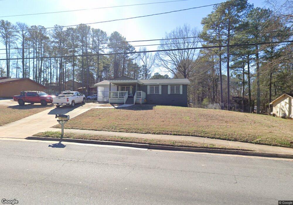
6290 Highpoint Rd Unit 1 Union City, GA 30291
Estimated Value: $179,000 - $205,000
3
Beds
2
Baths
975
Sq Ft
$194/Sq Ft
Est. Value
About This Home
This home is located at 6290 Highpoint Rd Unit 1, Union City, GA 30291 and is currently estimated at $189,489, approximately $194 per square foot. 6290 Highpoint Rd Unit 1 is a home located in Fulton County with nearby schools including Liberty Point Elementary School, Camp Creek Middle School, and Langston Hughes High School.
Ownership History
Date
Name
Owned For
Owner Type
Purchase Details
Closed on
Jan 12, 1994
Sold by
Secretary Of Hud
Bought by
Sharp Anjanette Latricia
Current Estimated Value
Home Financials for this Owner
Home Financials are based on the most recent Mortgage that was taken out on this home.
Original Mortgage
$56,238
Interest Rate
7.1%
Purchase Details
Closed on
Oct 5, 1993
Sold by
Nationsbanc Mtg Corp
Bought by
Secretary Of Hud
Create a Home Valuation Report for This Property
The Home Valuation Report is an in-depth analysis detailing your home's value as well as a comparison with similar homes in the area
Home Values in the Area
Average Home Value in this Area
Purchase History
| Date | Buyer | Sale Price | Title Company |
|---|---|---|---|
| Sharp Anjanette Latricia | -- | -- | |
| Secretary Of Hud | -- | -- | |
| Nationsbanc Mtg Corp | $56,000 | -- |
Source: Public Records
Mortgage History
| Date | Status | Borrower | Loan Amount |
|---|---|---|---|
| Closed | Sharp Anjanette Latricia | $56,238 |
Source: Public Records
Tax History Compared to Growth
Tax History
| Year | Tax Paid | Tax Assessment Tax Assessment Total Assessment is a certain percentage of the fair market value that is determined by local assessors to be the total taxable value of land and additions on the property. | Land | Improvement |
|---|---|---|---|---|
| 2025 | $774 | $50,120 | $16,640 | $33,480 |
| 2023 | $1,577 | $55,880 | $19,440 | $36,440 |
| 2022 | $1,090 | $38,600 | $12,560 | $26,040 |
| 2021 | $284 | $28,800 | $7,800 | $21,000 |
| 2020 | $283 | $28,480 | $7,720 | $20,760 |
| 2019 | $581 | $21,280 | $5,520 | $15,760 |
| 2018 | $263 | $16,560 | $3,000 | $13,560 |
| 2017 | $274 | $16,560 | $3,000 | $13,560 |
| 2016 | $329 | $19,560 | $4,840 | $14,720 |
| 2015 | $638 | $19,560 | $4,840 | $14,720 |
| 2014 | $181 | $11,560 | $1,960 | $9,600 |
Source: Public Records
Map
Nearby Homes
- 0 Highpoint Rd Unit 10553938
- 0 Lakeside Dr Unit 22475152
- 0 Lakeside Dr Unit 7515650
- 5135 Hilltop Dr
- 000 Highpoint Rd
- 99 Highpoint Rd
- 4418 Gladewood Run
- 3227 Diamond Bluff
- 5910 Rock Rd
- 0 Lower Dixie Lake Rd Unit 22475153
- 0 Lower Dixie Lake Rd Unit 7515143
- 5856 Rock Rd
- 5079 Alexander Ave
- 6024 Diamond Ln
- 6000 Diamond Ln
- 6200 Ward Rd
- 4695 Ravenwood Loop
- 5900 Union Woods Way
- 0 Simpson Ave Unit 10470974
- 0 Simpson Ave Unit 7532980
- 5430 Justice Ct
- 6278 Highpoint Rd
- 5174 Highpoint Rd
- 6300 Highpoint Rd
- 5440 Justice Ct
- 5426 Liberty Rd
- 5173 Highpoint Rd
- 5183 Highpoint Rd
- 6266 Highpoint Rd
- 5448 Justice Ct Unit 1
- 6204 Wellington Dr Unit 1
- 5163 Highpoint Rd
- 6077 Littleton Dr
- 5450 Liberty Rd
- 5427 Liberty Rd
- 5414 Hall Cir
- 0 High Point Unit 3220642
- 5439 Liberty Rd
- 6087 Littleton Dr
- 6224 Wellington Dr