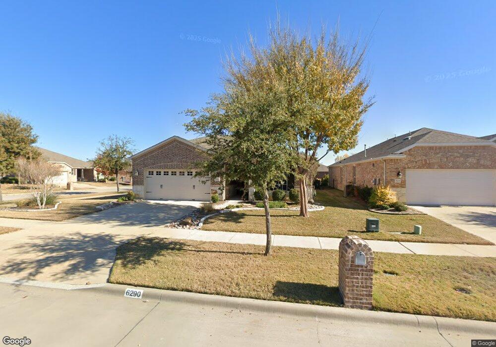
6290 Paragon Dr Frisco, TX 75036
Southwest Frisco NeighborhoodEstimated Value: $490,000 - $561,000
3
Beds
2
Baths
1,934
Sq Ft
$271/Sq Ft
Est. Value
About This Home
This home is located at 6290 Paragon Dr, Frisco, TX 75036 and is currently estimated at $523,733, approximately $270 per square foot. 6290 Paragon Dr is a home with nearby schools including Hackberry Elementary School, Lowell H Strike Middle School, and Little Elm High School.
Ownership History
Date
Name
Owned For
Owner Type
Purchase Details
Closed on
Sep 3, 2025
Sold by
Fromelius Robert J and Fromelius Janis W
Bought by
Fromelius Living Trust and Fromelius
Current Estimated Value
Purchase Details
Closed on
Jun 12, 2015
Sold by
Pulte Homes Of Texas Lp
Bought by
Fromelhas Robert J and Fromelius Janis W
Home Financials for this Owner
Home Financials are based on the most recent Mortgage that was taken out on this home.
Original Mortgage
$258,344
Interest Rate
3.7%
Mortgage Type
New Conventional
Create a Home Valuation Report for This Property
The Home Valuation Report is an in-depth analysis detailing your home's value as well as a comparison with similar homes in the area
Home Values in the Area
Average Home Value in this Area
Purchase History
| Date | Buyer | Sale Price | Title Company |
|---|---|---|---|
| Fromelius Living Trust | -- | Pgp Title | |
| Fromelhas Robert J | -- | Attorney |
Source: Public Records
Mortgage History
| Date | Status | Borrower | Loan Amount |
|---|---|---|---|
| Previous Owner | Fromelhas Robert J | $258,344 |
Source: Public Records
Tax History Compared to Growth
Tax History
| Year | Tax Paid | Tax Assessment Tax Assessment Total Assessment is a certain percentage of the fair market value that is determined by local assessors to be the total taxable value of land and additions on the property. | Land | Improvement |
|---|---|---|---|---|
| 2025 | $6,061 | $522,000 | $108,159 | $413,841 |
| 2024 | $10,353 | $563,081 | $0 | $0 |
| 2023 | $6,070 | $511,892 | $108,159 | $461,598 |
| 2022 | $9,666 | $465,356 | $92,708 | $375,296 |
| 2021 | $9,160 | $427,669 | $92,708 | $334,961 |
| 2020 | $8,500 | $384,592 | $65,668 | $318,924 |
| 2019 | $8,810 | $381,048 | $65,668 | $315,380 |
| 2018 | $8,382 | $376,811 | $54,342 | $322,469 |
| 2017 | $7,935 | $354,513 | $54,342 | $300,171 |
| 2016 | $7,382 | $351,002 | $54,342 | $296,660 |
| 2015 | -- | $27,171 | $27,171 | $0 |
Source: Public Records
Map
Nearby Homes
- 6281 Paragon Dr
- 6445 Paragon Dr
- 2221 Lariat Trail
- 6371 Walnut Hill Ct
- 6726 Hickory Creek Dr
- 3179 Fish Hook Ln
- 2464 Luna Vista Ln
- 6807 Deacon Dr
- 12233 Candle Island Dr
- 2990 Rolling River Rd
- 6373 Cherry Hills Dr
- 12105 Wind Surf Dr
- 3034 Lazy Rock Ln
- 5120 Seashore Ln
- 2941 Oyster Bay Dr
- 8736 Edgewater Dr
- 11721 Summer Springs Dr
- 8724 Edgewater Dr
- 11909 Beach St
- 5001 Bluewater Dr
- 6274 Paragon Dr
- 6326 Eagle Rock Dr
- 6258 Paragon Dr
- 6307 Eagle Rock Dr
- 6321 Eagle Rock Dr
- 6242 Paragon Dr
- 6340 Eagle Rock Dr
- 6297 Paragon Dr
- 6265 Paragon Dr
- 6335 Eagle Rock Dr
- 6313 Paragon Dr
- 6226 Paragon Dr
- 6249 Paragon Dr
- 6354 Eagle Rock Dr
- 6329 Paragon Dr
- 6233 Paragon Dr
- 6345 Paragon Dr
- 6359 Eagle Rock Dr
- 6217 Paragon Dr
- 2951 Rising Tide Dr