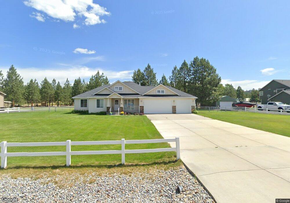
6290 Pearson Dr Nine Mile Falls, WA 99026
Estimated Value: $530,000 - $651,000
3
Beds
2
Baths
2,882
Sq Ft
$214/Sq Ft
Est. Value
About This Home
This home is located at 6290 Pearson Dr, Nine Mile Falls, WA 99026 and is currently estimated at $616,025, approximately $213 per square foot. 6290 Pearson Dr is a home located in Stevens County with nearby schools including Lakeside High School.
Ownership History
Date
Name
Owned For
Owner Type
Purchase Details
Closed on
Jul 12, 2021
Sold by
Fredrickson Mary C
Bought by
Fredrickson Raymond and Kamil Muhammad
Current Estimated Value
Home Financials for this Owner
Home Financials are based on the most recent Mortgage that was taken out on this home.
Original Mortgage
$235,653
Outstanding Balance
$213,819
Interest Rate
2.9%
Mortgage Type
FHA
Estimated Equity
$402,206
Purchase Details
Closed on
May 22, 2009
Sold by
Lanzce G Douglass Inc
Bought by
Fredrickson Gene L and Fredrickson Mary C
Home Financials for this Owner
Home Financials are based on the most recent Mortgage that was taken out on this home.
Original Mortgage
$149,900
Interest Rate
4.8%
Mortgage Type
New Conventional
Create a Home Valuation Report for This Property
The Home Valuation Report is an in-depth analysis detailing your home's value as well as a comparison with similar homes in the area
Home Values in the Area
Average Home Value in this Area
Purchase History
| Date | Buyer | Sale Price | Title Company |
|---|---|---|---|
| Fredrickson Raymond | $240,000 | Stevens County Title Co | |
| Fredrickson Gene L | $249,900 | Stevens County Title Company |
Source: Public Records
Mortgage History
| Date | Status | Borrower | Loan Amount |
|---|---|---|---|
| Open | Fredrickson Raymond | $235,653 | |
| Previous Owner | Fredrickson Gene L | $149,900 |
Source: Public Records
Tax History Compared to Growth
Tax History
| Year | Tax Paid | Tax Assessment Tax Assessment Total Assessment is a certain percentage of the fair market value that is determined by local assessors to be the total taxable value of land and additions on the property. | Land | Improvement |
|---|---|---|---|---|
| 2024 | $5,790 | $630,319 | $67,000 | $563,319 |
| 2023 | $5,555 | $626,914 | $67,000 | $559,914 |
| 2022 | $4,655 | $528,150 | $67,000 | $461,150 |
| 2021 | $2,997 | $307,653 | $37,000 | $270,653 |
| 2020 | $3,483 | $307,653 | $37,000 | $270,653 |
| 2019 | $2,968 | $294,638 | $37,000 | $257,638 |
| 2018 | $3,239 | $245,711 | $45,000 | $200,711 |
| 2017 | $2,986 | $249,697 | $45,000 | $204,697 |
| 2016 | $2,995 | $249,697 | $45,000 | $204,697 |
| 2015 | -- | $239,455 | $50,000 | $189,455 |
| 2013 | -- | $239,455 | $50,000 | $189,455 |
Source: Public Records
Map
Nearby Homes
- 6340 Jenna Ct
- 5885 Sandy Court Way
- 6263 Brennan Ct
- 6195 Khloe Ct
- 60849 Westview Dr
- 6282 W Bluebird Way
- 60829 Westview Dr
- 6265 W Bluebird Way
- XX Syringa
- 6299 Sundown Rd
- 56xx W (Lot 4W) Jergens Rd Unit For GPS use 5629 Jer
- 13228 W Sunnyvale Dr
- 16825 N Wylie Dr
- 5674B Jergens Rd
- 12719 W Greenfield Rd
- 6520 B Pine Ridge Way
- 6520 Pine Ridge Way
- 6571 Kate Dr
- 6563 Kate Dr
- 6578 Kate Dr
- 6292 Pearson Dr
- 6288 Pearson Dr
- 6337 Meadow Vista Dr
- 6287 Pearson Dr
- 6286 Pearson Dr
- 6317 Jenna Dr
- 6317 Jenna Dr
- 6319 Jenna Dr
- 6328 Meadow Vista Dr
- 6332 Meadow Vista Dr
- 6326 Meadow Vista Dr
- 6315 Jenna Dr
- 6272 Kassie Dr
- 6334 Meadow Vista Dr
- 6264 Kassie Ct
- 6313 Jenna Dr
- 6274 Kassie Dr
- 6262 Kassie Ct
- XXXX Jenna Ct
- XXX1 Jenna Ct