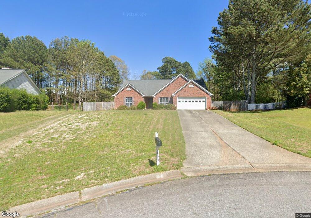
6293 Rock Port Dr Flowery Branch, GA 30542
Estimated Value: $420,821 - $473,000
3
Beds
2
Baths
2,112
Sq Ft
$207/Sq Ft
Est. Value
About This Home
This home is located at 6293 Rock Port Dr, Flowery Branch, GA 30542 and is currently estimated at $438,205, approximately $207 per square foot. 6293 Rock Port Dr is a home located in Hall County with nearby schools including Flowery Branch Elementary School, West Hall Middle School, and West Hall High School.
Ownership History
Date
Name
Owned For
Owner Type
Purchase Details
Closed on
Oct 25, 2019
Sold by
Evans Elaine
Bought by
Evans Margaret Ann
Current Estimated Value
Purchase Details
Closed on
Oct 11, 2017
Sold by
Evans Sue
Bought by
Garmon Margaret Ann
Purchase Details
Closed on
Sep 26, 2017
Sold by
Evans Grady Norman
Bought by
Garmon Margaret Ann
Purchase Details
Closed on
Oct 31, 2002
Sold by
English Margaret R
Bought by
Evans Edward L
Home Financials for this Owner
Home Financials are based on the most recent Mortgage that was taken out on this home.
Original Mortgage
$143,200
Interest Rate
5.95%
Mortgage Type
New Conventional
Purchase Details
Closed on
Nov 3, 1997
Sold by
Englis Peter Harold
Bought by
English Margaret R
Purchase Details
Closed on
Mar 15, 1996
Sold by
Bowen Bowen Const Co Inc
Bought by
English Peter Margaret
Purchase Details
Closed on
Mar 1, 1996
Purchase Details
Closed on
Nov 1, 1995
Create a Home Valuation Report for This Property
The Home Valuation Report is an in-depth analysis detailing your home's value as well as a comparison with similar homes in the area
Home Values in the Area
Average Home Value in this Area
Purchase History
| Date | Buyer | Sale Price | Title Company |
|---|---|---|---|
| Evans Margaret Ann | -- | -- | |
| Garmon Margaret Ann | -- | -- | |
| Garmon Margaret Ann | -- | -- | |
| Evans Edward L | $179,000 | -- | |
| English Margaret R | -- | -- | |
| English Peter Margaret | $127,900 | -- | |
| -- | $127,800 | -- | |
| -- | $95,400 | -- |
Source: Public Records
Mortgage History
| Date | Status | Borrower | Loan Amount |
|---|---|---|---|
| Previous Owner | Evans Edward L | $143,200 | |
| Closed | English Peter Margaret | $0 |
Source: Public Records
Tax History Compared to Growth
Tax History
| Year | Tax Paid | Tax Assessment Tax Assessment Total Assessment is a certain percentage of the fair market value that is determined by local assessors to be the total taxable value of land and additions on the property. | Land | Improvement |
|---|---|---|---|---|
| 2024 | $1,386 | $165,240 | $27,200 | $138,040 |
| 2023 | $994 | $130,040 | $25,120 | $104,920 |
| 2022 | $1,081 | $117,240 | $25,120 | $92,120 |
| 2021 | $991 | $101,280 | $16,560 | $84,720 |
| 2020 | $2,556 | $91,920 | $11,480 | $80,440 |
| 2019 | $2,437 | $86,720 | $11,480 | $75,240 |
| 2018 | $2,326 | $79,960 | $11,480 | $68,480 |
| 2017 | $2,203 | $78,400 | $11,480 | $66,920 |
| 2016 | $1,913 | $69,640 | $11,480 | $58,160 |
| 2015 | $1,546 | $55,694 | $9,200 | $46,494 |
| 2014 | $1,546 | $55,694 | $9,200 | $46,494 |
Source: Public Records
Map
Nearby Homes
- 6297 Rock Port Dr
- 6289 Rock Port Dr
- 6285 Rock Port Dr
- 6220 Mount Salem Cir
- 6216 Mount Salem Cir
- 6296 Rock Port Dr
- 6212 Mount Salem Cir
- LOT 2 6238 Mount Salem Cir Unit 2
- LOT 3 6244 Mount Salem Cir
- 0 Mount Salem Cir Unit 8675064
- 0 Mount Salem Cir Unit 8519705
- 0 Mount Salem Cir Unit 8779639
- 0 Mount Salem Cir Unit 9076505
- 6262 Mount Salem Cir Unit 1-3
- 0 Mount Salem Cir
- 6292 Rock Port Dr
- 6288 Rock Port Dr
- 6281 Rock Port Dr
- 6208 Mount Salem Cir
- 6208 Mt Salem Cir