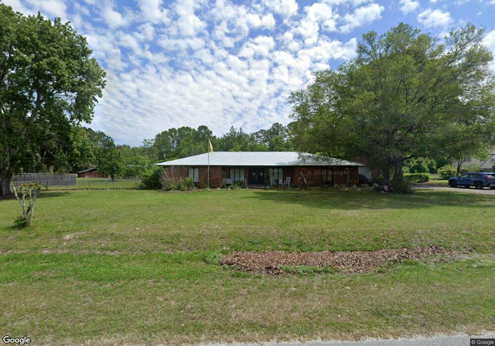
6293 W River Cir MacClenny, FL 32063
Estimated Value: $399,064 - $479,000
Studio
2
Baths
2,123
Sq Ft
$205/Sq Ft
Est. Value
About This Home
This home is located at 6293 W River Cir, MacClenny, FL 32063 and is currently estimated at $435,516, approximately $205 per square foot. 6293 W River Cir is a home located in Baker County with nearby schools including Keller Intermediate School, MacClenny Elementary School, and Baker County Middle School.
Ownership History
Date
Name
Owned For
Owner Type
Purchase Details
Closed on
Aug 31, 2001
Sold by
Aschenbrenner Tommy L and Aschenbrenner Cheryl Y
Bought by
Mccarty Ii Ray
Current Estimated Value
Home Financials for this Owner
Home Financials are based on the most recent Mortgage that was taken out on this home.
Original Mortgage
$158,500
Outstanding Balance
$60,549
Interest Rate
7.02%
Mortgage Type
VA
Estimated Equity
$374,967
Create a Home Valuation Report for This Property
The Home Valuation Report is an in-depth analysis detailing your home's value as well as a comparison with similar homes in the area
Home Values in the Area
Average Home Value in this Area
Purchase History
| Date | Buyer | Sale Price | Title Company |
|---|---|---|---|
| Mccarty Ii Ray | $158,428 | Baker Title & Escrow Co Inc |
Source: Public Records
Mortgage History
| Date | Status | Borrower | Loan Amount |
|---|---|---|---|
| Open | Mccarty Ii Ray | $158,500 |
Source: Public Records
Tax History
| Year | Tax Paid | Tax Assessment Tax Assessment Total Assessment is a certain percentage of the fair market value that is determined by local assessors to be the total taxable value of land and additions on the property. | Land | Improvement |
|---|---|---|---|---|
| 2025 | $1,895 | $175,614 | -- | -- |
| 2024 | $1,876 | $170,665 | -- | -- |
| 2023 | $1,827 | $165,694 | $0 | $0 |
| 2022 | $1,845 | $160,868 | $0 | $0 |
| 2021 | $1,829 | $156,183 | $0 | $0 |
| 2020 | $1,815 | $154,027 | $0 | $0 |
| 2019 | $1,775 | $150,564 | $0 | $0 |
| 2018 | $1,752 | $168,485 | $0 | $0 |
| 2017 | $1,678 | $164,047 | $0 | $0 |
| 2016 | $1,561 | $156,625 | $0 | $0 |
| 2015 | $1,588 | $150,224 | $0 | $0 |
| 2014 | $1,589 | $147,765 | $0 | $0 |
Source: Public Records
Map
Nearby Homes
- 6121 Michele Rd
- 906 Jacqueline Cir
- 369 Owen Acres Dr
- 10413 Greystone Dr
- 768 Constitution Place
- 10407 Greystone Dr
- 10399 Greystone Dr
- 10406 Greystone Dr
- 551 Heritage Crossing
- 10400 Greystone Dr
- 570 Independence Dr
- 574 Independence Dr
- 10359 Greystone Dr
- 717 Bogie Dr
- 10364 Greystone Dr
- 10358 Greystone Dr
- 406 Barbara Cir
- 10346 Greystone Dr
- 10333 Greystone Dr
- 10394 Greystone Dr
- 6331 W River Cir
- 6259 W River Cir
- 6298 W River Cir
- 6393 W River Cir
- 6258 W River Cir
- 6191 W River Cir
- 6324 W River Cir
- 6228 W River Cir
- 6280 N River Cir
- 6208 W River Cir
- 6363 W River Circle Extension
- 6155 S River Cir
- LOT 15 S River Cir
- 6368 W River Circle Extension
- 10752 Hillside Dr
- 6236 N River Cir
- 6396 W River Cir
- 6396 W River Circle Extension
- 6427 W River Circle Extension
- 6142 S River Cir
Your Personal Tour Guide
Ask me questions while you tour the home.