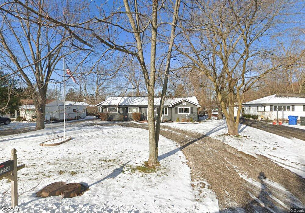
6294 Greer Rd West Bloomfield, MI 48324
Estimated Value: $243,000 - $310,000
3
Beds
2
Baths
1,234
Sq Ft
$216/Sq Ft
Est. Value
About This Home
This home is located at 6294 Greer Rd, West Bloomfield, MI 48324 and is currently estimated at $266,873, approximately $216 per square foot. 6294 Greer Rd is a home located in Oakland County with nearby schools including Haviland Elementary School, Pierce Middle School, and Waterford Mott High School.
Ownership History
Date
Name
Owned For
Owner Type
Purchase Details
Closed on
Jul 27, 2022
Sold by
Michael Blanchard
Bought by
Danhausen Dawn and Danhausen Susan
Current Estimated Value
Home Financials for this Owner
Home Financials are based on the most recent Mortgage that was taken out on this home.
Original Mortgage
$204,000
Outstanding Balance
$194,682
Interest Rate
5.78%
Mortgage Type
New Conventional
Estimated Equity
$72,191
Purchase Details
Closed on
Jul 14, 2017
Sold by
Estate Of Genevieve Hamblin
Bought by
Blanchard Michael
Home Financials for this Owner
Home Financials are based on the most recent Mortgage that was taken out on this home.
Original Mortgage
$73,641
Interest Rate
4.4%
Mortgage Type
FHA
Create a Home Valuation Report for This Property
The Home Valuation Report is an in-depth analysis detailing your home's value as well as a comparison with similar homes in the area
Home Values in the Area
Average Home Value in this Area
Purchase History
| Date | Buyer | Sale Price | Title Company |
|---|---|---|---|
| Danhausen Dawn | $240,000 | -- | |
| Blanchard Michael | $75,000 | Ata National Title Group Llc |
Source: Public Records
Mortgage History
| Date | Status | Borrower | Loan Amount |
|---|---|---|---|
| Open | Danhausen Dawn | $204,000 | |
| Previous Owner | Blanchard Michael | $73,641 |
Source: Public Records
Tax History
| Year | Tax Paid | Tax Assessment Tax Assessment Total Assessment is a certain percentage of the fair market value that is determined by local assessors to be the total taxable value of land and additions on the property. | Land | Improvement |
|---|---|---|---|---|
| 2025 | $3,352 | $106,590 | $48,600 | $57,990 |
| 2024 | $1,977 | $92,640 | $0 | $0 |
| 2022 | $1,899 | $86,500 | $36,000 | $50,500 |
| 2021 | $2,170 | $72,620 | $0 | $0 |
| 2020 | $1,290 | $68,750 | $26,570 | $42,180 |
| 2018 | $2,077 | $57,490 | $21,000 | $36,490 |
| 2015 | -- | $45,220 | $0 | $0 |
| 2014 | -- | $42,100 | $0 | $0 |
| 2011 | -- | $40,000 | $0 | $0 |
Source: Public Records
Map
Nearby Homes
- 6313 Kiev St
- 2275 Forest Glen
- 6620 Red Cedar Ln Unit 37
- 1763 Henbert Rd
- Lot 94 Hiller Rd
- 5699 Applegrove Dr
- 5920 Greer Rd
- VAC Mercedes Ave
- 2110 Peachtree Ct
- 1860 Hiller Rd
- 2833 Hiller Rd
- 2501 Doleman Dr
- 0000 Hiller Rd
- 1701 Marylestone Dr
- 5617 Millpointe Dr
- 9999 Cooley Lake Rd
- 2150 Mapesbury Dr
- 1150 Jay St
- 1630 Weymouth St
- 1901 Midchester Dr
- 6278 Greer Rd
- 6310 Greer Rd
- 2037 Henbert Rd
- 2047 Henbert Rd
- 6262 Greer Rd
- 2027 Henbert Rd
- 6342 Greer Rd
- 6344 Odessa Dr
- 6356 Odessa Dr
- 2054 Sarona Ln
- 6336 Odessa Dr
- 6330 Odessa Dr
- 6362 Odessa Dr
- 2038 Sarona Ln
- 6362 Greer Rd
- 2017 Henbert Rd
- 2028 Henbert Rd
- 2044 Henbert Rd
- 2022 Sarona Ln
- 6368 Odessa Dr
Your Personal Tour Guide
Ask me questions while you tour the home.