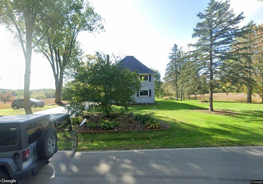
6295 Mccain Rd Spring Arbor, MI 49283
Estimated Value: $237,751 - $335,000
Studio
--
Bath
2,256
Sq Ft
$131/Sq Ft
Est. Value
About This Home
This home is located at 6295 Mccain Rd, Spring Arbor, MI 49283 and is currently estimated at $294,688, approximately $130 per square foot. 6295 Mccain Rd is a home located in Jackson County with nearby schools including Western High School, Paragon Charter Academy, and Trinity Lutheran School.
Ownership History
Date
Name
Owned For
Owner Type
Purchase Details
Closed on
Jul 16, 2001
Sold by
Paul Colin L and Paul Holly J
Bought by
Russell Brantly P and Russell Patricia A
Current Estimated Value
Home Financials for this Owner
Home Financials are based on the most recent Mortgage that was taken out on this home.
Original Mortgage
$104,000
Outstanding Balance
$43,440
Interest Rate
8.3%
Estimated Equity
$251,248
Purchase Details
Closed on
Mar 1, 1994
Bought by
Spicer
Create a Home Valuation Report for This Property
The Home Valuation Report is an in-depth analysis detailing your home's value as well as a comparison with similar homes in the area
Purchase History
| Date | Buyer | Sale Price | Title Company |
|---|---|---|---|
| Russell Brantly P | $130,000 | -- | |
| Spicer | $94,000 | -- |
Source: Public Records
Mortgage History
| Date | Status | Borrower | Loan Amount |
|---|---|---|---|
| Open | Russell Brantly P | $104,000 |
Source: Public Records
Tax History
| Year | Tax Paid | Tax Assessment Tax Assessment Total Assessment is a certain percentage of the fair market value that is determined by local assessors to be the total taxable value of land and additions on the property. | Land | Improvement |
|---|---|---|---|---|
| 2025 | $2,550 | $98,400 | $0 | $0 |
| 2024 | $15 | $96,700 | $0 | $0 |
| 2023 | $1,514 | $88,900 | $0 | $0 |
| 2022 | $2,314 | $78,800 | $0 | $0 |
| 2021 | $2,273 | $75,400 | $0 | $0 |
| 2020 | $2,245 | $78,900 | $0 | $0 |
| 2019 | $2,134 | $70,850 | $0 | $0 |
| 2018 | $2,127 | $69,000 | $7,400 | $61,600 |
| 2017 | $2,015 | $66,040 | $0 | $0 |
| 2016 | $1,286 | $66,170 | $66,170 | $0 |
| 2015 | $54,559 | $60,500 | $60,500 | $0 |
| 2014 | $54,559 | $57,350 | $0 | $0 |
| 2013 | -- | $57,350 | $57,350 | $0 |
Source: Public Records
Map
Nearby Homes
- 6728 King Rd
- 0 King Rd Unit 25060444
- 4920 Slayton Rd
- 4880 Indian Creek Dr Unit 26
- 7315 King Rd
- 4894 Indian Creek Dr
- 28 Engelhardt Strasse
- V/L S Dearing Rd Unit 40 Acres Vacant Land
- 2503 Milford Rd
- 4540 Westbrook Dr Unit 45
- 2635 S Dearing Rd
- 2625 S Dearing Rd
- 1570 Chapel Rd
- 2659 Fairway Dr
- 1864 Chapel Rd
- 1126 Chapel Rd
- 1956 Trinity Ln
- 800 Obrien Rd
- 208 Glasgow Rd
- 4070 Magnolia Pkwy
- 6480 Mccain Rd
- 6474 Mccain Rd
- 6400 Mccain Rd
- 6203 Mccain Rd
- 6330 Mccain Rd
- 6690 Mccain Rd
- 6318 Mccain Rd
- 6314 Mccain Rd
- 6333 Mccain Rd
- 6410 Mccain Rd
- 6503 Mccain Rd
- 6200 Mccain Rd
- 6535 Mccain Rd
- 6142 Mccain Rd
- 6120 Mccain Rd
- 0 Moscow Rd Unit 211068832
- 0 Moscow Rd Unit 201802473
- 0 Moscow Rd Unit 201801152
- 0 Moscow Rd Unit 1061619
- 0 Moscow Rd Unit 1064834
Your Personal Tour Guide
Ask me questions while you tour the home.