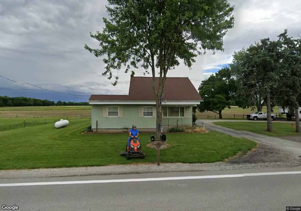
6295 N State Route 635 Fostoria, OH 44830
Estimated Value: $188,980 - $227,000
4
Beds
1
Bath
2,394
Sq Ft
$88/Sq Ft
Est. Value
About This Home
This home is located at 6295 N State Route 635, Fostoria, OH 44830 and is currently estimated at $211,495, approximately $88 per square foot. 6295 N State Route 635 is a home located in Seneca County with nearby schools including Lakota Elementary School, Lakota Middle School, and Lakota High School.
Ownership History
Date
Name
Owned For
Owner Type
Purchase Details
Closed on
Nov 9, 2004
Bought by
Potteiger Jon P
Current Estimated Value
Purchase Details
Closed on
Mar 16, 2004
Sold by
Garcia Christopher R
Bought by
Federal Home Loan Mortgage
Purchase Details
Closed on
Dec 23, 1996
Sold by
Swing Cynthia A
Bought by
Swing Cynthia A
Purchase Details
Closed on
Jan 29, 1993
Sold by
Swing Stephen John
Bought by
Swing Cynthia A
Create a Home Valuation Report for This Property
The Home Valuation Report is an in-depth analysis detailing your home's value as well as a comparison with similar homes in the area
Home Values in the Area
Average Home Value in this Area
Purchase History
| Date | Buyer | Sale Price | Title Company |
|---|---|---|---|
| Potteiger Jon P | $57,000 | -- | |
| Federal Home Loan Mortgage | $36,700 | -- | |
| Swing Cynthia A | $66,200 | -- | |
| Swing Cynthia A | -- | -- |
Source: Public Records
Tax History Compared to Growth
Tax History
| Year | Tax Paid | Tax Assessment Tax Assessment Total Assessment is a certain percentage of the fair market value that is determined by local assessors to be the total taxable value of land and additions on the property. | Land | Improvement |
|---|---|---|---|---|
| 2024 | $1,645 | $47,410 | $8,590 | $38,820 |
| 2023 | $1,690 | $47,410 | $8,590 | $38,820 |
| 2022 | $1,560 | $37,110 | $7,370 | $29,740 |
| 2021 | $1,486 | $37,110 | $7,370 | $29,740 |
| 2020 | $1,441 | $37,107 | $7,371 | $29,736 |
| 2019 | $1,269 | $32,270 | $6,412 | $25,858 |
| 2018 | $1,236 | $32,270 | $6,412 | $25,858 |
| 2017 | $1,138 | $32,270 | $6,412 | $25,858 |
| 2016 | $1,011 | $27,727 | $6,412 | $21,315 |
| 2015 | $1,060 | $27,727 | $6,412 | $21,315 |
| 2014 | $964 | $27,727 | $6,412 | $21,315 |
| 2013 | $984 | $27,727 | $6,412 | $21,315 |
Source: Public Records
Map
Nearby Homes
- 4885 N Township Road 101
- 6780 W Township Road 174
- 0 State Route 224 Unit 20240095
- 230 State St
- 203 Washington St
- 8399 N County Road 31
- 3166 N County Road 11
- 2595 County Road 13
- N Township Rd 45
- 0 State Route 590 Unit 6136844
- 7934 Pleasant Rd
- 2821 N County Road 11
- 000 Weaver Rd
- 0000 Weaver Rd
- 5941 W Tiffin St
- 6040 W Tiffin St
- 2231 County Road 23
- 5479 N State Route 53
- 132 E Township Road 152
- 3384 N State Route 53
- 6278 N State Route 635
- 6278 Ohio 635
- 6147 N State Route 635
- 6474 N State Route 635
- 5949 Ohio 635
- 6082 W State Route 12
- 5909 N State Route 635
- 5849 Ohio 635
- 6335 Tr 0103
- 5800 State Route 12
- 6335 N Township Road 103
- 6321 N Township Road 103
- 6452 Township Road 103
- 6562 N Tr 103
- 6625 W State Route 12
- 5323 W Tr 156
- 5271 Township Road 156
- 5271 T R 156
- 7020 N State Route 635
- 7060 N State Route 635