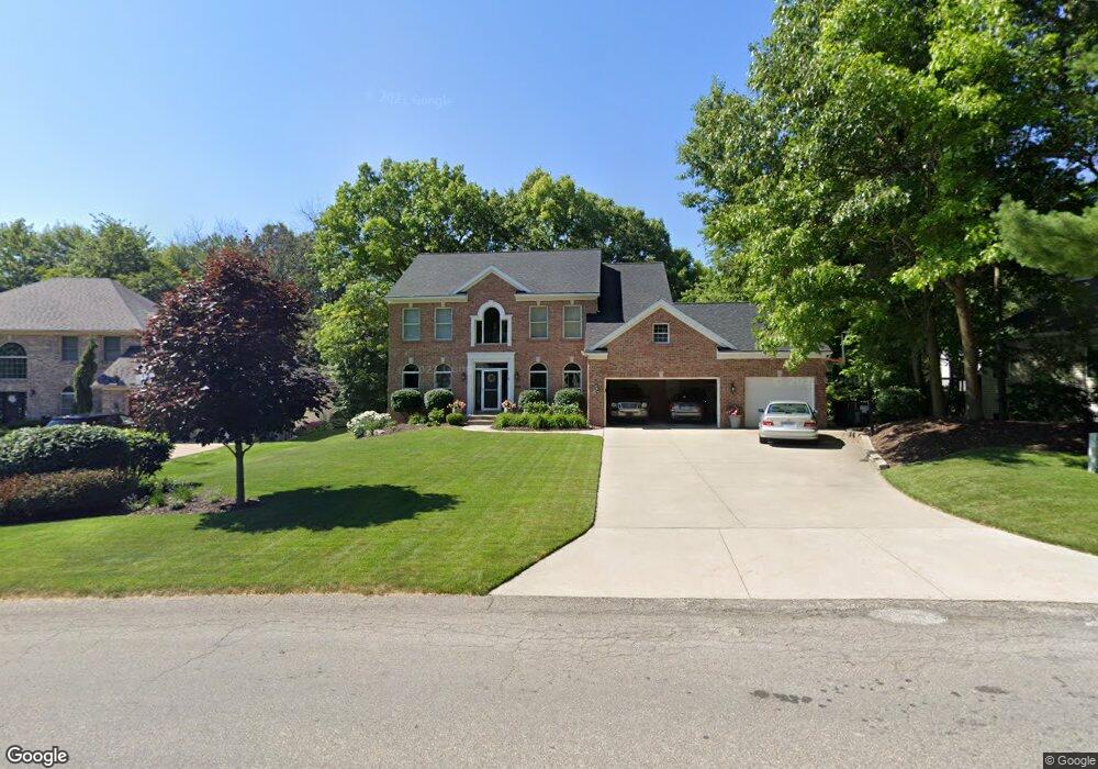
6297 Scarborough Dr SE Ada, MI 49301
Forest Hills NeighborhoodEstimated Value: $715,799 - $807,000
4
Beds
3
Baths
2,626
Sq Ft
$289/Sq Ft
Est. Value
About This Home
This home is located at 6297 Scarborough Dr SE, Ada, MI 49301 and is currently estimated at $759,200, approximately $289 per square foot. 6297 Scarborough Dr SE is a home located in Kent County with nearby schools including Ada Elementary School, Central Woodlands 5/6 School, and Central Middle School.
Ownership History
Date
Name
Owned For
Owner Type
Purchase Details
Closed on
Jun 17, 2021
Sold by
Woodard David J and Woodard Linda S
Bought by
Balogh Daniel and Balogh Bridget
Current Estimated Value
Home Financials for this Owner
Home Financials are based on the most recent Mortgage that was taken out on this home.
Original Mortgage
$459,000
Outstanding Balance
$348,501
Interest Rate
2.9%
Mortgage Type
Closed End Mortgage
Estimated Equity
$410,699
Purchase Details
Closed on
Dec 1, 2000
Sold by
M & W Construction Corp
Bought by
Woodard David J and Woodard Linda S
Home Financials for this Owner
Home Financials are based on the most recent Mortgage that was taken out on this home.
Original Mortgage
$234,900
Interest Rate
7.58%
Purchase Details
Closed on
Jul 19, 2000
Bought by
M&W Construction Corporation and Woodard David J
Create a Home Valuation Report for This Property
The Home Valuation Report is an in-depth analysis detailing your home's value as well as a comparison with similar homes in the area
Home Values in the Area
Average Home Value in this Area
Purchase History
| Date | Buyer | Sale Price | Title Company |
|---|---|---|---|
| Balogh Daniel | $580,000 | None Available | |
| Woodard David J | $329,900 | Michigan Title Company | |
| Woodard David J | $329,900 | -- | |
| M&W Construction Corporation | $55,900 | -- |
Source: Public Records
Mortgage History
| Date | Status | Borrower | Loan Amount |
|---|---|---|---|
| Open | Balogh Daniel | $459,000 | |
| Previous Owner | Woodard David J | $234,900 |
Source: Public Records
Tax History Compared to Growth
Tax History
| Year | Tax Paid | Tax Assessment Tax Assessment Total Assessment is a certain percentage of the fair market value that is determined by local assessors to be the total taxable value of land and additions on the property. | Land | Improvement |
|---|---|---|---|---|
| 2025 | $5,674 | $310,400 | $0 | $0 |
| 2024 | $5,674 | $308,200 | $0 | $0 |
| 2023 | $8,194 | $272,400 | $0 | $0 |
| 2022 | $7,937 | $248,400 | $0 | $0 |
| 2021 | $5,324 | $230,500 | $0 | $0 |
| 2020 | $3,502 | $218,700 | $0 | $0 |
| 2019 | $4,823 | $220,100 | $0 | $0 |
| 2018 | $5,021 | $188,000 | $26,800 | $161,200 |
| 2017 | $5,000 | $184,500 | $0 | $0 |
| 2016 | $4,823 | $178,400 | $0 | $0 |
| 2015 | -- | $178,400 | $0 | $0 |
| 2013 | -- | $147,300 | $0 | $0 |
Source: Public Records
Map
Nearby Homes
- 6300 Redington Ct SE
- 6375 Duxbury Dr SE
- 60 Alta Dale Ave NE
- 6050 Grand River Dr NE
- 6040 Adacroft Dr SE
- 5855 Grand River Dr NE
- 5656 Highbury Dr SE Unit 261
- 7063 Ada Depot Dr Unit 20
- 7033 Ada Depot Dr
- 86 Carl Dr NE
- 77 Landall Ln SE
- 7187 Bradfield St SE
- 495 W Abbey Mill Dr SE
- 5479 Ada Dr SE
- 868 Bridge Walk Ct SE Unit 85
- 1233 Ballybunion Ct SE
- 657 Greenslate Dr SE
- 664 Abbey Mill Dr SE
- 645 Abbey Mill Dr SE
- 527 Sanctuary Ct NE
- 6293 Scarborough Dr SE
- 6298 Redington Ct SE
- 6306 Redington Dr SE
- 6289 Scarborough Dr SE
- 6296 Scarborough Dr SE
- 6290 Scarborough Dr SE
- 6300 Scarborough Dr SE
- 6281 Scarborough Dr SE
- 6329 Scarborough Dr SE
- 6284 Scarborough Dr SE
- 6333 Redington Dr SE
- 6310 Redington Dr SE
- 6332 Scarborough Dr SE
- 6291 Redington Ct SE
- 6284 Redington Ct SE
- 6320 Redington Dr SE
- 6275 Scarborough Dr SE
- 6283 Redington Ct SE
- 6278 Scarborough Dr SE
- 6341 Scarborough Dr SE