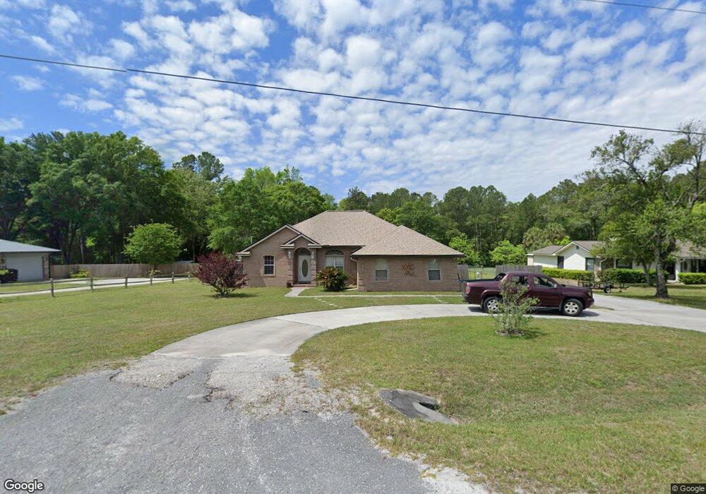
6298 W River Cir MacClenny, FL 32063
Estimated Value: $321,464 - $398,000
Studio
2
Baths
1,686
Sq Ft
$213/Sq Ft
Est. Value
About This Home
This home is located at 6298 W River Cir, MacClenny, FL 32063 and is currently estimated at $359,866, approximately $213 per square foot. 6298 W River Cir is a home located in Baker County with nearby schools including Keller Intermediate School, MacClenny Elementary School, and Baker County Middle School.
Ownership History
Date
Name
Owned For
Owner Type
Purchase Details
Closed on
May 14, 2002
Sold by
Rewis Richard Lawson and Lewis Beverly M
Bought by
Holland Stephen B
Current Estimated Value
Home Financials for this Owner
Home Financials are based on the most recent Mortgage that was taken out on this home.
Original Mortgage
$140,100
Outstanding Balance
$58,770
Interest Rate
7.12%
Mortgage Type
Construction
Estimated Equity
$301,096
Purchase Details
Closed on
Jul 3, 2000
Sold by
Rewis Richard L and Rewis Sr Revocable L Richard L
Bought by
Rewis Richard Lawson
Create a Home Valuation Report for This Property
The Home Valuation Report is an in-depth analysis detailing your home's value as well as a comparison with similar homes in the area
Home Values in the Area
Average Home Value in this Area
Purchase History
| Date | Buyer | Sale Price | Title Company |
|---|---|---|---|
| Holland Stephen B | $28,500 | Baker Title & Escrow Co Inc | |
| Rewis Richard Lawson | -- | -- |
Source: Public Records
Mortgage History
| Date | Status | Borrower | Loan Amount |
|---|---|---|---|
| Open | Holland Stephen B | $140,100 |
Source: Public Records
Tax History
| Year | Tax Paid | Tax Assessment Tax Assessment Total Assessment is a certain percentage of the fair market value that is determined by local assessors to be the total taxable value of land and additions on the property. | Land | Improvement |
|---|---|---|---|---|
| 2025 | $2,111 | $183,475 | -- | -- |
| 2024 | $2,049 | $178,304 | -- | -- |
| 2023 | $1,998 | $173,111 | $0 | $0 |
| 2022 | $1,945 | $168,069 | $0 | $0 |
| 2021 | $1,930 | $163,174 | $0 | $0 |
| 2020 | $1,915 | $160,921 | $0 | $0 |
| 2019 | $1,874 | $157,303 | $0 | $0 |
| 2018 | $1,851 | $167,055 | $0 | $0 |
| 2017 | $1,776 | $162,570 | $0 | $0 |
| 2016 | $1,773 | $157,784 | $0 | $0 |
| 2015 | $1,774 | $150,907 | $0 | $0 |
| 2014 | $1,774 | $148,348 | $0 | $0 |
Source: Public Records
Map
Nearby Homes
- 6191 W River Cir
- 6121 Michele Rd
- 369 Owen Acres Dr
- 10399 Greystone Dr
- 10359 Greystone Dr
- 10364 Greystone Dr
- 10358 Greystone Dr
- 551 Heritage Crossing
- 10346 Greystone Dr
- 10333 Greystone Dr
- 10340 Greystone Dr
- 583 Heritage Crossing
- 10394 Greystone Dr
- 10388 Greystone Dr
- 10382 Greystone Dr
- 724 Miltondale Rd
- 10370 Greystone Dr
- 820 Golf Club Rd
- 10393 Greystone Dr
- 570 Independence Dr
- 6324 W River Cir
- 6331 W River Cir
- 6393 W River Cir
- 6293 W River Cir
- 6258 W River Cir
- 6368 W River Circle Extension
- 6228 W River Cir
- 6259 W River Cir
- 6363 W River Circle Extension
- 6208 W River Cir
- 6396 W River Cir
- 6396 W River Circle Extension
- 10752 Hillside Dr
- 6280 N River Cir
- 6427 W River Circle Extension
- LOT 15 S River Cir
- 6155 S River Cir
- 10718 Hillside Dr
- TBD Hillside Dr E
- 6436 W River Circle Extension
Your Personal Tour Guide
Ask me questions while you tour the home.