Estimated Value: $383,485 - $437,000
4
Beds
3
Baths
1,964
Sq Ft
$205/Sq Ft
Est. Value
About This Home
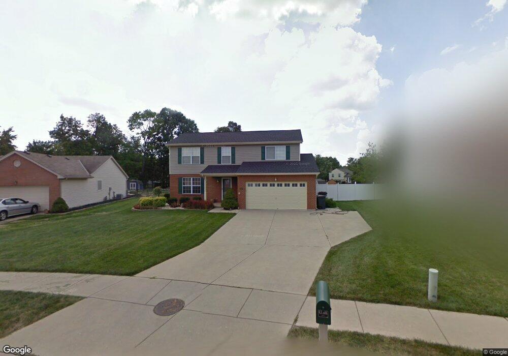
This home is located at 6299 Fireside Dr, Mason, OH 45040 and is currently estimated at $402,871, approximately $205 per square foot. 6299 Fireside Dr is a home located in Warren County with nearby schools including Mason Intermediate Elementary School, Mason Middle School, and William Mason High School.
Ownership History
Date
Name
Owned For
Owner Type
Purchase Details
Closed on
Jan 27, 2025
Sold by
Staton James Darryl and Staton Daryl
Bought by
Staton James Darryl and Staton Penelope June
Current Estimated Value
Purchase Details
Closed on
Jan 14, 1998
Sold by
Hutchinson Homes Inc
Bought by
Staton James D
Purchase Details
Closed on
Mar 28, 1996
Sold by
T Intererst C
Bought by
A J Enterprises
Create a Home Valuation Report for This Property
The Home Valuation Report is an in-depth analysis detailing your home's value as well as a comparison with similar homes in the area
Home Values in the Area
Average Home Value in this Area
Purchase History
| Date | Buyer | Sale Price | Title Company |
|---|---|---|---|
| Staton James Darryl | -- | None Listed On Document | |
| Staton James D | $146,000 | -- | |
| A J Enterprises | $162,000 | -- |
Source: Public Records
Tax History
| Year | Tax Paid | Tax Assessment Tax Assessment Total Assessment is a certain percentage of the fair market value that is determined by local assessors to be the total taxable value of land and additions on the property. | Land | Improvement |
|---|---|---|---|---|
| 2025 | $3,975 | $97,950 | $24,500 | $73,450 |
| 2024 | $3,975 | $97,950 | $24,500 | $73,450 |
| 2023 | $3,223 | $75,855 | $10,762 | $65,093 |
| 2022 | $3,597 | $75,856 | $10,763 | $65,093 |
| 2021 | $3,407 | $75,856 | $10,763 | $65,093 |
| 2020 | $3,231 | $61,670 | $8,750 | $52,920 |
| 2019 | $2,970 | $61,670 | $8,750 | $52,920 |
| 2018 | $2,980 | $61,670 | $8,750 | $52,920 |
| 2017 | $2,736 | $52,850 | $8,274 | $44,576 |
| 2016 | $2,818 | $52,850 | $8,274 | $44,576 |
| 2015 | $2,824 | $52,850 | $8,274 | $44,576 |
| 2014 | $2,830 | $49,390 | $7,730 | $41,660 |
| 2013 | $2,836 | $55,910 | $8,750 | $47,160 |
Source: Public Records
Map
Nearby Homes
- 6300 Amber Ct
- 6411 Coverage Ct
- 6404 Coverage Ct
- 6394 Coverage Ct
- 6382 Coverage Ct
- 6378 Coverage Ct
- 6364 Coverage Ct
- 6354 Coverage Ct
- 6379 Coverage Ct
- 6375 Coverage Ct
- 6358 Coverage Ct
- 6403 Nicholas Way
- 6393 Nicholas Way
- 6179 Nicholas Way
- 6175 Nicholas Way
- 6171 Nicholas Way
- 6361 Coverage Ct
- 6342 Coverage Ct
- 6160 Nicholas Way
- 6164 Nicholas Way
- 6275 Fireside Dr
- 6307 Fireside Dr
- 6261 Fireside Dr
- 6319 Fireside Dr
- 6308 Fireside Dr
- 6274 Fireside Dr
- 6247 Fireside Dr
- 1271 Kay Dr
- 6260 Fireside Dr
- 1273 Kay Dr
- 6331 Fireside Dr
- 6336 Fireside Dr
- 1269 Kay Dr
- 1171 Anthony Ln
- 1167 Anthony Ln
- 1275 Kay Dr
- 6248 Fireside Dr
- 6235 Fireside Dr
- 504 Charles Ct
- 1163 Anthony Ln
Your Personal Tour Guide
Ask me questions while you tour the home.