Estimated Value: $265,427 - $327,000
4
Beds
3
Baths
2,348
Sq Ft
$129/Sq Ft
Est. Value
About This Home
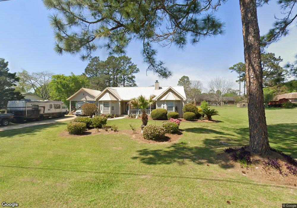
This home is located at 63 25th St NE, Cairo, GA 39828 and is currently estimated at $303,107, approximately $129 per square foot. 63 25th St NE is a home located in Grady County with nearby schools including Cairo High School.
Ownership History
Date
Name
Owned For
Owner Type
Purchase Details
Closed on
May 16, 2017
Sold by
Crisco Constance S
Bought by
Saul Alan D and Saul Constance S
Current Estimated Value
Purchase Details
Closed on
Jun 20, 2003
Bought by
Crisco Constance S
Purchase Details
Closed on
Jul 21, 1997
Sold by
Faircloth Tommy
Bought by
Bishop Jody L
Purchase Details
Closed on
Aug 17, 1994
Bought by
Faircloth Tommy
Create a Home Valuation Report for This Property
The Home Valuation Report is an in-depth analysis detailing your home's value as well as a comparison with similar homes in the area
Home Values in the Area
Average Home Value in this Area
Purchase History
| Date | Buyer | Sale Price | Title Company |
|---|---|---|---|
| Saul Alan D | -- | -- | |
| Crisco Constance S | $164,000 | -- | |
| Bishop Jody L | $9,000 | -- | |
| Faircloth Tommy | $6,000 | -- |
Source: Public Records
Tax History Compared to Growth
Tax History
| Year | Tax Paid | Tax Assessment Tax Assessment Total Assessment is a certain percentage of the fair market value that is determined by local assessors to be the total taxable value of land and additions on the property. | Land | Improvement |
|---|---|---|---|---|
| 2024 | $3,421 | $88,281 | $5,566 | $82,715 |
| 2023 | $2,225 | $61,770 | $6,600 | $55,170 |
| 2022 | $2,317 | $61,770 | $6,600 | $55,170 |
| 2021 | $2,323 | $61,770 | $6,600 | $55,170 |
| 2020 | $2,329 | $61,770 | $6,600 | $55,170 |
| 2019 | $2,328 | $61,770 | $6,600 | $55,170 |
| 2018 | $2,214 | $61,770 | $6,600 | $55,170 |
| 2017 | $2,130 | $61,770 | $6,600 | $55,170 |
| 2016 | $1,839 | $52,379 | $6,600 | $45,779 |
| 2015 | $1,821 | $52,379 | $6,600 | $45,779 |
| 2014 | $1,839 | $52,858 | $9,600 | $43,258 |
| 2013 | -- | $49,159 | $9,600 | $39,559 |
Source: Public Records
Map
Nearby Homes
- 21 24th St NE
- 2600 U S 84
- 78.6 Ac Strickland Rd
- 66 22nd St NE
- 0 20th St NE
- 00 20th St NE
- 0 NE Airport Rd Unit 145784
- 236 Helton Ln
- 225 Helton Ln
- 00 #10 Oak Bend Circle 4 38 Acres
- 3109 U S 84
- 3109 U S 84
- 00 NW 9th Ave
- 711 2nd Ave NE
- Lot #15, 3 64 Acres Oakbend Cir
- 530 6th St
- 530 6th Ave SE
- 471 4th St SE
- 481 4th St SE
- 00 State Route 188
- 57 25th St NE
- 62 25th St NE
- 68 25th St NE
- 51 25th St NE
- 58 24th St NE
- 74 25th St NE
- 62 24th St NE
- 56 24th St NE
- 2506 MacIvor Dr NE
- 2506 MacIvor Dr NE Unit 1
- 2460 Pineacre Dr NE
- 63 26th St NE
- 69 26th St NE
- 80 25th St NE
- 35 25th St NE
- 54 24th St NE
- 64 24th St NE
- 2580 MacIvor Dr NE
- 42 24th St NE
- 55 24th St NE