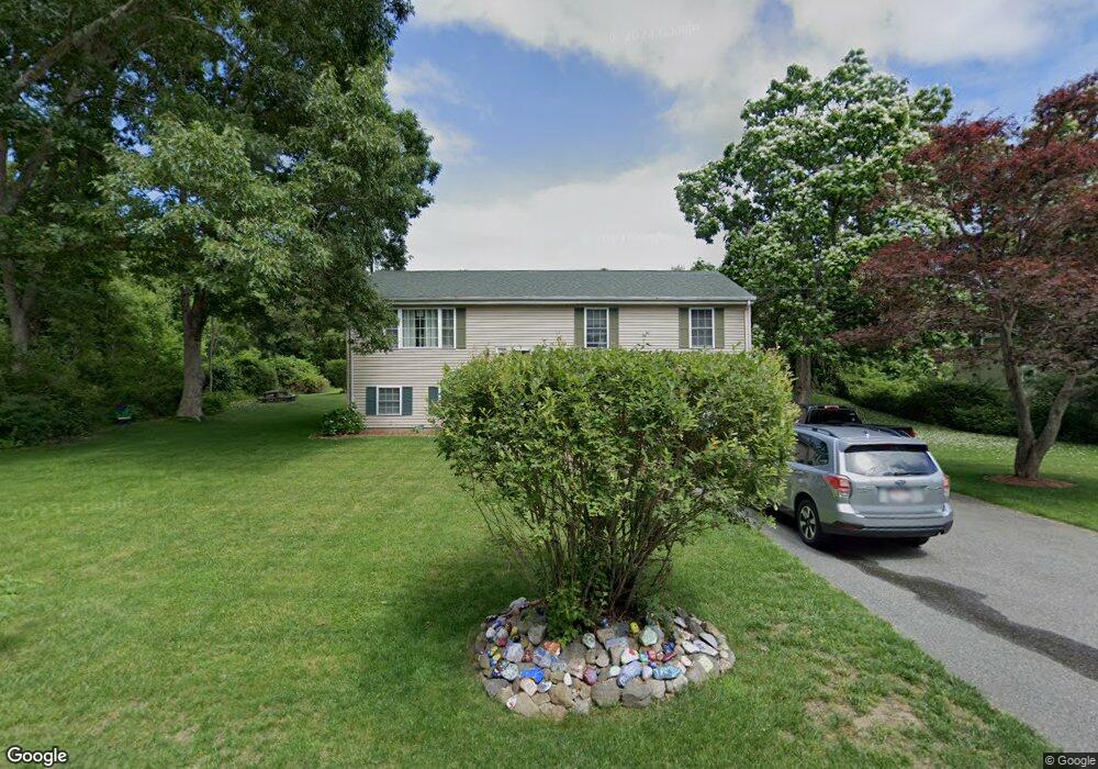
63 Adirondack Ln Westport, MA 02790
Estimated Value: $428,000 - $509,000
3
Beds
--
Bath
1,144
Sq Ft
$411/Sq Ft
Est. Value
About This Home
This home is located at 63 Adirondack Ln, Westport, MA 02790 and is currently estimated at $469,805, approximately $410 per square foot. 63 Adirondack Ln is a home located in Bristol County with nearby schools including Alice A. Macomber Primary School, Westport Elementary School, and Westport Middle-High School.
Ownership History
Date
Name
Owned For
Owner Type
Purchase Details
Closed on
Feb 28, 2001
Sold by
Adirondack Rt
Bought by
Brow Richard and Brow Carrie
Current Estimated Value
Purchase Details
Closed on
Jun 14, 2000
Sold by
Citimortgage Inc
Bought by
Adirondack Rt
Create a Home Valuation Report for This Property
The Home Valuation Report is an in-depth analysis detailing your home's value as well as a comparison with similar homes in the area
Home Values in the Area
Average Home Value in this Area
Purchase History
| Date | Buyer | Sale Price | Title Company |
|---|---|---|---|
| Brow Richard | $172,500 | -- | |
| Adirondack Rt | $42,250 | -- |
Source: Public Records
Mortgage History
| Date | Status | Borrower | Loan Amount |
|---|---|---|---|
| Open | Adirondack Rt | $204,000 | |
| Closed | Adirondack Rt | $188,000 | |
| Closed | Adirondack Rt | $110,000 | |
| Closed | Adirondack Rt | $175,000 |
Source: Public Records
Tax History Compared to Growth
Tax History
| Year | Tax Paid | Tax Assessment Tax Assessment Total Assessment is a certain percentage of the fair market value that is determined by local assessors to be the total taxable value of land and additions on the property. | Land | Improvement |
|---|---|---|---|---|
| 2025 | $2,666 | $357,800 | $99,000 | $258,800 |
| 2024 | $2,681 | $346,800 | $91,700 | $255,100 |
| 2023 | $2,519 | $308,700 | $87,300 | $221,400 |
| 2022 | $2,485 | $293,000 | $87,300 | $205,700 |
| 2021 | $8,540 | $285,100 | $79,400 | $205,700 |
| 2020 | $2,376 | $281,900 | $76,200 | $205,700 |
| 2019 | $2,249 | $271,900 | $76,200 | $195,700 |
| 2018 | $4,314 | $264,000 | $85,400 | $178,600 |
| 2017 | $2,079 | $260,900 | $91,200 | $169,700 |
| 2016 | $1,923 | $243,100 | $86,500 | $156,600 |
| 2015 | $2,030 | $256,000 | $99,400 | $156,600 |
Source: Public Records
Map
Nearby Homes
- 128 Old Bedford Rd
- 125 Angell St
- 34 Alsop St
- 33 William St
- 25 Beaulieu St
- 6 Beaulieu St
- 219 Earle St Unit 3
- 217 Earle St Unit 2
- 215 Earle St Unit 1
- 85 Reney St
- 37 Eaton St
- 172 Earle St
- 89 Lafayette St
- 1792 Pleasant St Unit 1808
- 10 Choate St
- 9 Register Ave
- 31 Choate St
- 529 Eastern Ave
- 383 Alden St
- 3 Diane Way
- 55 Adirondack Ln
- 55 Adirondack Ln Unit House
- 12 Oliver Ln
- 8 Oliver Ln
- 45 Adirondack Ln
- 0 Frontage St
- 17 Adirondack Ln
- 10 Adirondack Ln
- 34 Frontage St
- 24 Frontage St Unit 1 South
- 24 Frontage St Unit 1 North
- 24 Frontage St
- 24-28 Frontage Rd
- 148 Old Bedford Rd Unit 150
- 140 Old Bedford Rd
- 44C Old Bedford Rd
- 75 Old Bedford Rd
- 85 Old Bedford Rd
- Lot 31A Frontage St
- 93 Old Bedford Rd