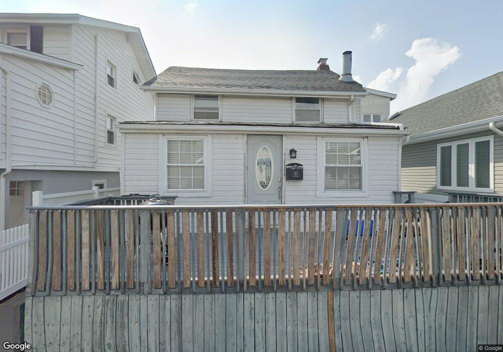
63 Alabama St Long Beach, NY 11561
Estimated Value: $811,000 - $904,239
--
Bed
3
Baths
1,260
Sq Ft
$681/Sq Ft
Est. Value
About This Home
This home is located at 63 Alabama St, Long Beach, NY 11561 and is currently estimated at $857,620, approximately $680 per square foot. 63 Alabama St is a home located in Nassau County with nearby schools including Lido Elementary School, West Elementary School, and Lindell Elementary School.
Ownership History
Date
Name
Owned For
Owner Type
Purchase Details
Closed on
Apr 18, 2016
Sold by
Lipomi Josephine
Bought by
Wolfson Jesse
Current Estimated Value
Purchase Details
Closed on
May 20, 2013
Sold by
Leidner Benjamin and Leidner Robyn
Bought by
Wolfson Jesse and Lipomi Josephine
Home Financials for this Owner
Home Financials are based on the most recent Mortgage that was taken out on this home.
Original Mortgage
$338,000
Interest Rate
5.91%
Purchase Details
Closed on
Jul 18, 2003
Sold by
Mcdonnell John
Bought by
Leidner Benjamin
Create a Home Valuation Report for This Property
The Home Valuation Report is an in-depth analysis detailing your home's value as well as a comparison with similar homes in the area
Home Values in the Area
Average Home Value in this Area
Purchase History
| Date | Buyer | Sale Price | Title Company |
|---|---|---|---|
| Wolfson Jesse | $22,500 | Judicial Title | |
| Wolfson Jesse | $422,500 | Nqt Land Services Llc As Age | |
| Leidner Benjamin | $399,500 | -- |
Source: Public Records
Mortgage History
| Date | Status | Borrower | Loan Amount |
|---|---|---|---|
| Previous Owner | Wolfson Jesse | $338,000 |
Source: Public Records
Tax History Compared to Growth
Tax History
| Year | Tax Paid | Tax Assessment Tax Assessment Total Assessment is a certain percentage of the fair market value that is determined by local assessors to be the total taxable value of land and additions on the property. | Land | Improvement |
|---|---|---|---|---|
| 2025 | $8,337 | $579 | $228 | $351 |
| 2024 | $1,005 | $557 | $228 | $329 |
| 2023 | $7,182 | $526 | $207 | $319 |
| 2022 | $7,182 | $579 | $228 | $351 |
| 2021 | $14,487 | $554 | $218 | $336 |
| 2020 | $10,449 | $801 | $613 | $188 |
| 2019 | $7,518 | $801 | $613 | $188 |
| 2018 | $7,119 | $802 | $0 | $0 |
| 2017 | $4,832 | $852 | $578 | $274 |
| 2016 | $1,052 | $903 | $545 | $358 |
| 2015 | $1,170 | $953 | $576 | $377 |
| 2014 | $1,170 | $953 | $576 | $377 |
| 2013 | $1,191 | $1,015 | $613 | $402 |
Source: Public Records
Map
Nearby Homes
- 59 Delaware Ave
- 62 Wisconsin St
- 49 Oregon St
- 74 Wisconsin St
- 66 Virginia Ave
- 56 Oregon St
- 30 Delaware Ave
- 64 Tennessee Ave
- 923 Oceanfront St
- 931 Oceanfront St
- 88 Oregon St
- 91 Virginia Ave
- 82 Tennessee Ave
- 77 Nebraska St
- 84 Nebraska St
- 93 Nebraska St
- 839 Oceanfront
- 77 New Hampshire St
- 92 Nebraska St
- 105 Vermont St
- 65 Alabama St
- 61 Alabama St
- 67 Alabama St
- 59 Alabama St
- 66 Wyoming Ave
- 62 Wyoming Ave
- 62 Wyoming Ave
- 68 Wyoming Ave
- 64 Alabama St
- 64 Alabama St Unit House
- 69 Alabama St
- 66 Alabama St
- 62 Alabama St
- 68 Alabama St
- 891b W Beech St
- 891 W Beech St
- 70 Wyoming Ave
- 889 W Beech St
- 885 W Beech St
- 71 Alabama St