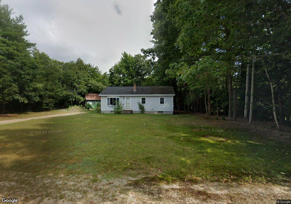
63 Allen Ave Buxton, ME 04093
Estimated Value: $369,861 - $428,000
3
Beds
1
Bath
1,092
Sq Ft
$367/Sq Ft
Est. Value
About This Home
This home is located at 63 Allen Ave, Buxton, ME 04093 and is currently estimated at $400,715, approximately $366 per square foot. 63 Allen Ave is a home with nearby schools including Bonny Eagle High School.
Create a Home Valuation Report for This Property
The Home Valuation Report is an in-depth analysis detailing your home's value as well as a comparison with similar homes in the area
Home Values in the Area
Average Home Value in this Area
Tax History
| Year | Tax Paid | Tax Assessment Tax Assessment Total Assessment is a certain percentage of the fair market value that is determined by local assessors to be the total taxable value of land and additions on the property. | Land | Improvement |
|---|---|---|---|---|
| 2025 | $2,915 | $255,700 | $98,100 | $157,600 |
| 2024 | $2,810 | $255,700 | $98,100 | $157,600 |
| 2023 | $2,600 | $249,300 | $98,100 | $151,200 |
| 2022 | $2,575 | $251,500 | $98,100 | $153,400 |
| 2021 | $2,340 | $161,848 | $60,800 | $101,048 |
| 2020 | $2,360 | $161,848 | $60,800 | $101,048 |
| 2019 | $2,170 | $146,400 | $60,800 | $85,600 |
| 2018 | $2,070 | $146,400 | $60,800 | $85,600 |
| 2017 | $1,991 | $146,400 | $60,800 | $85,600 |
| 2016 | $1,911 | $146,400 | $60,800 | $85,600 |
| 2015 | $1,896 | $146,400 | $60,800 | $85,600 |
| 2014 | $1,859 | $146,400 | $60,800 | $85,600 |
| 2013 | $1,830 | $146,400 | $60,800 | $85,600 |
Source: Public Records
Map
Nearby Homes
- 866 Parker Farm Lot B Rd
- 866 Parker Farm Lot A Rd
- 866 Parker Farm Rd Unit A
- 866 Parker Farm Rd Unit B
- 42 Brandons Way
- 30 Joan Dixon Way
- Lot 2 Commerce Way
- 4 Musket Dr
- 107 Sokokis Trail
- 116 Dingley Spring Rd
- 63 Ossipee Trail E
- 1 Cortland Place Unit 7
- 27 Ossipee Trail E Unit 1
- 35 Rust Rd
- 66 Ossipee Trail East Trail E
- 207 Dunnell Rd
- 1 Macie Dr Unit 84
- 11 Macie Dr Unit 79
- 7 Macie Dr
- TBD Saco Rd
Your Personal Tour Guide
Ask me questions while you tour the home.