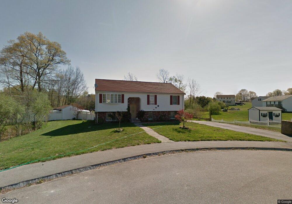
63 Amy Way Taunton, MA 02780
Estimated Value: $454,000 - $520,000
3
Beds
2
Baths
1,130
Sq Ft
$437/Sq Ft
Est. Value
About This Home
This home is located at 63 Amy Way, Taunton, MA 02780 and is currently estimated at $493,766, approximately $436 per square foot. 63 Amy Way is a home located in Bristol County with nearby schools including Mulcahey Elementary School, Taunton High School, and Our Lady of Lourdes School.
Ownership History
Date
Name
Owned For
Owner Type
Purchase Details
Closed on
Nov 2, 2023
Sold by
Paiva Manuel M and Paiva Maria I
Bought by
Amy Way 36 Rt and Paiva
Current Estimated Value
Purchase Details
Closed on
Dec 23, 1998
Sold by
Hawthorne Dev Inc
Bought by
Paiva Manuel M and Paiva Maria I
Home Financials for this Owner
Home Financials are based on the most recent Mortgage that was taken out on this home.
Original Mortgage
$130,300
Interest Rate
6.89%
Mortgage Type
Purchase Money Mortgage
Create a Home Valuation Report for This Property
The Home Valuation Report is an in-depth analysis detailing your home's value as well as a comparison with similar homes in the area
Home Values in the Area
Average Home Value in this Area
Purchase History
| Date | Buyer | Sale Price | Title Company |
|---|---|---|---|
| Amy Way 36 Rt | -- | None Available | |
| Paiva Manuel M | $137,200 | -- |
Source: Public Records
Mortgage History
| Date | Status | Borrower | Loan Amount |
|---|---|---|---|
| Previous Owner | Paiva Manuel M | $108,000 | |
| Previous Owner | Paiva Manuel M | $104,700 | |
| Previous Owner | Paiva Manuel M | $130,300 |
Source: Public Records
Tax History Compared to Growth
Tax History
| Year | Tax Paid | Tax Assessment Tax Assessment Total Assessment is a certain percentage of the fair market value that is determined by local assessors to be the total taxable value of land and additions on the property. | Land | Improvement |
|---|---|---|---|---|
| 2025 | $4,814 | $440,000 | $147,500 | $292,500 |
| 2024 | $4,410 | $394,100 | $147,500 | $246,600 |
| 2023 | $4,569 | $379,200 | $154,100 | $225,100 |
| 2022 | $4,273 | $324,200 | $120,000 | $204,200 |
| 2021 | $4,040 | $284,500 | $109,300 | $175,200 |
| 2020 | $3,965 | $266,800 | $109,300 | $157,500 |
| 2019 | $4,217 | $267,600 | $114,700 | $152,900 |
| 2018 | $4,018 | $255,600 | $115,700 | $139,900 |
| 2017 | $3,778 | $240,500 | $110,400 | $130,100 |
| 2016 | $3,668 | $233,900 | $107,100 | $126,800 |
| 2015 | $3,484 | $232,100 | $107,100 | $125,000 |
| 2014 | $3,368 | $230,500 | $107,100 | $123,400 |
Source: Public Records
Map
Nearby Homes
- 125 Highland St Unit 103
- 56 Silver St
- 24 Highland Terrace
- 193 Winthrop St
- 22 Everett St
- 170 Highland St Unit 320
- 132 Winthrop St
- 72 Barnum St
- 450 Somerset Ave Unit 2-7
- 450 Somerset Ave Unit 6-6
- 98 Winthrop St
- 278 Cohannet St
- 39 Myrtle St
- 16 Clinton St
- 24 1st St
- 252 Somerset Ave
- 4 A Lawton St Unit A
- 154 Appaloosa Way
- 19 Mason St
- 4 Parkin Ct
- 55 Amy Way
- 14 Meadowview Cir
- 116 Briggs St
- 52 Amy Way
- 68 Amy Way
- 1 Meadowview Cir
- 22 Meadowview Cir
- 120 Briggs St Unit 2
- 120 Briggs St Unit 1
- 120 Briggs St Unit 1A
- 120 Briggs St Unit A+B
- 120A Briggs St Unit 1
- 120 Briggs St Unit A
- 120 Briggs St Unit B
- 34 Amy Way
- 33 Amy Way
- 17 Meadowview Cir
- 117 Briggs St Unit 2
- 117 Briggs St
- 117 Briggs St Unit 1