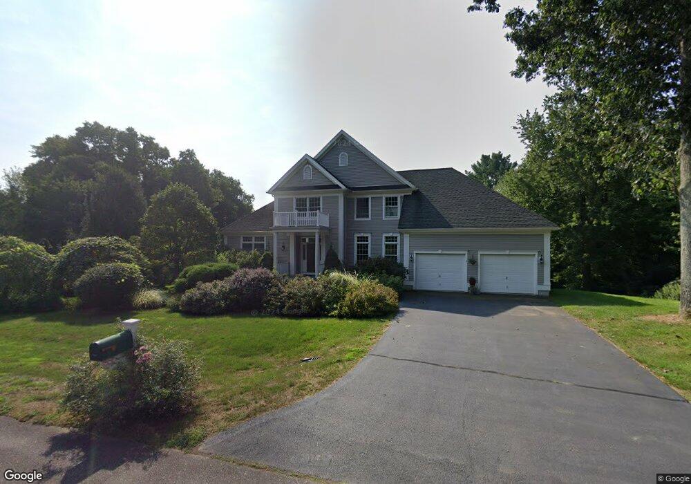
63 Ayers Point Rd Old Saybrook, CT 06475
Estimated Value: $875,000 - $996,000
5
Beds
4
Baths
3,775
Sq Ft
$246/Sq Ft
Est. Value
About This Home
This home is located at 63 Ayers Point Rd, Old Saybrook, CT 06475 and is currently estimated at $926,839, approximately $245 per square foot. 63 Ayers Point Rd is a home located in Middlesex County with nearby schools including Kathleen E. Goodwin School, Old Saybrook Middle School, and Old Saybrook Senior High School.
Ownership History
Date
Name
Owned For
Owner Type
Purchase Details
Closed on
Dec 20, 2000
Sold by
Tree Grp Llc
Bought by
Saraceno Nicholas A and Saraceno Susan H
Current Estimated Value
Purchase Details
Closed on
Oct 7, 1999
Sold by
Est Sheehan John J and Cronin Michael E
Bought by
Tree Group Llc
Home Financials for this Owner
Home Financials are based on the most recent Mortgage that was taken out on this home.
Original Mortgage
$236,250
Interest Rate
7.81%
Create a Home Valuation Report for This Property
The Home Valuation Report is an in-depth analysis detailing your home's value as well as a comparison with similar homes in the area
Home Values in the Area
Average Home Value in this Area
Purchase History
| Date | Buyer | Sale Price | Title Company |
|---|---|---|---|
| Saraceno Nicholas A | $175,000 | -- | |
| Tree Group Llc | $315,000 | -- |
Source: Public Records
Mortgage History
| Date | Status | Borrower | Loan Amount |
|---|---|---|---|
| Open | Tree Group Llc | $100,000 | |
| Previous Owner | Tree Group Llc | $236,250 | |
| Previous Owner | Tree Group Llc | $20,000 |
Source: Public Records
Tax History
| Year | Tax Paid | Tax Assessment Tax Assessment Total Assessment is a certain percentage of the fair market value that is determined by local assessors to be the total taxable value of land and additions on the property. | Land | Improvement |
|---|---|---|---|---|
| 2025 | $8,855 | $571,300 | $114,600 | $456,700 |
| 2024 | $6,782 | $446,200 | $114,600 | $331,600 |
| 2023 | $7,888 | $385,700 | $94,400 | $291,300 |
| 2022 | $7,745 | $385,700 | $94,400 | $291,300 |
| 2021 | $7,733 | $385,700 | $94,400 | $291,300 |
| 2020 | $7,733 | $385,700 | $94,400 | $291,300 |
| 2019 | $7,618 | $385,700 | $94,400 | $291,300 |
| 2018 | $7,505 | $382,900 | $94,400 | $288,500 |
| 2017 | $7,528 | $382,900 | $94,400 | $288,500 |
| 2016 | $7,375 | $382,900 | $94,400 | $288,500 |
| 2015 | $7,202 | $382,900 | $94,400 | $288,500 |
| 2014 | $7,084 | $382,900 | $94,400 | $288,500 |
Source: Public Records
Map
Nearby Homes
- 6 Parkman Place
- 96 Ayers Point Rd
- 12 Hill Rd
- 9 2nd Ave
- 5 Sunrise Ave
- 62-14,15,16 Middlesex Turnpike
- 41 Watrous Point Rd
- Lot 2 - 160 Saybrook Rd
- 9 Essex Hills Dr
- 10 Cove Hill Rd
- 1 Huntley Rd
- 0 Middlesex Turnpike
- 1 & 3 Neck Rd
- 8 Lieutenant River Ln
- 3 Ferry Rd
- 60 Lyme St
- 34 Lyme St
- 0 Merritt Ln
- 45 Main St
- 56 S Main St
- 55 Ayers Point Rd
- 3 Parkman Place
- 2 Mallard Dr
- 39 Ayers Point Rd
- 5 Parkman Place
- 40 Ayers Point Rd
- 40-A Ayers Point Rd
- 40 Ayers Point Rd
- 40 Ayers Point Rd
- 37 Ayers Point Rd
- 4 Mallard Dr
- 21 Ayers Point Rd
- 70 Ayers Point Rd
- 7 Otterbrook Dr
- 2 Otterbrook Dr
- 2 Parkman Place
- 33 Ayers Point Rd
- 4 Parkman Place
- 7 Parkman Place
- 3 Mallard Dr
Your Personal Tour Guide
Ask me questions while you tour the home.