Estimated Value: $2,203,419
--
Bed
--
Bath
9,960
Sq Ft
$221/Sq Ft
Est. Value
About This Home
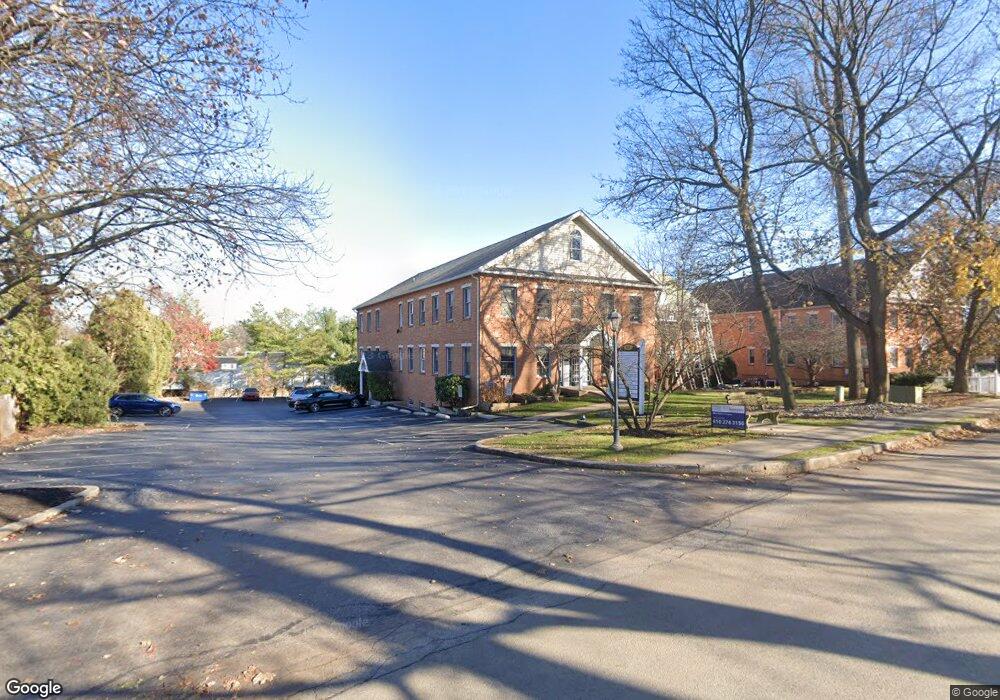
This home is located at 63 Chestnut Rd, Paoli, PA 19301 and is currently estimated at $2,203,419, approximately $221 per square foot. 63 Chestnut Rd is a home located in Chester County with nearby schools including Beaumont Elementary School, Tredyffrin-Easttown Middle School, and Conestoga Senior High School.
Ownership History
Date
Name
Owned For
Owner Type
Purchase Details
Closed on
Dec 23, 2022
Sold by
Dannunzio Vincent J and Dannunzio Carole M
Bought by
Chestnut Group Llc
Current Estimated Value
Home Financials for this Owner
Home Financials are based on the most recent Mortgage that was taken out on this home.
Original Mortgage
$1,368,750
Outstanding Balance
$1,324,812
Interest Rate
6.58%
Mortgage Type
New Conventional
Estimated Equity
$878,607
Purchase Details
Closed on
Nov 1, 1985
Bought by
Dannunzio Vincent J and Dannunzio Carole M
Create a Home Valuation Report for This Property
The Home Valuation Report is an in-depth analysis detailing your home's value as well as a comparison with similar homes in the area
Home Values in the Area
Average Home Value in this Area
Purchase History
| Date | Buyer | Sale Price | Title Company |
|---|---|---|---|
| Chestnut Group Llc | $1,825,000 | -- | |
| Dannunzio Vincent J | $340,000 | -- |
Source: Public Records
Mortgage History
| Date | Status | Borrower | Loan Amount |
|---|---|---|---|
| Open | Chestnut Group Llc | $1,368,750 |
Source: Public Records
Tax History Compared to Growth
Tax History
| Year | Tax Paid | Tax Assessment Tax Assessment Total Assessment is a certain percentage of the fair market value that is determined by local assessors to be the total taxable value of land and additions on the property. | Land | Improvement |
|---|---|---|---|---|
| 2025 | $23,877 | $677,880 | $77,520 | $600,360 |
| 2024 | $23,877 | $677,880 | $77,520 | $600,360 |
| 2023 | $22,429 | $677,880 | $77,520 | $600,360 |
| 2022 | $21,850 | $677,880 | $77,520 | $600,360 |
| 2021 | $21,435 | $677,880 | $77,520 | $600,360 |
| 2020 | $20,844 | $677,880 | $77,520 | $600,360 |
| 2019 | $25,465 | $855,180 | $77,520 | $777,660 |
| 2018 | $24,960 | $855,180 | $77,520 | $777,660 |
| 2017 | $24,365 | $855,180 | $77,520 | $777,660 |
| 2016 | -- | $855,180 | $77,520 | $777,660 |
| 2015 | -- | $855,180 | $77,520 | $777,660 |
| 2014 | -- | $855,180 | $77,520 | $777,660 |
Source: Public Records
Map
Nearby Homes
- 2102 Quail Ridge Dr
- 521 Foxwood Ln
- 1304 Weatherstone Dr Unit 1304
- 109 Vincent Rd
- 1705 Weatherstone Dr
- 106 N Valley Rd
- 5 Kent Ln
- 1 Whitworth Ave
- 104 Lynbrook Rd
- 114 Manor Rd
- 29 Manor Rd
- 21 Manor Rd
- 1441 Berwyn Paoli Rd
- 12 Moreland Rd
- 3 Bryan Ave
- 1242 Old Lancaster Rd
- 201 Penns Ln
- 202 Shoreline Dr
- 10 Arlington Rd
- 32 Manchester Ct
- 63 Chestnut Rd Unit SUITE 9
- 83 Chestnut Rd
- 55 Chestnut Rd
- 49 Chestnut Rd
- 49 Rose Ln
- 140 Woodgate Ln
- 141 Woodgate Ln Unit 31
- 142 Woodgate Ln Unit 32
- 143 Woodgate Ln Unit 33
- 139 Woodgate Ln Unit 29
- 144 Woodgate Ln
- 144 Woodgate Ln Unit 34
- 138 Woodgate Ln Unit 28
- 45 Chestnut Rd
- 151 Woodgate Ln
- 91 Chestnut Rd
- 145 Woodgate Ln Unit 35
- 152 Woodgate Ln
- 152 Woodgate Ln Unit 42
- 43 Chestnut Rd