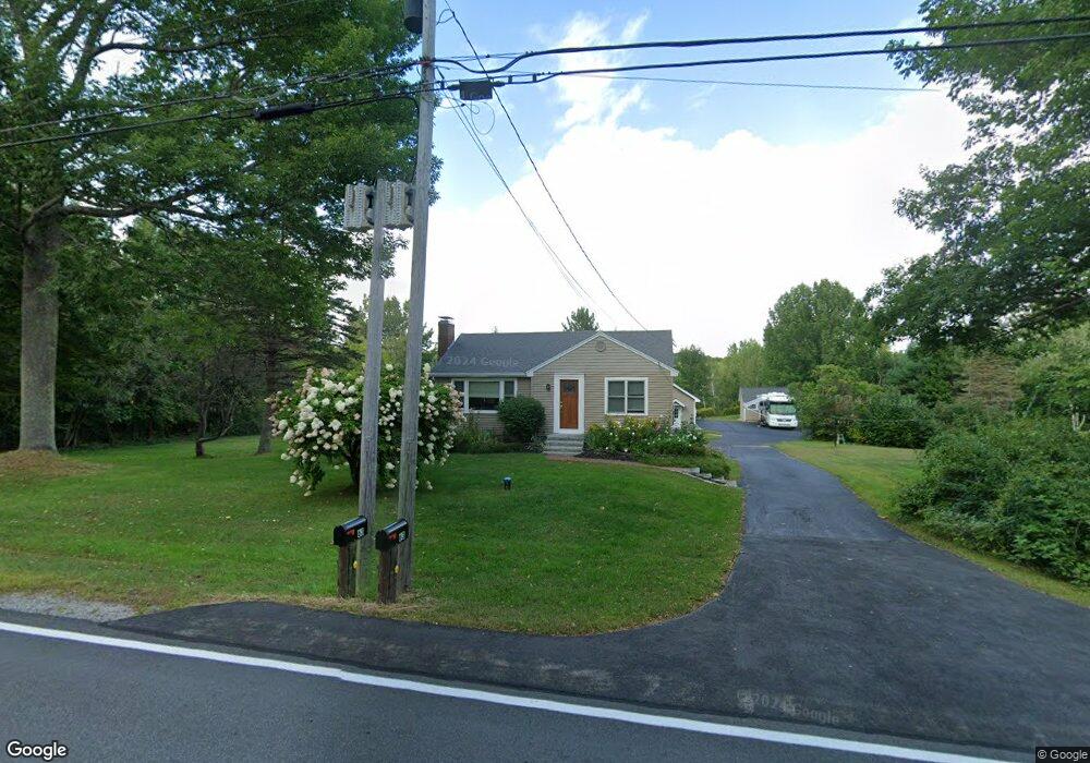
63 Dow Rd Gorham, ME 04038
Estimated Value: $387,000 - $415,000
2
Beds
2
Baths
835
Sq Ft
$483/Sq Ft
Est. Value
About This Home
This home is located at 63 Dow Rd, Gorham, ME 04038 and is currently estimated at $402,918, approximately $482 per square foot. 63 Dow Rd is a home located in Cumberland County with nearby schools including Village Elementary School and Gorham High School.
Create a Home Valuation Report for This Property
The Home Valuation Report is an in-depth analysis detailing your home's value as well as a comparison with similar homes in the area
Home Values in the Area
Average Home Value in this Area
Tax History Compared to Growth
Tax History
| Year | Tax Paid | Tax Assessment Tax Assessment Total Assessment is a certain percentage of the fair market value that is determined by local assessors to be the total taxable value of land and additions on the property. | Land | Improvement |
|---|---|---|---|---|
| 2024 | $4,203 | $285,900 | $72,500 | $213,400 |
| 2023 | $3,931 | $285,900 | $72,500 | $213,400 |
| 2022 | $3,674 | $285,900 | $72,500 | $213,400 |
| 2021 | $2,730 | $140,700 | $55,100 | $85,600 |
| 2020 | $2,673 | $140,700 | $55,100 | $85,600 |
| 2019 | $2,666 | $140,700 | $55,100 | $85,600 |
| 2018 | $2,561 | $140,700 | $55,100 | $85,600 |
| 2017 | $2,406 | $140,700 | $55,100 | $85,600 |
| 2016 | $2,392 | $140,700 | $55,100 | $85,600 |
| 2015 | $2,293 | $140,700 | $55,100 | $85,600 |
| 2014 | $2,217 | $127,400 | $48,500 | $78,900 |
| 2013 | $2,204 | $127,400 | $48,500 | $78,900 |
Source: Public Records
Map
Nearby Homes
- 22 Finn Parker Rd
- 00 Ossipee Trail E
- 21 Alexander Dr
- 35 Rust Rd
- 183 Buck St
- 14 Patrick Dr
- 135 Buck St
- 125 Old Thompson Rd
- 116 Dingley Spring Rd
- TBD Fort Hill Rd
- 12 Richard Rd
- 8 Wolf River Run
- 30 Joan Dixon Way
- Lot A Martin Dr
- 3 Oliver Ln
- 75 Mighty St
- 15 Winter St
- 114 Narragansett St
- 127 Falcon Crest Dr Unit 4
- 56 Hay Field Dr