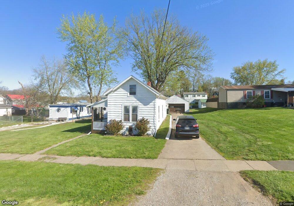
63 E King St Zanesville, OH 43701
Estimated Value: $78,000 - $198,000
3
Beds
1
Bath
1,191
Sq Ft
$119/Sq Ft
Est. Value
About This Home
This home is located at 63 E King St, Zanesville, OH 43701 and is currently estimated at $142,192, approximately $119 per square foot. 63 E King St is a home located in Muskingum County with nearby schools including Maysville Elementary School, Maysville Middle School, and Maysville High School.
Ownership History
Date
Name
Owned For
Owner Type
Purchase Details
Closed on
Jan 14, 2022
Sold by
Mills Kenneth G
Bought by
Kenneth G Mills And Linda S Mills Revocable T and Mi Linda
Current Estimated Value
Purchase Details
Closed on
May 25, 2001
Sold by
Oxley Margaret
Bought by
Mills Kenneth G and Mills Linda S
Home Financials for this Owner
Home Financials are based on the most recent Mortgage that was taken out on this home.
Original Mortgage
$46,000
Interest Rate
8.37%
Mortgage Type
New Conventional
Create a Home Valuation Report for This Property
The Home Valuation Report is an in-depth analysis detailing your home's value as well as a comparison with similar homes in the area
Home Values in the Area
Average Home Value in this Area
Purchase History
| Date | Buyer | Sale Price | Title Company |
|---|---|---|---|
| Kenneth G Mills And Linda S Mills Revocable T | $24,666 | None Listed On Document | |
| Mills Kenneth G | $34,000 | -- |
Source: Public Records
Mortgage History
| Date | Status | Borrower | Loan Amount |
|---|---|---|---|
| Previous Owner | Mills Kenneth G | $46,000 |
Source: Public Records
Tax History Compared to Growth
Tax History
| Year | Tax Paid | Tax Assessment Tax Assessment Total Assessment is a certain percentage of the fair market value that is determined by local assessors to be the total taxable value of land and additions on the property. | Land | Improvement |
|---|---|---|---|---|
| 2024 | $843 | $25,900 | $6,895 | $19,005 |
| 2023 | $749 | $21,630 | $5,285 | $16,345 |
| 2022 | $732 | $21,630 | $5,285 | $16,345 |
| 2021 | $720 | $21,630 | $5,285 | $16,345 |
| 2020 | $640 | $18,025 | $4,410 | $13,615 |
| 2019 | $644 | $18,025 | $4,410 | $13,615 |
| 2018 | $635 | $18,025 | $4,410 | $13,615 |
| 2017 | $597 | $15,610 | $4,410 | $11,200 |
| 2016 | $603 | $15,610 | $4,410 | $11,200 |
| 2015 | $615 | $15,610 | $4,410 | $11,200 |
| 2013 | $659 | $15,610 | $4,410 | $11,200 |
Source: Public Records
Map
Nearby Homes
- 67 E King St
- 72 E Berkley St
- 72 N Pembroke Ave
- 97 E Main St
- 137 E King St
- 105 Rains Cir
- 16 Beech Rock Dr
- 77 Grandview Ave
- 108 N Montague Ave
- 2810 Maysville Pike
- 211A E Main St
- 92 Beechrock Dr
- 1705 Bradford Ave
- 2188 S River Rd
- 1321 S Westwood Dr
- 224 Searle St
- 403 Seborn Ave
- 1222 Putnam Ave
- 2065 Russell Dr
- 108 Summit Dr
- 63 1/2 E King St
- 44 N Pembroke Ave
- 60 E Berkley St
- 52 N Pembroke Ave
- 60 E King St
- 60 1/2 E King St
- 48 N Pembroke Ave
- 68 E Berkley St
- 75 E King St
- 58 E Berkley St
- 58 E King St
- 56 E Berkley St Unit 60
- 56 E Berkley St Unit 58
- 56 E Berkley St
- 52 E Berkley St
- 54 E King St
- 68 E King St
- 40 N Pembroke Ave
- 76 E King St
- 38 N Pembroke Ave