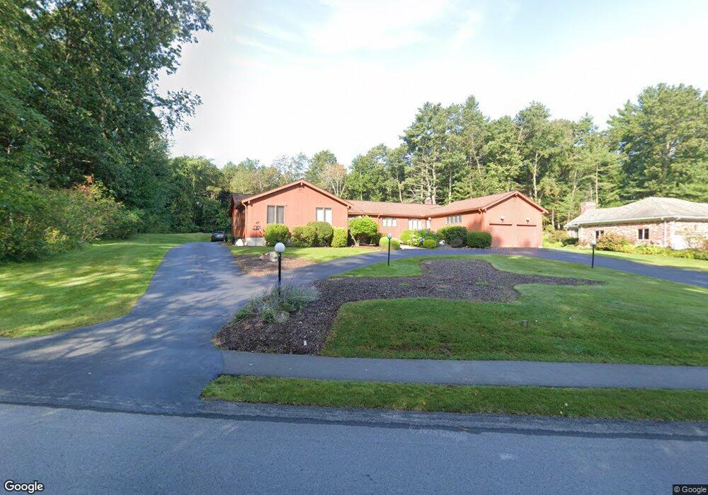
63 Eliot Hill Rd Natick, MA 01760
Estimated Value: $1,312,000 - $1,728,000
5
Beds
5
Baths
4,001
Sq Ft
$387/Sq Ft
Est. Value
About This Home
This home is located at 63 Eliot Hill Rd, Natick, MA 01760 and is currently estimated at $1,549,651, approximately $387 per square foot. 63 Eliot Hill Rd is a home located in Middlesex County with nearby schools including Natick High School, Memorial Elementary School, and J F Kennedy Middle School.
Ownership History
Date
Name
Owned For
Owner Type
Purchase Details
Closed on
Jun 30, 2017
Sold by
Frank Nesvet Ret Of 20
Bought by
Katz Daniel L and Katz Kimberly A
Current Estimated Value
Home Financials for this Owner
Home Financials are based on the most recent Mortgage that was taken out on this home.
Original Mortgage
$450,000
Outstanding Balance
$375,203
Interest Rate
4.02%
Mortgage Type
New Conventional
Estimated Equity
$1,174,448
Purchase Details
Closed on
Jan 9, 2012
Sold by
Nesvet Frank and Nesvet Marsha A
Bought by
Frank Nesvet Ret and Nesvet Frank
Purchase Details
Closed on
Apr 1, 1981
Bought by
Frank & Marsha A Nesvet Ret
Create a Home Valuation Report for This Property
The Home Valuation Report is an in-depth analysis detailing your home's value as well as a comparison with similar homes in the area
Home Values in the Area
Average Home Value in this Area
Purchase History
| Date | Buyer | Sale Price | Title Company |
|---|---|---|---|
| Katz Daniel L | $750,000 | -- | |
| Frank Nesvet Ret | -- | -- | |
| Frank & Marsha A Nesvet Ret | -- | -- |
Source: Public Records
Mortgage History
| Date | Status | Borrower | Loan Amount |
|---|---|---|---|
| Open | Katz Daniel L | $450,000 | |
| Previous Owner | Frank & Marsha A Nesvet Ret | $412,500 | |
| Previous Owner | Frank & Marsha A Nesvet Ret | $200,000 |
Source: Public Records
Tax History
| Year | Tax Paid | Tax Assessment Tax Assessment Total Assessment is a certain percentage of the fair market value that is determined by local assessors to be the total taxable value of land and additions on the property. | Land | Improvement |
|---|---|---|---|---|
| 2025 | $16,758 | $1,401,200 | $555,800 | $845,400 |
| 2024 | $16,200 | $1,321,400 | $526,500 | $794,900 |
| 2023 | $16,095 | $1,273,300 | $526,500 | $746,800 |
| 2022 | $14,391 | $1,078,800 | $431,500 | $647,300 |
| 2021 | $17 | $1,014,400 | $408,800 | $605,600 |
| 2020 | $6,524 | $997,400 | $391,800 | $605,600 |
| 2019 | $18 | $779,900 | $391,800 | $388,100 |
| 2018 | $9,844 | $754,300 | $375,600 | $378,700 |
| 2017 | $5,284 | $746,400 | $374,700 | $371,700 |
| 2016 | $10,084 | $743,100 | $374,700 | $368,400 |
| 2015 | $9,791 | $708,500 | $374,700 | $333,800 |
Source: Public Records
Map
Nearby Homes
- 211 Eliot St
- 6 Hopewell Farm Rd
- 189 Eliot St
- 16 Wayside Rd Unit 14
- 81 Woodland St
- 11 Morgan Dr Unit 404
- 36 Yorkshire Rd
- 7 Allison Way Unit 7
- 2 Phillips Pond Rd
- 18 Phillips Pond Rd
- 104 Eliot St
- 104 Glen St
- 14 Pinewood Ave
- 216-218 S Main St
- 137 Lake St
- 83 Eliot St
- 165 Woodland St
- 61 Glen St
- 2 Arrow Path
- 8 Greystone Rd
- 61 Eliot Hill Rd
- 65 Eliot Hill Rd
- 21 Everett St
- 54 Eliot Hill Rd
- 15 Everett St
- 56 Eliot Hill Rd
- 59 Eliot Hill Rd
- 52 Eliot Hill Rd
- 5 Whitridge Rd
- 3 Whitridge Rd
- 57 Eliot Hill Rd
- 1 Whitridge Rd
- 271 Eliot St
- 25 Everett St
- 7 Whitridge Rd
- 4 Everett St
- 4 Everett St
- 4 Everett St Unit Single Fam
- 6 Everett St
- 9 Whitridge Rd
Your Personal Tour Guide
Ask me questions while you tour the home.