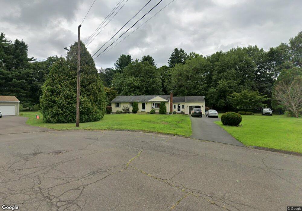
63 Foster Ln Windsor, CT 06095
Hayden NeighborhoodEstimated Value: $360,612 - $394,000
3
Beds
1
Bath
1,672
Sq Ft
$222/Sq Ft
Est. Value
About This Home
This home is located at 63 Foster Ln, Windsor, CT 06095 and is currently estimated at $370,403, approximately $221 per square foot. 63 Foster Ln is a home located in Hartford County with nearby schools including Oliver Ellsworth School, John F. Kennedy School, and Sage Park Middle School.
Ownership History
Date
Name
Owned For
Owner Type
Purchase Details
Closed on
Oct 6, 2015
Sold by
Porter Kelly M and Porter Monica J
Bought by
Porter Kelly M and Porter Garland H
Current Estimated Value
Purchase Details
Closed on
May 6, 2009
Sold by
Pratt Dianne
Bought by
Porter Kelly and Porter Monica
Home Financials for this Owner
Home Financials are based on the most recent Mortgage that was taken out on this home.
Original Mortgage
$219,942
Interest Rate
4.9%
Mortgage Type
Purchase Money Mortgage
Purchase Details
Closed on
Nov 30, 1987
Sold by
Lacasse Harvey
Bought by
Shaw William
Home Financials for this Owner
Home Financials are based on the most recent Mortgage that was taken out on this home.
Original Mortgage
$140,000
Interest Rate
11.59%
Mortgage Type
Purchase Money Mortgage
Create a Home Valuation Report for This Property
The Home Valuation Report is an in-depth analysis detailing your home's value as well as a comparison with similar homes in the area
Home Values in the Area
Average Home Value in this Area
Purchase History
| Date | Buyer | Sale Price | Title Company |
|---|---|---|---|
| Porter Kelly M | -- | -- | |
| Porter Kelly | $224,000 | -- | |
| Shaw William | $161,500 | -- |
Source: Public Records
Mortgage History
| Date | Status | Borrower | Loan Amount |
|---|---|---|---|
| Previous Owner | Shaw William | $219,942 | |
| Previous Owner | Shaw William | $75,000 | |
| Previous Owner | Shaw William | $84,000 | |
| Previous Owner | Shaw William | $140,000 |
Source: Public Records
Tax History
| Year | Tax Paid | Tax Assessment Tax Assessment Total Assessment is a certain percentage of the fair market value that is determined by local assessors to be the total taxable value of land and additions on the property. | Land | Improvement |
|---|---|---|---|---|
| 2025 | $6,600 | $231,980 | $72,800 | $159,180 |
| 2024 | $7,034 | $231,980 | $72,800 | $159,180 |
| 2023 | $5,186 | $154,350 | $56,140 | $98,210 |
| 2022 | $5,135 | $154,350 | $56,140 | $98,210 |
| 2021 | $5,135 | $154,350 | $56,140 | $98,210 |
| 2020 | $5,111 | $154,350 | $56,140 | $98,210 |
| 2019 | $4,590 | $141,750 | $56,140 | $85,610 |
| 2018 | $4,416 | $133,980 | $56,140 | $77,840 |
| 2017 | $4,109 | $126,630 | $56,140 | $70,490 |
| 2016 | $3,991 | $126,630 | $56,140 | $70,490 |
| 2015 | $3,915 | $126,630 | $56,140 | $70,490 |
| 2014 | $3,858 | $126,630 | $56,140 | $70,490 |
Source: Public Records
Map
Nearby Homes
- 16 Brown Ave
- 9 Brown Ave
- 1333 Palisado Ave
- 66 Maple Ave
- 39 Warham St
- 211 MacKtown Rd
- 294 S Main St Unit LOT 2
- 957 Palisado Ave
- 44 Oxbow Ln
- 342 Capen St
- 318 Capen St
- 27 W River Rd
- 27 Fyler Dr
- 18 Cathy (Lot 17) Ln
- 20 Cathy (Lot 16) Ln
- 24 Cathy (Lot 14) Ln
- 29 W River Rd
- 26 Cathy (Lot 13) Ln
- 22 Cathy (Lot 15) Ln
- 0 Abbe Rd
Your Personal Tour Guide
Ask me questions while you tour the home.