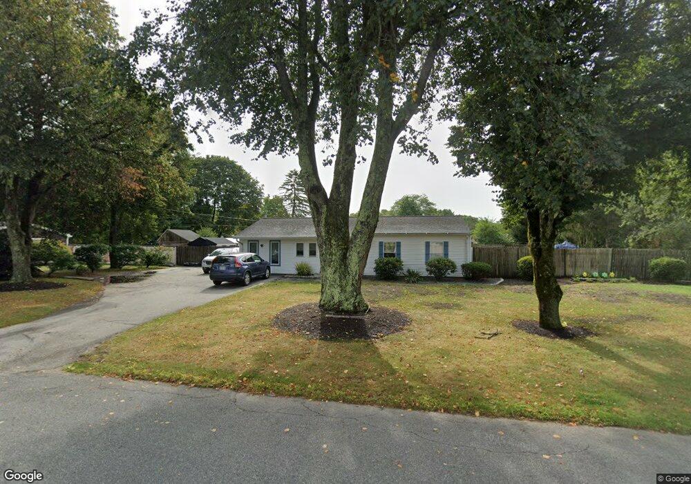
63 Franklin Rd Hanover, MA 02339
Estimated Value: $567,536 - $796,000
3
Beds
1
Bath
1,225
Sq Ft
$537/Sq Ft
Est. Value
About This Home
This home is located at 63 Franklin Rd, Hanover, MA 02339 and is currently estimated at $658,134, approximately $537 per square foot. 63 Franklin Rd is a home located in Plymouth County with nearby schools including Hanover High School and Calvary Chapel Academy.
Ownership History
Date
Name
Owned For
Owner Type
Purchase Details
Closed on
Nov 4, 2011
Sold by
Quill John F and Quill Julie A
Bought by
John F Quill Ret and Quill
Current Estimated Value
Purchase Details
Closed on
Mar 4, 2008
Sold by
Quill John F and Quill Julie A
Bought by
Quill Tr John F and Quill Julie A
Purchase Details
Closed on
Oct 25, 2002
Sold by
Hudgins Jem A
Bought by
Quill John F and Quill Julie A
Purchase Details
Closed on
Oct 11, 1996
Sold by
Sandhu Amarpal S and Dhillon Sonia
Bought by
Porter Robert F and Porter Susan T
Purchase Details
Closed on
Aug 1, 1989
Sold by
Singh Pritam
Bought by
Sandhu Amarpal S
Create a Home Valuation Report for This Property
The Home Valuation Report is an in-depth analysis detailing your home's value as well as a comparison with similar homes in the area
Home Values in the Area
Average Home Value in this Area
Purchase History
| Date | Buyer | Sale Price | Title Company |
|---|---|---|---|
| John F Quill Ret | -- | -- | |
| Quill John F | -- | -- | |
| Quill Tr John F | -- | -- | |
| Quill John F | $413,250 | -- | |
| Porter Robert F | $139,000 | -- | |
| Sandhu Amarpal S | $136,500 | -- | |
| John F Quill Ret | -- | -- | |
| Quill Tr John F | -- | -- | |
| Quill John F | $413,250 | -- | |
| Porter Robert F | $139,000 | -- | |
| Sandhu Amarpal S | $136,500 | -- |
Source: Public Records
Mortgage History
| Date | Status | Borrower | Loan Amount |
|---|---|---|---|
| Previous Owner | Sandhu Amarpal S | $64,500 |
Source: Public Records
Tax History Compared to Growth
Tax History
| Year | Tax Paid | Tax Assessment Tax Assessment Total Assessment is a certain percentage of the fair market value that is determined by local assessors to be the total taxable value of land and additions on the property. | Land | Improvement |
|---|---|---|---|---|
| 2025 | $5,704 | $461,900 | $210,300 | $251,600 |
| 2024 | $5,931 | $461,900 | $210,300 | $251,600 |
| 2023 | $5,438 | $403,100 | $191,300 | $211,800 |
| 2022 | $5,813 | $381,200 | $215,200 | $166,000 |
| 2021 | $8,368 | $346,400 | $184,800 | $161,600 |
| 2020 | $8,357 | $331,100 | $173,900 | $157,200 |
| 2019 | $5,489 | $291,800 | $152,200 | $139,600 |
| 2018 | $5,173 | $303,700 | $169,600 | $134,100 |
| 2017 | $4,639 | $280,800 | $158,100 | $122,700 |
| 2016 | $4,734 | $280,800 | $158,100 | $122,700 |
| 2015 | $4,302 | $266,400 | $158,100 | $108,300 |
Source: Public Records
Map
Nearby Homes
- 53 Franklin Rd
- 71 Franklin Rd
- 60 Jefferson Rd
- 60 Franklin Rd
- 50 Franklin Rd
- 68 Jefferson Rd Unit 1
- 70 Franklin Rd
- 50 Jefferson Rd
- 39 Franklin Rd
- 79 Franklin Rd
- 40 Jefferson Rd
- 82 Franklin Rd
- 40 Franklin Rd
- 78 Jefferson Rd
- 57 Jefferson Rd
- 37 West Ave
- 39 Jefferson Rd
- 25 Franklin Rd
- 91 Franklin Rd
- 30 Franklin Rd