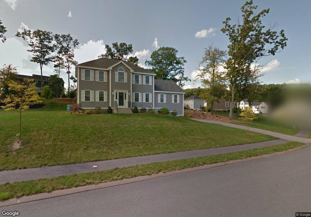
63 Joel Scott Dr Holden, MA 01520
Estimated Value: $722,000 - $928,000
4
Beds
3
Baths
2,344
Sq Ft
$344/Sq Ft
Est. Value
About This Home
This home is located at 63 Joel Scott Dr, Holden, MA 01520 and is currently estimated at $806,918, approximately $344 per square foot. 63 Joel Scott Dr is a home with nearby schools including Wachusett Regional High School and Holden Christian Academy.
Ownership History
Date
Name
Owned For
Owner Type
Purchase Details
Closed on
Jun 7, 2012
Sold by
Stoney Brook Ests Llc
Bought by
Deschenes 3Rd Wilfrid and Deschenes Julie B
Current Estimated Value
Home Financials for this Owner
Home Financials are based on the most recent Mortgage that was taken out on this home.
Original Mortgage
$281,210
Outstanding Balance
$195,527
Interest Rate
3.9%
Mortgage Type
New Conventional
Estimated Equity
$611,391
Create a Home Valuation Report for This Property
The Home Valuation Report is an in-depth analysis detailing your home's value as well as a comparison with similar homes in the area
Home Values in the Area
Average Home Value in this Area
Purchase History
| Date | Buyer | Sale Price | Title Company |
|---|---|---|---|
| Deschenes 3Rd Wilfrid | $361,940 | -- |
Source: Public Records
Mortgage History
| Date | Status | Borrower | Loan Amount |
|---|---|---|---|
| Open | Deschenes 3Rd Wilfrid | $281,210 |
Source: Public Records
Tax History Compared to Growth
Tax History
| Year | Tax Paid | Tax Assessment Tax Assessment Total Assessment is a certain percentage of the fair market value that is determined by local assessors to be the total taxable value of land and additions on the property. | Land | Improvement |
|---|---|---|---|---|
| 2025 | $9,009 | $650,000 | $180,300 | $469,700 |
| 2024 | $8,626 | $609,600 | $175,100 | $434,500 |
| 2023 | $8,189 | $546,300 | $152,200 | $394,100 |
| 2022 | $7,836 | $473,200 | $118,900 | $354,300 |
| 2021 | $7,585 | $435,900 | $113,200 | $322,700 |
| 2020 | $7,370 | $433,500 | $107,700 | $325,800 |
| 2019 | $7,237 | $414,700 | $107,700 | $307,000 |
| 2018 | $7,009 | $398,000 | $102,500 | $295,500 |
| 2017 | $6,765 | $384,600 | $102,500 | $282,100 |
| 2016 | $6,314 | $366,000 | $97,600 | $268,400 |
| 2015 | $6,438 | $355,300 | $97,600 | $257,700 |
| 2014 | $6,307 | $355,300 | $97,600 | $257,700 |
Source: Public Records
Map
Nearby Homes
- 216 Reservoir St Unit 103
- 216 Reservoir St Unit 309
- 33 Thorny Lea Rd
- 289 Bailey Rd
- 124 Bailey Rd
- 7 Holmes Dr
- 9 Holmes Dr
- 26 Avery Heights Dr
- 168 Twinbrooke Dr
- 8 Dawson Cir
- 100 Avery Heights Dr
- 0 Chapin Rd
- 35 Chapin Rd
- 10 Sumac Cir
- 8 (Lot 1) Holmes Dr
- 47 Banbury Ln
- 33 Meadow Wood Dr
- 48 Lexington Cir
- 527 Salisbury St
- 56 Highland Ave
- 55 Joel Scott Dr
- 67 Joel Scott Dr
- 66 Joel Scott Dr
- 62 Joel Scott Dr
- 58 Joel Scott Dr
- 48 Teresa Dr
- 70 Joel Scott Dr
- 75 Joel Scott Dr
- 47 Joel Scott Dr
- 54 Joel Scott Dr
- 54 Joel Scott Dr
- 74 Joel Scott Dr
- 46 Teresa Dr
- 47 Teresa Dr
- 50 Joel Scott Dr
- 41 Joel Scott Dr
- 78 Joel Scott Dr
- 46 Joel Scott Dr
- 81 Joel Scott Dr
- 82 Joel Scott Dr