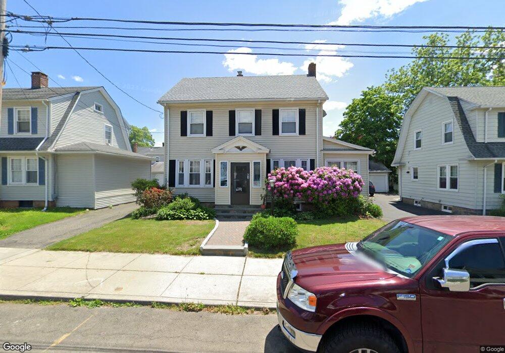
63 Keeler Ave Bridgeport, CT 06606
North End NeighborhoodEstimated Value: $432,000 - $473,000
4
Beds
2
Baths
2,168
Sq Ft
$206/Sq Ft
Est. Value
About This Home
This home is located at 63 Keeler Ave, Bridgeport, CT 06606 and is currently estimated at $447,617, approximately $206 per square foot. 63 Keeler Ave is a home located in Fairfield County with nearby schools including Blackham School, Central High School, and St Andrew School.
Ownership History
Date
Name
Owned For
Owner Type
Purchase Details
Closed on
Mar 3, 1997
Sold by
Hopkins John G and Hopkins Janet A
Bought by
Ung Kimon and Touch Bora
Current Estimated Value
Home Financials for this Owner
Home Financials are based on the most recent Mortgage that was taken out on this home.
Original Mortgage
$92,800
Interest Rate
7.78%
Mortgage Type
Unknown
Purchase Details
Closed on
Nov 27, 1990
Sold by
Lynch Jerome
Bought by
Hopkins John
Create a Home Valuation Report for This Property
The Home Valuation Report is an in-depth analysis detailing your home's value as well as a comparison with similar homes in the area
Home Values in the Area
Average Home Value in this Area
Purchase History
| Date | Buyer | Sale Price | Title Company |
|---|---|---|---|
| Ung Kimon | $116,000 | -- | |
| Ung Kimon | $116,000 | -- | |
| Hopkins John | $143,000 | -- |
Source: Public Records
Mortgage History
| Date | Status | Borrower | Loan Amount |
|---|---|---|---|
| Open | Hopkins John | $65,620 | |
| Closed | Hopkins John | $94,000 | |
| Closed | Hopkins John | $92,800 |
Source: Public Records
Tax History Compared to Growth
Tax History
| Year | Tax Paid | Tax Assessment Tax Assessment Total Assessment is a certain percentage of the fair market value that is determined by local assessors to be the total taxable value of land and additions on the property. | Land | Improvement |
|---|---|---|---|---|
| 2025 | $7,470 | $171,920 | $75,310 | $96,610 |
| 2024 | $7,470 | $171,920 | $75,310 | $96,610 |
| 2023 | $7,470 | $171,920 | $75,310 | $96,610 |
| 2022 | $7,470 | $171,920 | $75,310 | $96,610 |
| 2021 | $7,470 | $171,920 | $75,310 | $96,610 |
| 2020 | $6,870 | $127,250 | $39,340 | $87,910 |
| 2019 | $6,870 | $127,250 | $39,340 | $87,910 |
| 2018 | $6,919 | $127,250 | $39,340 | $87,910 |
| 2017 | $6,919 | $127,250 | $39,340 | $87,910 |
| 2016 | $6,919 | $127,250 | $39,340 | $87,910 |
| 2015 | $7,143 | $169,260 | $47,600 | $121,660 |
| 2014 | $7,143 | $169,260 | $47,600 | $121,660 |
Source: Public Records
Map
Nearby Homes