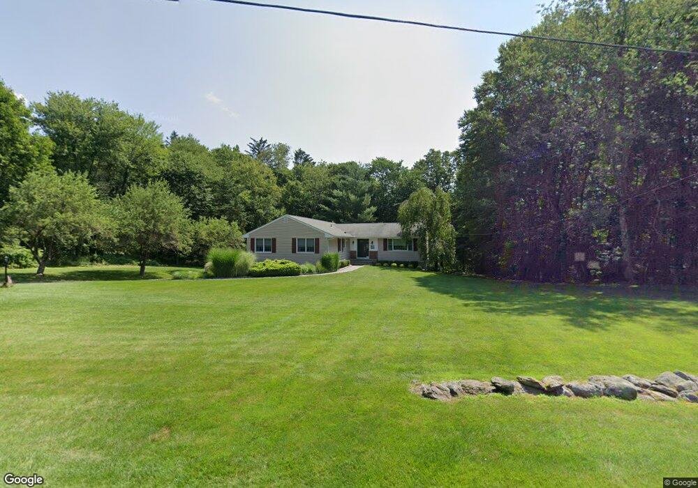
63 Langstroth Dr Ridgefield, CT 06877
Estimated Value: $772,474 - $899,000
3
Beds
2
Baths
1,696
Sq Ft
$482/Sq Ft
Est. Value
About This Home
This home is located at 63 Langstroth Dr, Ridgefield, CT 06877 and is currently estimated at $818,119, approximately $482 per square foot. 63 Langstroth Dr is a home located in Fairfield County with nearby schools including Ridgebury Elementary School, Scotts Ridge Middle School, and Ridgefield High School.
Ownership History
Date
Name
Owned For
Owner Type
Purchase Details
Closed on
Sep 30, 2004
Sold by
Frank Brian O and Frank Jennifer Hope
Bought by
Arnett Marc C and Arnett Cheryl C
Current Estimated Value
Purchase Details
Closed on
Jun 30, 2003
Sold by
Smith Patrick S and Smith Sandra W
Bought by
Frank Brian P and Frank Jennifer Hope
Purchase Details
Closed on
Sep 4, 1990
Sold by
Brooks David
Bought by
Smith Patrick
Create a Home Valuation Report for This Property
The Home Valuation Report is an in-depth analysis detailing your home's value as well as a comparison with similar homes in the area
Home Values in the Area
Average Home Value in this Area
Purchase History
| Date | Buyer | Sale Price | Title Company |
|---|---|---|---|
| Arnett Marc C | $590,000 | -- | |
| Frank Brian P | $527,500 | -- | |
| Smith Patrick | $224,000 | -- |
Source: Public Records
Mortgage History
| Date | Status | Borrower | Loan Amount |
|---|---|---|---|
| Open | Smith Patrick | $100,000 | |
| Closed | Smith Patrick | $47,500 | |
| Open | Smith Patrick | $335,000 |
Source: Public Records
Tax History
| Year | Tax Paid | Tax Assessment Tax Assessment Total Assessment is a certain percentage of the fair market value that is determined by local assessors to be the total taxable value of land and additions on the property. | Land | Improvement |
|---|---|---|---|---|
| 2025 | $9,207 | $336,140 | $205,800 | $130,340 |
| 2024 | $8,857 | $336,140 | $205,800 | $130,340 |
| 2023 | $8,676 | $336,140 | $205,800 | $130,340 |
| 2022 | $8,818 | $310,170 | $171,500 | $138,670 |
| 2021 | $8,750 | $310,170 | $171,500 | $138,670 |
| 2020 | $8,722 | $310,170 | $171,500 | $138,670 |
| 2019 | $8,722 | $310,170 | $171,500 | $138,670 |
| 2018 | $8,617 | $310,170 | $171,500 | $138,670 |
| 2017 | $8,396 | $308,550 | $166,010 | $142,540 |
| 2016 | $8,235 | $308,550 | $166,010 | $142,540 |
| 2015 | $8,025 | $308,550 | $166,010 | $142,540 |
| 2014 | $8,025 | $308,550 | $166,010 | $142,540 |
Source: Public Records
Map
Nearby Homes
- 41 Old Mill Rd
- 0 Ives Ct
- 15 Marc Rd
- 399 Ridgebury Rd
- 2 Rolf Dr
- 219 Bennetts Farm Rd
- 82 Keeler Dr
- 14 Dillman Ct
- 29 Harwood Dr
- 0 Holly Ridge Way Unit Lot 79 24090094
- 11 Olympic Dr
- 10 Foxwood Dr Unit Lot 65
- 16 Holly Ridge Way Unit Lot 86
- 16 Holly Ridge Way
- 6 Thorncrest Ridge Unit Lot 72
- 6 Holly Ridge Way Dr Unit Lot 81
- 7 Foxwood Dr Unit Lot 57
- 5 Thorncrest Ridge Unit Lot 54
- 5 Foxwood Dr Unit Lot 58
- 42 Miry Brook Rd Unit TRLR 27
Your Personal Tour Guide
Ask me questions while you tour the home.