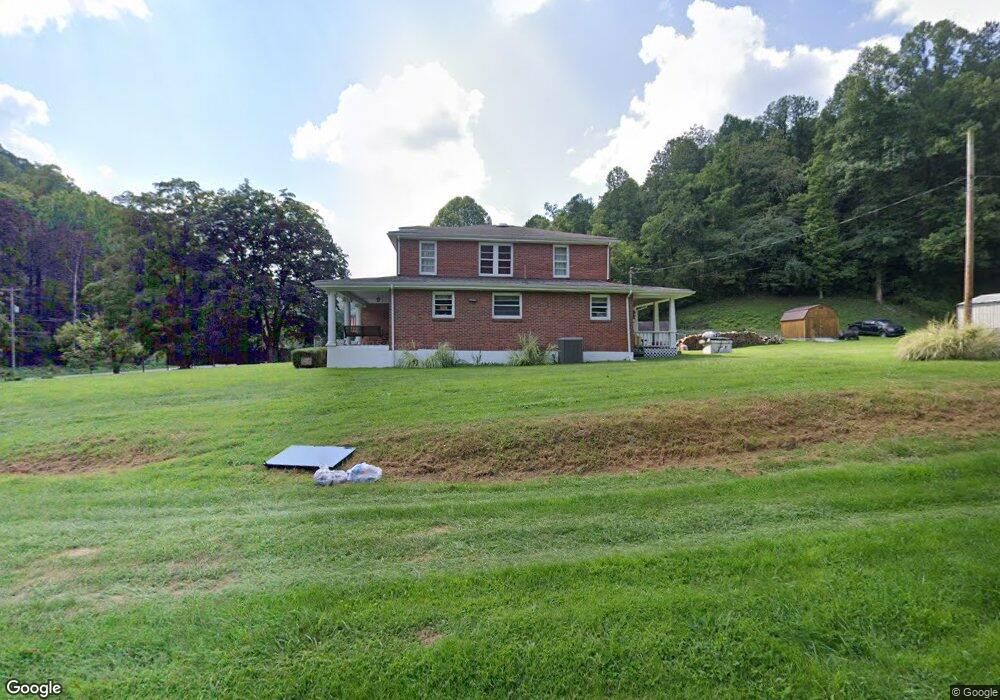
63 Laurel Branch Rd Peytona, WV 25154
Estimated Value: $235,000 - $310,000
3
Beds
2
Baths
2,464
Sq Ft
$107/Sq Ft
Est. Value
About This Home
This home is located at 63 Laurel Branch Rd, Peytona, WV 25154 and is currently estimated at $263,511, approximately $106 per square foot. 63 Laurel Branch Rd is a home located in Boone County.
Ownership History
Date
Name
Owned For
Owner Type
Purchase Details
Closed on
Aug 21, 2007
Sold by
Wall Kenneth B and Wall Angela D
Bought by
Rollo Ronald W and Rollo Karen G
Current Estimated Value
Home Financials for this Owner
Home Financials are based on the most recent Mortgage that was taken out on this home.
Original Mortgage
$155,200
Outstanding Balance
$97,560
Interest Rate
6.7%
Mortgage Type
Purchase Money Mortgage
Estimated Equity
$165,951
Create a Home Valuation Report for This Property
The Home Valuation Report is an in-depth analysis detailing your home's value as well as a comparison with similar homes in the area
Purchase History
| Date | Buyer | Sale Price | Title Company |
|---|---|---|---|
| Rollo Ronald W | -- | -- |
Source: Public Records
Mortgage History
| Date | Status | Borrower | Loan Amount |
|---|---|---|---|
| Open | Rollo Ronald W | $155,200 |
Source: Public Records
Tax History
| Year | Tax Paid | Tax Assessment Tax Assessment Total Assessment is a certain percentage of the fair market value that is determined by local assessors to be the total taxable value of land and additions on the property. | Land | Improvement |
|---|---|---|---|---|
| 2025 | $1,143 | $111,300 | $11,220 | $100,080 |
| 2024 | $1,133 | $111,480 | $11,220 | $100,260 |
| 2023 | $1,040 | $102,840 | $10,440 | $92,400 |
| 2022 | $945 | $94,560 | $9,660 | $84,900 |
| 2021 | $892 | $90,540 | $9,660 | $80,880 |
| 2020 | $1,147 | $90,540 | $9,660 | $80,880 |
| 2019 | $1,147 | $90,540 | $9,660 | $80,880 |
| 2018 | $1,323 | $104,400 | $9,660 | $94,740 |
| 2017 | $1,228 | $96,960 | $9,660 | $87,300 |
| 2016 | $1,229 | $97,020 | $9,660 | $87,360 |
| 2015 | $1,284 | $101,340 | $9,660 | $91,680 |
| 2014 | $1,212 | $95,640 | $9,660 | $85,980 |
Source: Public Records
Map
Nearby Homes
- 17801 Daniel Boone Pkwy
- 103 Chestnut Dr
- 9354 Daniel Boone Pkwy
- 24664 Daniel Boone Pkwy
- 140 Baron St
- 276 Easily Rd
- 14001 Ridgeview Nellis Rd
- 31 Fork Creek Rd
- 50 Graley Rd
- 5712 Daniel Boone Pkwy
- 13278 Ridgeview Nellis Rd
- 391 River Rd
- 0 Coal River Rd
- 3631 Daniel Boone Pkwy
- 99 Adler Ln
- 872 Country Estates Rd
- 501 Mallard Ln
- 161 Gable Ln
- 1136 Pond Fork Rd
- 14368 Coal River Rd
- 16 Laurel Branch Rd
- 16634 Daniel Boone Pkwy
- 181 Laurel Branch Rd
- 16600 Daniel Boone Pkwy
- 16633 Daniel Boone Pkwy
- 16359 Daniel Boone Pkwy
- 16656 Daniel Boone Pkwy
- 16327 Daniel Boone Pkwy
- 228 Laurel Branch Rd
- 16686 Daniel Boone Pkwy
- 16259 Daniel Boone Pkwy
- 16710 Daniel Boone Pkwy
- 16769 Daniel Boone Pkwy
- 16193 Daniel Boone Pkwy
- 16780 Daniel Boone Pkwy
- 16780 Daniel Boone Pkwy
- 416 Laurel Branch Rd
- 16808 Daniel Boone Pkwy
- 16127 Daniel Boone Pkwy
- 39 Arvle Ln
Your Personal Tour Guide
Ask me questions while you tour the home.