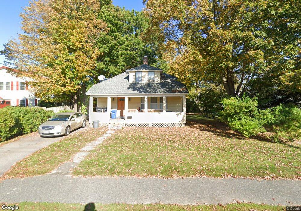
63 Neponset Ave Foxboro, MA 02035
Estimated Value: $485,776 - $586,000
3
Beds
2
Baths
1,176
Sq Ft
$453/Sq Ft
Est. Value
About This Home
This home is located at 63 Neponset Ave, Foxboro, MA 02035 and is currently estimated at $533,194, approximately $453 per square foot. 63 Neponset Ave is a home located in Norfolk County with nearby schools including Foxborough High School, Foxborough Regional Charter School, and The Sage School.
Ownership History
Date
Name
Owned For
Owner Type
Purchase Details
Closed on
Aug 26, 2010
Sold by
Ross Peter J and Ross Karen J
Bought by
Ross Peter J and Ross Karen J
Current Estimated Value
Purchase Details
Closed on
May 11, 1988
Sold by
Brown Laurence E
Bought by
Aetna Finance Co
Purchase Details
Closed on
Jan 15, 1986
Bought by
Ross Peter J and Ross Karen J
Create a Home Valuation Report for This Property
The Home Valuation Report is an in-depth analysis detailing your home's value as well as a comparison with similar homes in the area
Home Values in the Area
Average Home Value in this Area
Purchase History
| Date | Buyer | Sale Price | Title Company |
|---|---|---|---|
| Ross Peter J | -- | -- | |
| Aetna Finance Co | $6,439 | -- | |
| Ross Peter J | $89,000 | -- |
Source: Public Records
Mortgage History
| Date | Status | Borrower | Loan Amount |
|---|---|---|---|
| Open | Ross Peter J | $195,000 | |
| Closed | Ross Peter J | $50,000 | |
| Previous Owner | Ross Peter J | $92,250 | |
| Previous Owner | Ross Peter J | $85,000 |
Source: Public Records
Tax History Compared to Growth
Tax History
| Year | Tax Paid | Tax Assessment Tax Assessment Total Assessment is a certain percentage of the fair market value that is determined by local assessors to be the total taxable value of land and additions on the property. | Land | Improvement |
|---|---|---|---|---|
| 2025 | $4,504 | $340,700 | $188,500 | $152,200 |
| 2024 | $4,693 | $347,400 | $203,100 | $144,300 |
| 2023 | $4,587 | $322,800 | $193,500 | $129,300 |
| 2022 | $4,032 | $277,700 | $173,500 | $104,200 |
| 2021 | $4,223 | $286,500 | $164,800 | $121,700 |
| 2020 | $4,081 | $280,100 | $164,800 | $115,300 |
| 2019 | $3,703 | $251,900 | $165,200 | $86,700 |
| 2018 | $3,628 | $249,000 | $157,000 | $92,000 |
| 2017 | $3,706 | $246,400 | $154,400 | $92,000 |
| 2016 | $3,566 | $240,600 | $148,600 | $92,000 |
| 2015 | $3,146 | $207,100 | $110,800 | $96,300 |
| 2014 | $3,104 | $207,100 | $110,800 | $96,300 |
Source: Public Records
Map
Nearby Homes
- 2 Bradford Ave
- 4 Bradford Ave
- 10 Bradford Ave
- 59 Neponset Ave
- 12 Bradford Ave
- 12 Bradford Ave Unit 2
- 3 Bradford Ave
- 57 Neponset Ave
- 9 Bradford Ave
- 14 Bradford Ave
- 11 Bradford Ave
- 11 Bradford Ave Unit B
- 11 Bradford Ave Unit A
- 55 Neponset Ave
- 16 Bradford Ave
- 4 Pond Ave
- 6 Pond Ave
- 2 Pond Ave
- 22 Pond Ave
- 2 Pond Ave Unit 2A