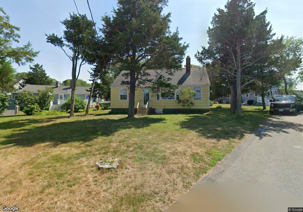
63 Newport St Marshfield, MA 02050
Ocean Bluff-Brant Rock NeighborhoodEstimated Value: $548,000 - $746,000
2
Beds
1
Bath
912
Sq Ft
$677/Sq Ft
Est. Value
About This Home
This home is located at 63 Newport St, Marshfield, MA 02050 and is currently estimated at $617,398, approximately $676 per square foot. 63 Newport St is a home with nearby schools including Daniel Webster, Furnace Brook Middle School, and Marshfield High School.
Create a Home Valuation Report for This Property
The Home Valuation Report is an in-depth analysis detailing your home's value as well as a comparison with similar homes in the area
Home Values in the Area
Average Home Value in this Area
Tax History Compared to Growth
Tax History
| Year | Tax Paid | Tax Assessment Tax Assessment Total Assessment is a certain percentage of the fair market value that is determined by local assessors to be the total taxable value of land and additions on the property. | Land | Improvement |
|---|---|---|---|---|
| 2025 | $4,718 | $476,600 | $319,200 | $157,400 |
| 2024 | $4,601 | $442,800 | $299,300 | $143,500 |
| 2023 | $4,341 | $394,700 | $269,400 | $125,300 |
| 2022 | $4,341 | $335,200 | $229,400 | $105,800 |
| 2021 | $4,140 | $313,900 | $219,500 | $94,400 |
| 2020 | $3,784 | $283,900 | $189,500 | $94,400 |
| 2019 | $3,716 | $277,700 | $189,500 | $88,200 |
| 2018 | $3,654 | $273,300 | $189,500 | $83,800 |
| 2017 | $3,479 | $253,600 | $179,600 | $74,000 |
| 2016 | $3,331 | $240,000 | $169,600 | $70,400 |
| 2015 | $3,190 | $240,000 | $169,600 | $70,400 |
| 2014 | $3,073 | $231,200 | $169,600 | $61,600 |
Source: Public Records
Map
Nearby Homes