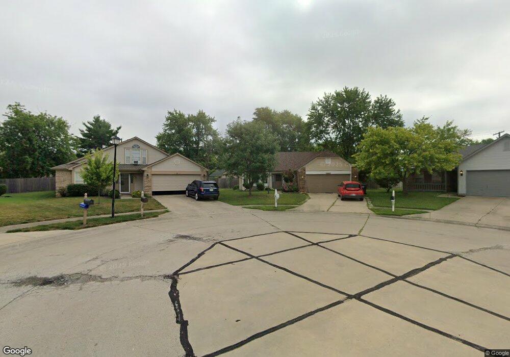
63 Pine Ct Whiteland, IN 46184
Estimated Value: $261,000 - $276,000
3
Beds
2
Baths
1,619
Sq Ft
$166/Sq Ft
Est. Value
About This Home
This home is located at 63 Pine Ct, Whiteland, IN 46184 and is currently estimated at $269,263, approximately $166 per square foot. 63 Pine Ct is a home located in Johnson County with nearby schools including Break-O-Day Elementary School, Clark-Pleasant Middle School, and Whiteland Community High School.
Ownership History
Date
Name
Owned For
Owner Type
Purchase Details
Closed on
Nov 16, 2018
Sold by
Trader Mark E
Bought by
Trader Mark E and Trader Ruth A
Current Estimated Value
Purchase Details
Closed on
Nov 14, 2017
Sold by
Trader Trust
Bought by
Trader Mark E
Purchase Details
Closed on
Jun 23, 2010
Sold by
Cobb Llewellyn E
Bought by
Trader Carl E
Create a Home Valuation Report for This Property
The Home Valuation Report is an in-depth analysis detailing your home's value as well as a comparison with similar homes in the area
Home Values in the Area
Average Home Value in this Area
Purchase History
| Date | Buyer | Sale Price | Title Company |
|---|---|---|---|
| Trader Mark E | -- | None Available | |
| Trader Mark E | -- | -- | |
| Trader Carl E | -- | Ctic |
Source: Public Records
Tax History Compared to Growth
Tax History
| Year | Tax Paid | Tax Assessment Tax Assessment Total Assessment is a certain percentage of the fair market value that is determined by local assessors to be the total taxable value of land and additions on the property. | Land | Improvement |
|---|---|---|---|---|
| 2025 | $2,265 | $225,600 | $56,000 | $169,600 |
| 2024 | $2,265 | $218,000 | $56,000 | $162,000 |
| 2023 | $2,211 | $212,000 | $56,000 | $156,000 |
| 2022 | $1,883 | $180,800 | $29,900 | $150,900 |
| 2021 | $1,581 | $151,400 | $29,900 | $121,500 |
| 2020 | $1,404 | $133,800 | $29,900 | $103,900 |
| 2019 | $1,285 | $122,600 | $29,900 | $92,700 |
| 2018 | $1,240 | $118,300 | $21,000 | $97,300 |
| 2017 | $2,450 | $121,800 | $21,000 | $100,800 |
| 2016 | $2,311 | $115,300 | $21,000 | $94,300 |
| 2014 | $2,161 | $108,400 | $25,700 | $82,700 |
| 2013 | $2,161 | $108,000 | $25,700 | $82,300 |
Source: Public Records
Map
Nearby Homes
- 190 Tracy Ridge Blvd
- 53 Oakden Ct
- 106 Tracy Ridge Blvd
- 57 Oakden Ct
- 256 Bittersweet Dr
- 1119 Chateaugay Ct
- 6540 N Us Highway 31
- 1137 Chateaugay Ct
- 638 Harvest Meadow Way
- 821 Princeton Dr
- 1000 Mount Olive Rd
- 840 Sweetbriar Ave
- 551 Greenwood Trace Dr
- 250 Southlane Dr
- 1041 Mount Olive Rd
- 50 Meadow Creek Blvd
- 523 Genisis Dr
- 559 Genisis Dr
- 779 Harvest Meadow Way
- 111 Meadow Creek Blvd
- 61 Pine Ct
- 65 Pine Ct
- 1030 Ashland Ave
- 1028 Ashland Ave
- 1032 Ashland Ave
- 64 Pine Ct
- 168 Tracy Ridge Blvd
- 166 Tracy Ridge Blvd
- 1026 Ashland Ave
- 1034 Ashland Ave
- 62 Pine Ct
- 170 Tracy Ridge Blvd
- 139 Brentwood Ln
- 164 Tracy Ridge Blvd
- 137 Brentwood Ln
- 1024 Ashland Ave
- 135 Brentwood Ln
- 1036 Ashland Ave
- 172 Tracy Ridge Blvd
- 162 Tracy Ridge Blvd