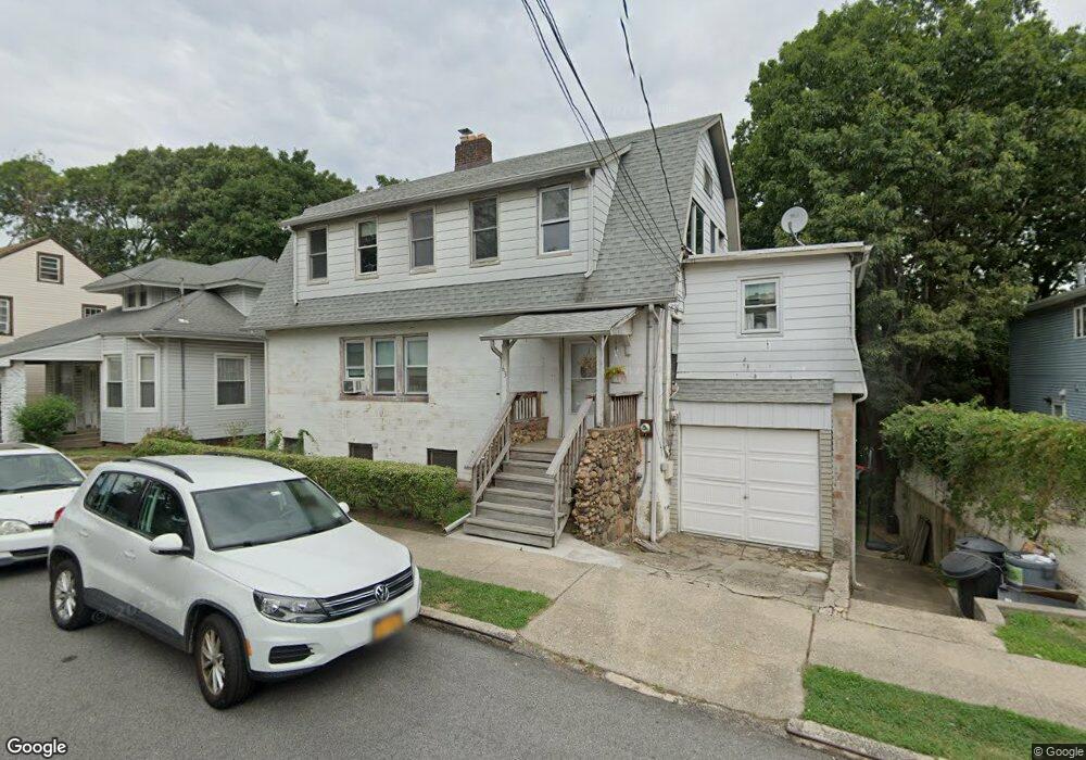
63 Portland Place Staten Island, NY 10301
Tompkinsville NeighborhoodEstimated Value: $727,000 - $907,105
6
Beds
3
Baths
2,032
Sq Ft
$389/Sq Ft
Est. Value
About This Home
This home is located at 63 Portland Place, Staten Island, NY 10301 and is currently estimated at $790,276, approximately $388 per square foot. 63 Portland Place is a home located in Richmond County with nearby schools including P.S. 45 John Tyler, Is 61 William A Morris, and Curtis High School.
Ownership History
Date
Name
Owned For
Owner Type
Purchase Details
Closed on
Jun 30, 2000
Sold by
Purewal Kirpal Singh and Purewal Jasvinder Kaur
Bought by
Daniels Craig and Daniels Dawn J
Current Estimated Value
Home Financials for this Owner
Home Financials are based on the most recent Mortgage that was taken out on this home.
Original Mortgage
$204,690
Outstanding Balance
$72,570
Interest Rate
8.1%
Estimated Equity
$717,706
Create a Home Valuation Report for This Property
The Home Valuation Report is an in-depth analysis detailing your home's value as well as a comparison with similar homes in the area
Home Values in the Area
Average Home Value in this Area
Purchase History
| Date | Buyer | Sale Price | Title Company |
|---|---|---|---|
| Daniels Craig | $215,500 | First American Title Ins Co |
Source: Public Records
Mortgage History
| Date | Status | Borrower | Loan Amount |
|---|---|---|---|
| Open | Daniels Craig | $204,690 |
Source: Public Records
Tax History Compared to Growth
Tax History
| Year | Tax Paid | Tax Assessment Tax Assessment Total Assessment is a certain percentage of the fair market value that is determined by local assessors to be the total taxable value of land and additions on the property. | Land | Improvement |
|---|---|---|---|---|
| 2025 | $6,987 | $49,260 | $15,188 | $34,072 |
| 2024 | $6,999 | $48,720 | $15,241 | $33,479 |
| 2023 | $6,649 | $34,139 | $12,915 | $21,224 |
| 2022 | $6,142 | $44,100 | $20,520 | $23,580 |
| 2021 | $6,091 | $36,840 | $20,520 | $16,320 |
| 2020 | $6,135 | $33,720 | $20,520 | $13,200 |
| 2019 | $6,015 | $33,060 | $20,520 | $12,540 |
| 2018 | $5,502 | $28,449 | $19,077 | $9,372 |
| 2017 | $5,171 | $26,839 | $19,954 | $6,885 |
| 2016 | $4,752 | $25,320 | $20,520 | $4,800 |
| 2015 | $4,576 | $25,435 | $15,039 | $10,396 |
| 2014 | $4,576 | $25,435 | $15,827 | $9,608 |
Source: Public Records
Map
Nearby Homes
- 260 Brighton Ave
- 279 Stanley Ave
- 310 Brighton Ave
- 328 Stanley Ave
- 435 Castleton Ave
- 414 Castleton Ave
- 171 Silver Lake Rd
- 0 Stanley Ave
- 776 Brighton Ave
- 333 Lafayette Ave
- 164 Brighton Ave
- 251 Castleton Ave
- 132 Alden Place
- 293 Lafayette Ave
- 139 Brighton Ave
- 130 Brighton Ave
- 525 Castleton Ave Unit 1C
- 26 Valencia Ave
- 110 Arnold St
- 24 Webster Ave
- 55 Portland Place
- 65 Portland Place
- 51 Portland Place
- 69 Portland Place
- 47 Portland Place
- 272 Brighton Ave
- 50 Portland Place
- 262 Brighton Ave
- 60 Portland Place
- 77 Portland Place
- 280 Brighton Ave
- 64 Portland Place
- 68 Portland Place
- 288 Brighton Ave
- 81 Portland Place
- 311 Stanley Ave
- 315 Stanley Ave
- 74 Portland Place
- 290 Brighton Ave
- 290 Brighton Ave